U.S. flag

An official website of the United States government

Here’s how you know

Dot gov

Official websites use .gov
A .gov website belongs to an official government organization in the United States.

HTTPS

Secure .gov websites use HTTPS
A lock ( Lock A locked padlock ) or https:// means you’ve safely connected to the .gov website. Share sensitive information only on official, secure websites.

EPA Region 1
Contact Us

Peak AQI Ozone Maps

Peak ozone Air Quality Index (AQI) maps are based on the highest 8-hour ozone AQI measured at each ozone monitoring station. Peak ozone AQIs typically occur at different times at different monitors. Thus, peak maps do not represent a "snapshot" of air quality at any one moment. Rather, they are more like maps depicting cumulative rainfall, providing the viewer with an indication of how the air quality may have been at its worst in his or her area during the course of the day.

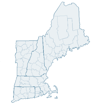
Click each state on the map of New England below to view the peak ozone AQI for each monitor in that state.

Click on state to view peal AQI ozone map.

View peak ozone maps for other days and domains in the United States.

Contact Us to ask a question, provide feedback, or report a problem.

United States Environmental Protection Agency

Discover.

  • Accessibility
  • Budget & Performance
  • Contracting
  • EPA www Web Snapshots
  • Grants
  • No FEAR Act Data
  • Privacy
  • Privacy and Security Notice

Connect.

  • Data.gov
  • Inspector General
  • Jobs
  • Newsroom
  • Open Government
  • Regulations.gov
  • Subscribe
  • USA.gov
  • White House

Ask.

  • Contact EPA
  • EPA Disclaimers
  • Hotlines
  • FOIA Requests
  • Frequent Questions

Follow.

Last updated on January 18, 2023