| Site Photos |
| Site photos not available |
| Site Information |
| Site ID |
YEL408 |
| Site name |
Yellowstone NP |
| County |
Teton |
| State abbreviation |
WY |
| AQS ID |
560391011 |
| Latitude; decimal degrees |
44.565356 |
| Longitude; decimal degrees |
-110.400338 |
| Elevation; m |
2430 |
| Operating agency |
NPS |
| Start date |
06/01/1996 |
| Primary Land Use |
Agric |
| Terrain surrounding site |
Rolling |
| NADP/NTN site ID |
WY08 |
| Distance to nearest NTN site; km |
39.065 |
| View Map |
View Map |
|
| Graphical Results |
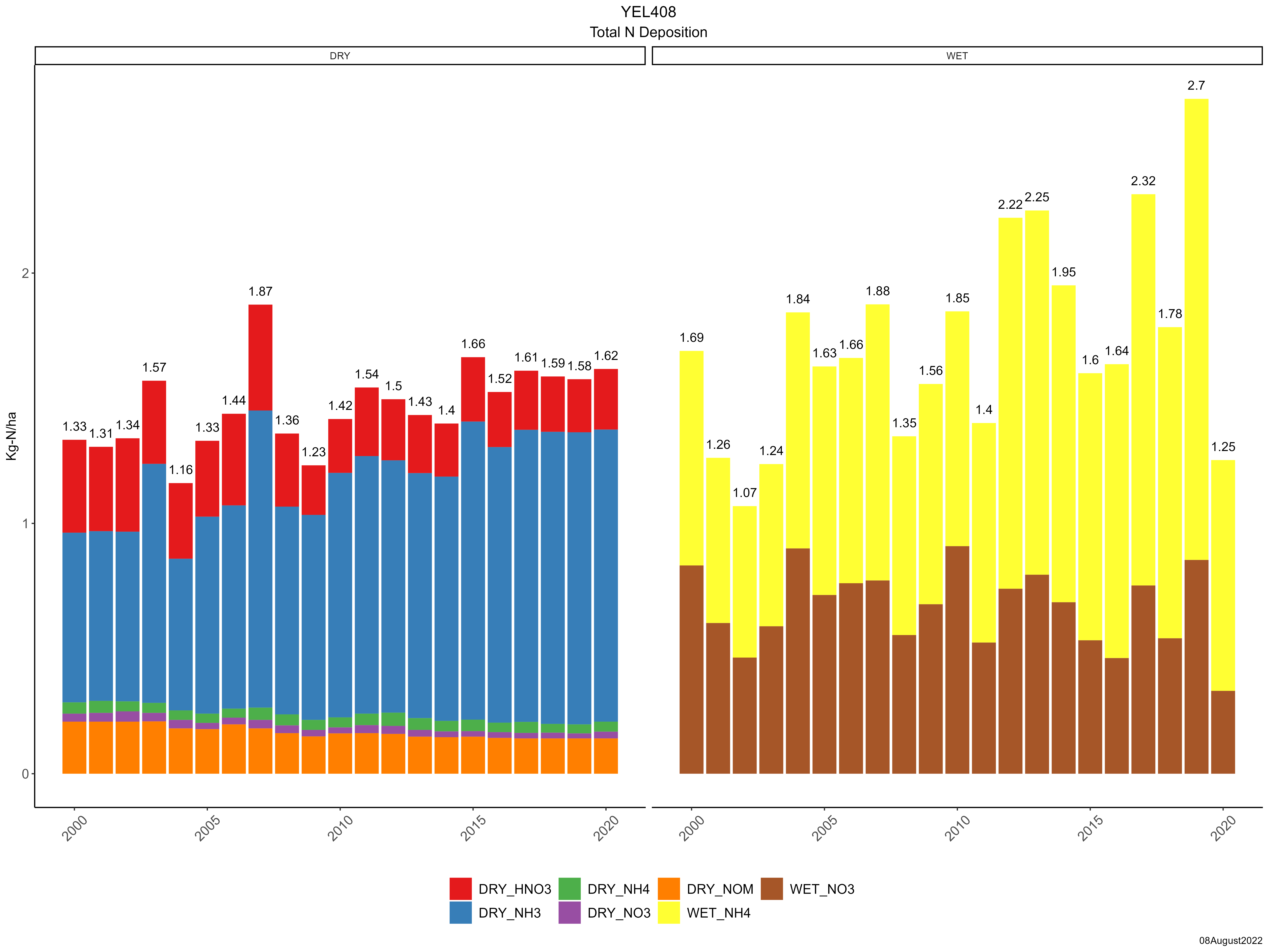
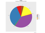
| Composition of total nitrogen deposition by species |
 |
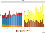
| Trends in total nitrogen deposition |
 |
| Trends in wet and dry nitrogen deposition |
 |
| Composition of total sulfur deposition by species |
 |
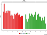
| Trends in total sulfur deposition |
 |
| Trends in wet and dry sulfur deposition |
 |
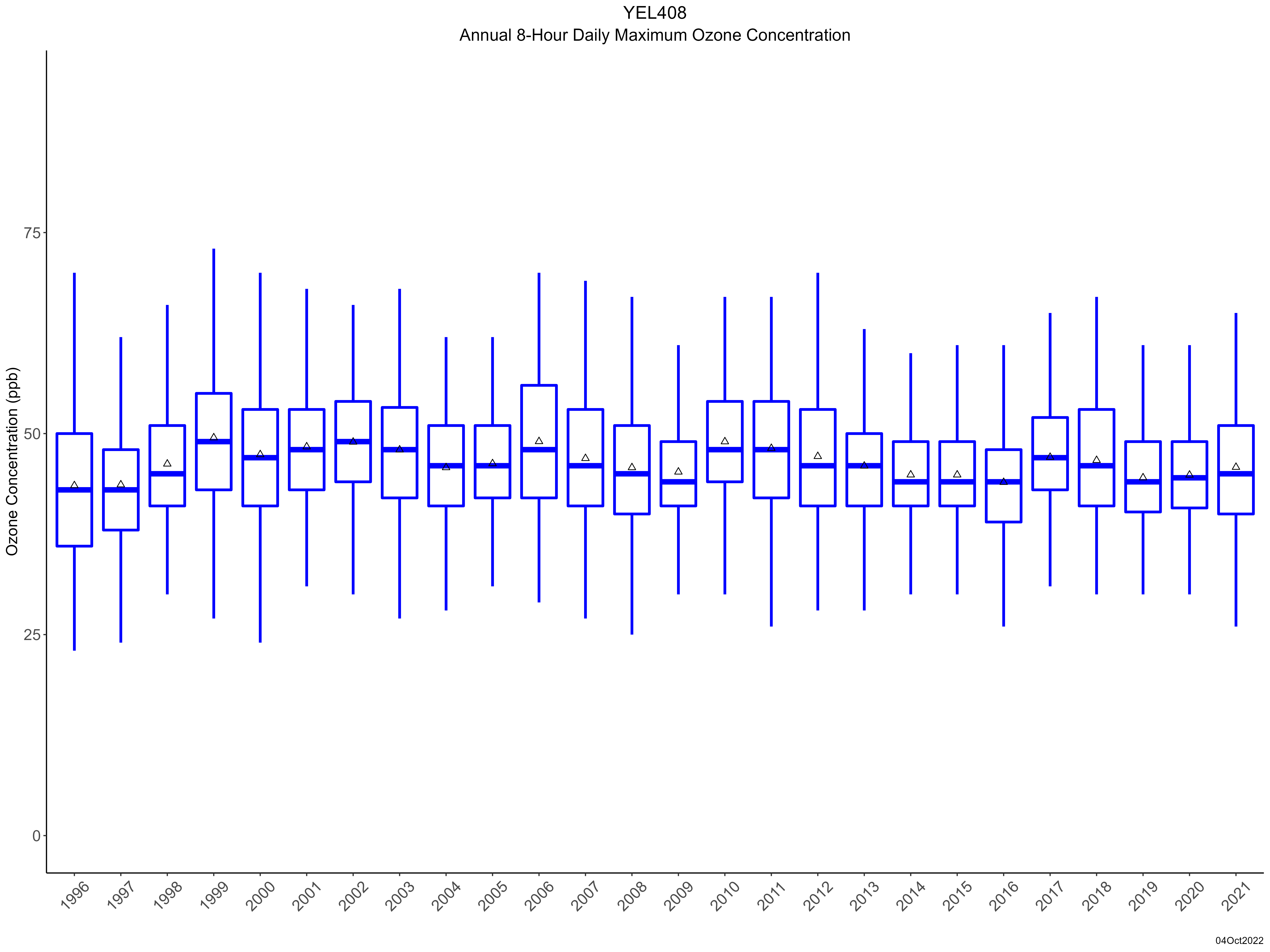
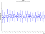
| Trend in maximum 8-hour average ozone concentrations |
 |
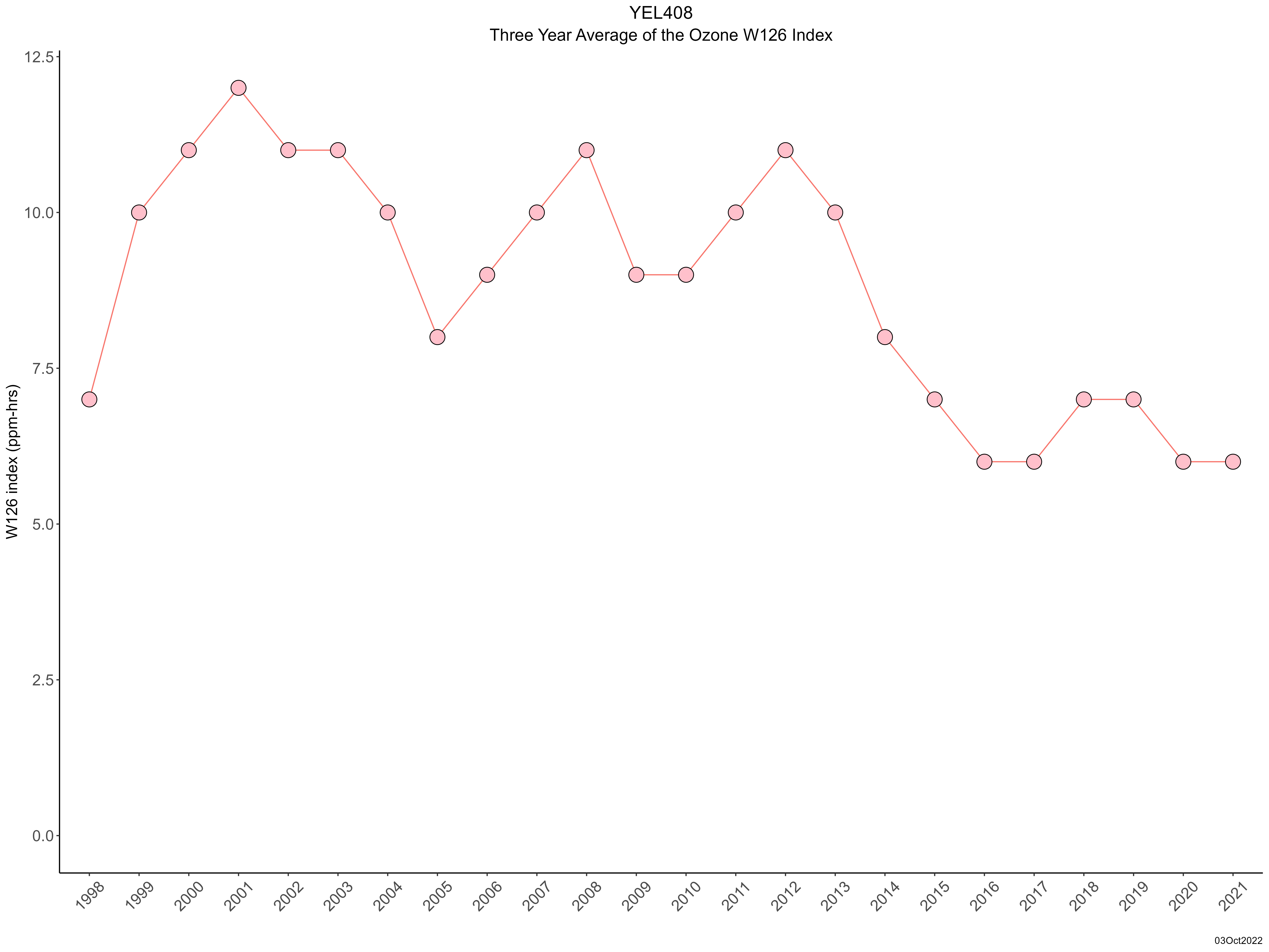
| Trend in 3-year average of ozone W126 index |
 |
|