| Site Information |
| Site ID |
UND002 |
| Site name |
Underhill |
| County |
Chittenden |
| State abbreviation |
VT |
| Latitude; decimal degrees |
44.5283 |
| Longitude; decimal degrees |
-72.8688 |
| Elevation; m |
399 |
| Operating agency |
EPA |
| Start date |
11/13/2012 |
| Primary Land Use |
Forest |
| Terrain surrounding site |
Complex |
| NADP/NTN site ID |
VT99 |
| Distance to nearest NTN site; km |
.032 |
| Co-located NADP/AMoN Site ID |
VT99 |
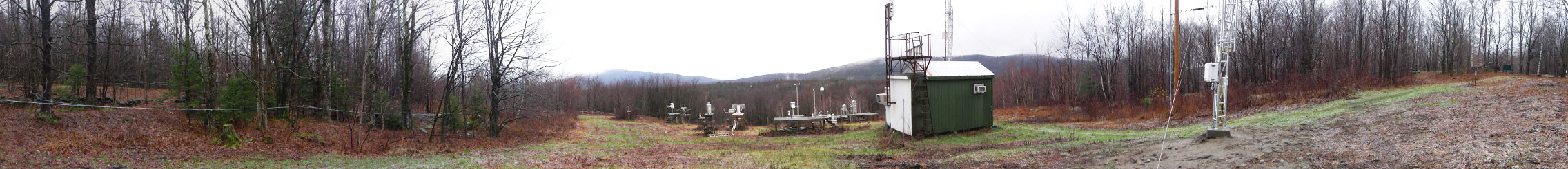
| View Map |
View Map |
|
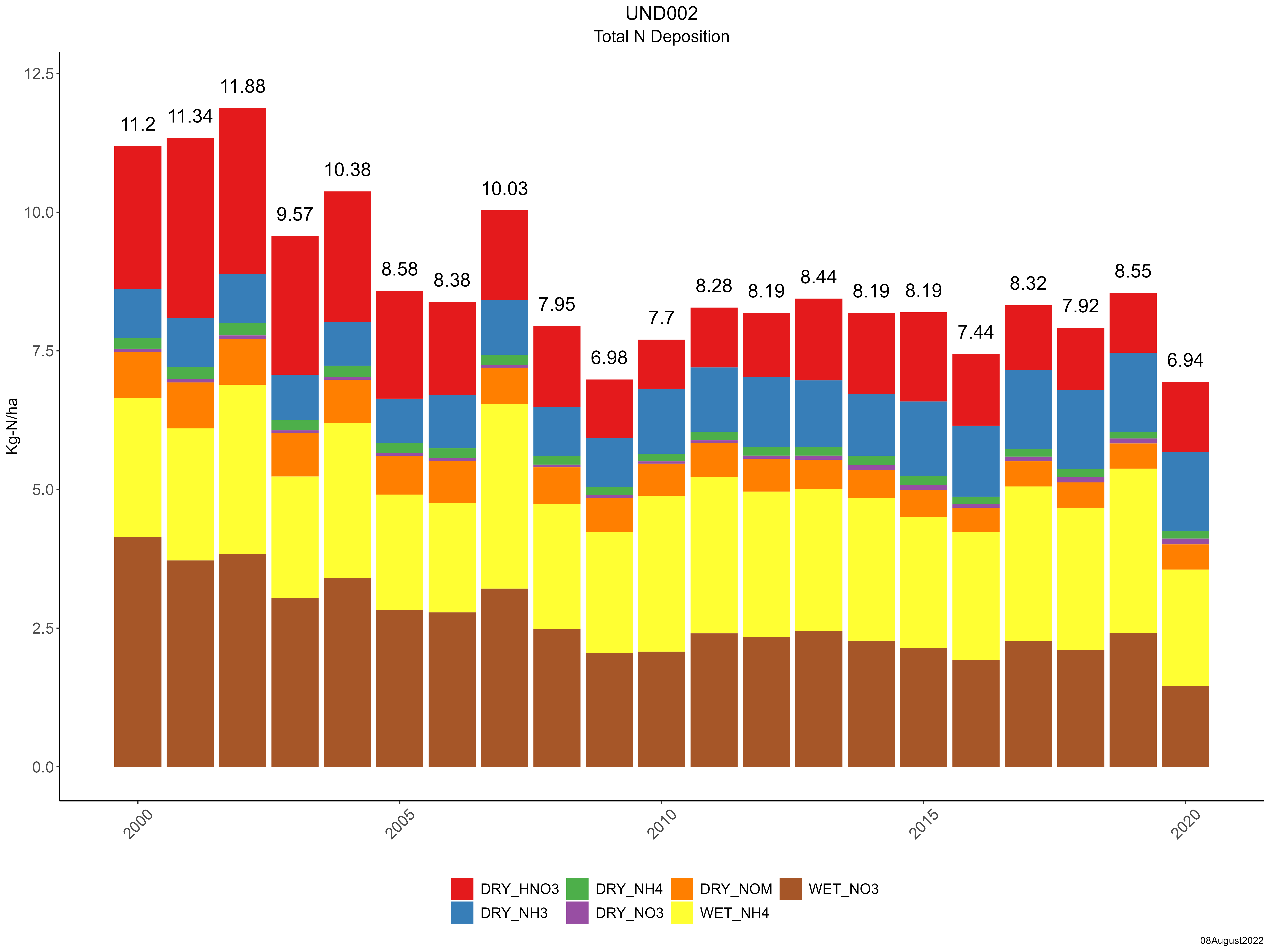
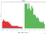
| Graphical Results |
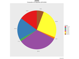
| Composition of total nitrogen deposition by species |
 |
| Trends in total nitrogen deposition |
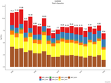 |
| Trends in wet and dry nitrogen deposition |
 |
| Composition of total sulfur deposition by species |
 |
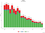
| Trends in total sulfur deposition |
 |
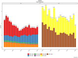
| Trends in wet and dry sulfur deposition |
 |
|