Jump to main content or area navigation.

Contact Us

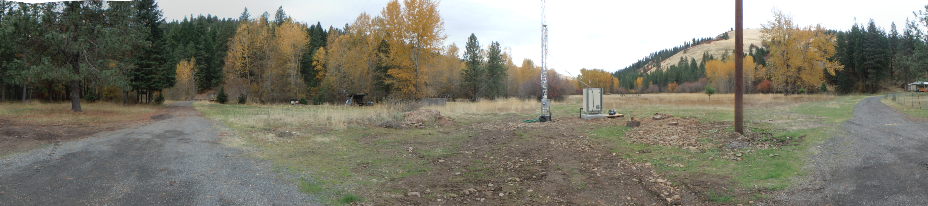
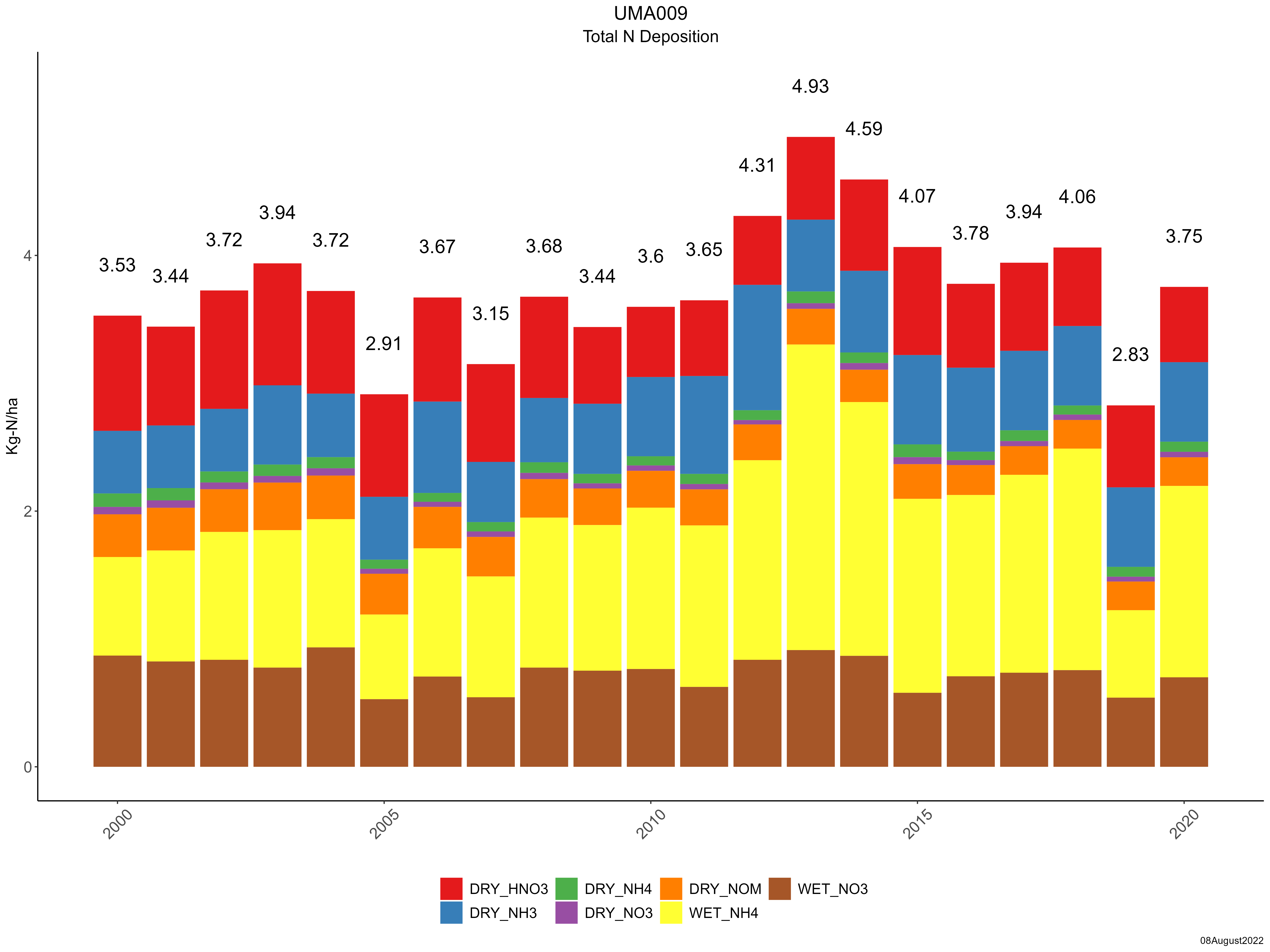
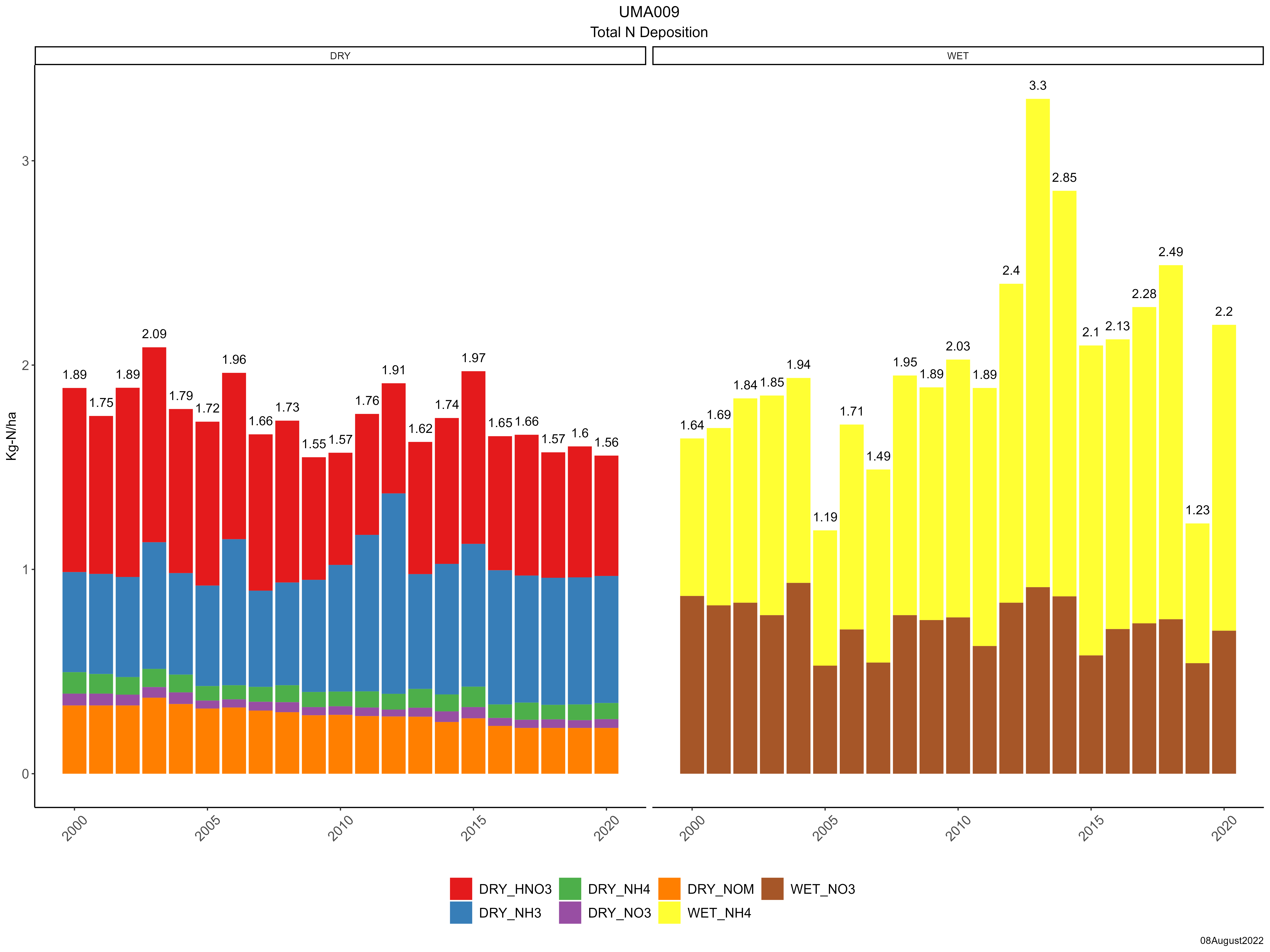
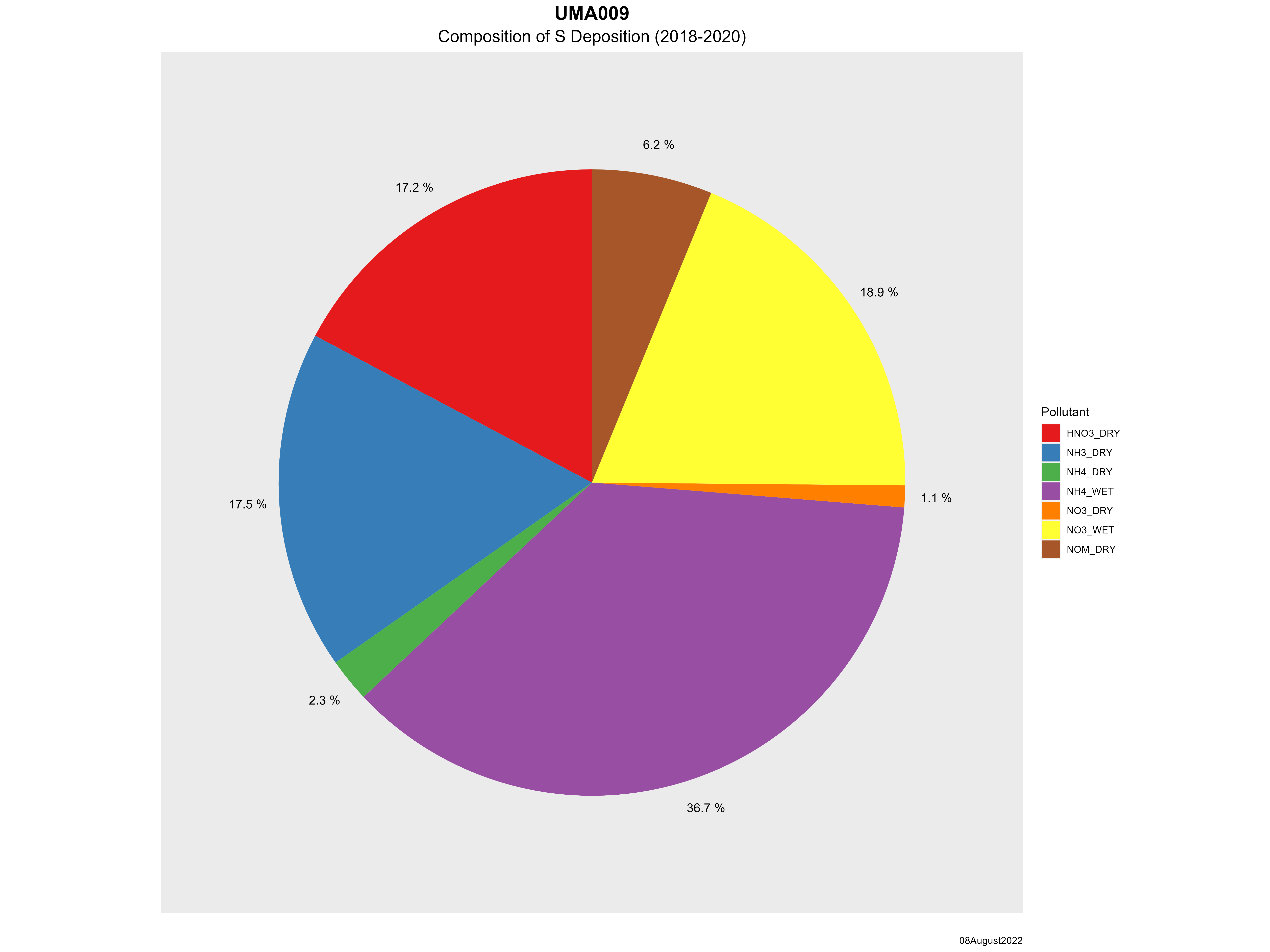
Confederated Tribes of the Umatilla Indian Reservation (UMA009)

Site Photos
Site Information
Site ID UMA009
Site name Confederated Tribes of the Umatilla Indian Reservation
County Columbia
State abbreviation WA
AQS ID 530139991
Latitude; decimal degrees 46.2026
Longitude; decimal degrees -117.9539
Elevation; m 681
Operating agency EPA
Start date 11/04/2020
Primary Land Use Forest
Terrain surrounding site Rolling
NADP/NTN site ID WA24
Distance to nearest NTN site; km 85
Co-located NADP/AMoN Site ID WA04
View Map View Map
Graphical Results
Composition of total nitrogen deposition by species
Trends in total nitrogen deposition
Trends in wet and dry nitrogen deposition
Composition of total sulfur deposition by species
Trends in total sulfur deposition
Trends in wet and dry sulfur deposition
Trend in maximum 8-hour average ozone concentrations
Trend in 3-year average of ozone W126 index
Site History

Jump to main content.