| Site Photos |
| Site photos not available |
| Site Information |
| Site ID |
PBF129 |
| Site name |
Perryville |
| County |
Boyle |
| State abbreviation |
KY |
| Latitude; decimal degrees |
37.68 |
| Longitude; decimal degrees |
-84.97 |
| Elevation; m |
279 |
| Operating agency |
EPA |
| Start date |
08/08/1987 |
| End date |
07/28/1990 |
| Primary Land Use |
Agric |
| Terrain surrounding site |
Rolling |
| NADP/NTN site ID |
KY03 |
| Distance to nearest NTN site; km |
7.479 |
| View Map |
View Map |
|
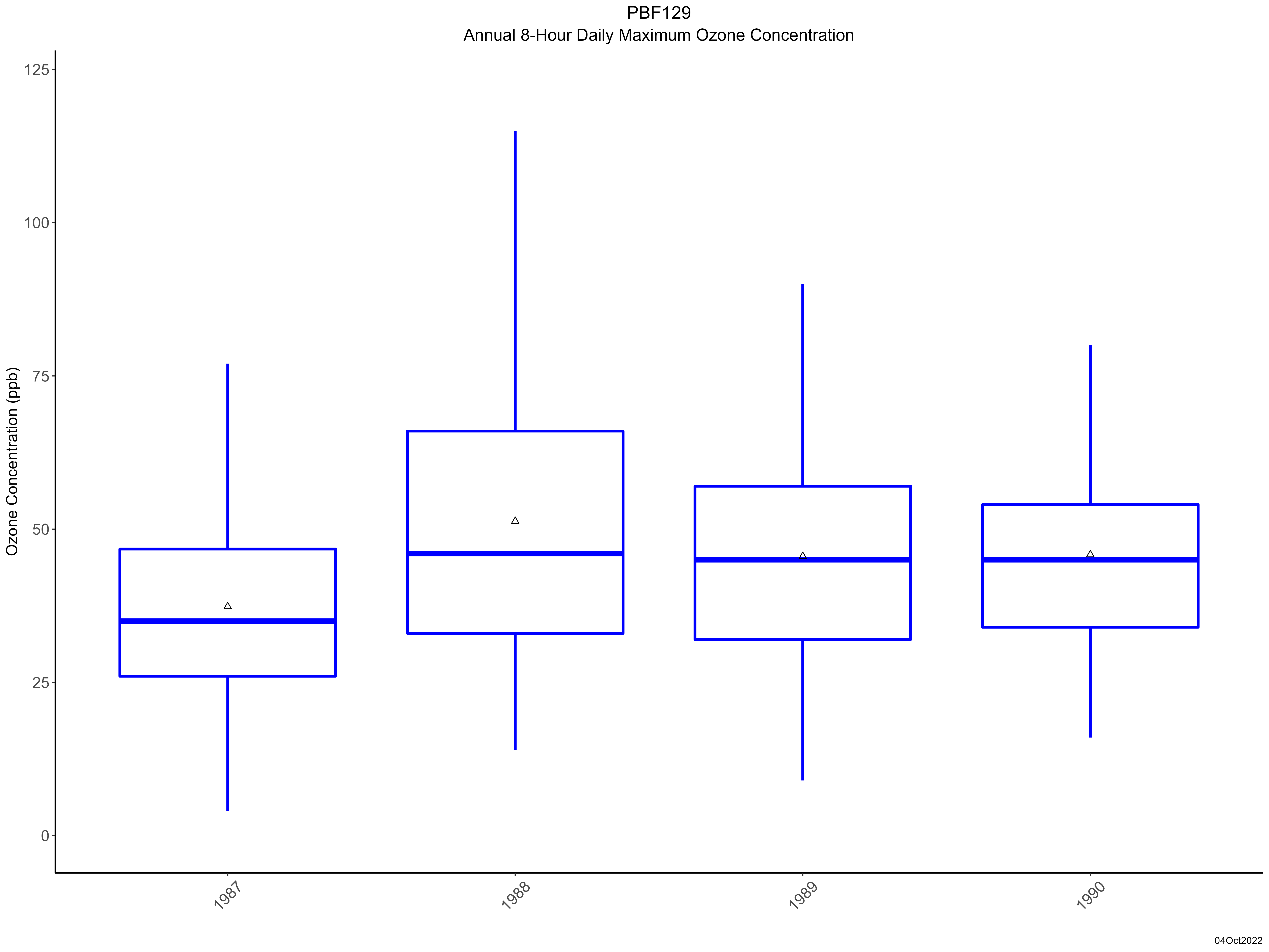
| Graphical Results |
| Trend in maximum 8-hour average ozone concentrations |
 |
|