| Site Photos |
| Site photos not available |
| Site Information |
| Site ID |
MAC426 |
| Site name |
Mammoth Cave NP |
| County |
Edmonson |
| State abbreviation |
KY |
| AQS ID |
210610501 |
| Latitude; decimal degrees |
37.131794 |
| Longitude; decimal degrees |
-86.142953 |
| Elevation; m |
243 |
| Operating agency |
NPS |
| Start date |
07/01/2002 |
| Primary Land Use |
Agric |
| Terrain surrounding site |
Rolling |
| NADP/NTN site ID |
KY10 |
| Distance to nearest NTN site; km |
.449 |
| View Map |
View Map |
|
| Graphical Results |
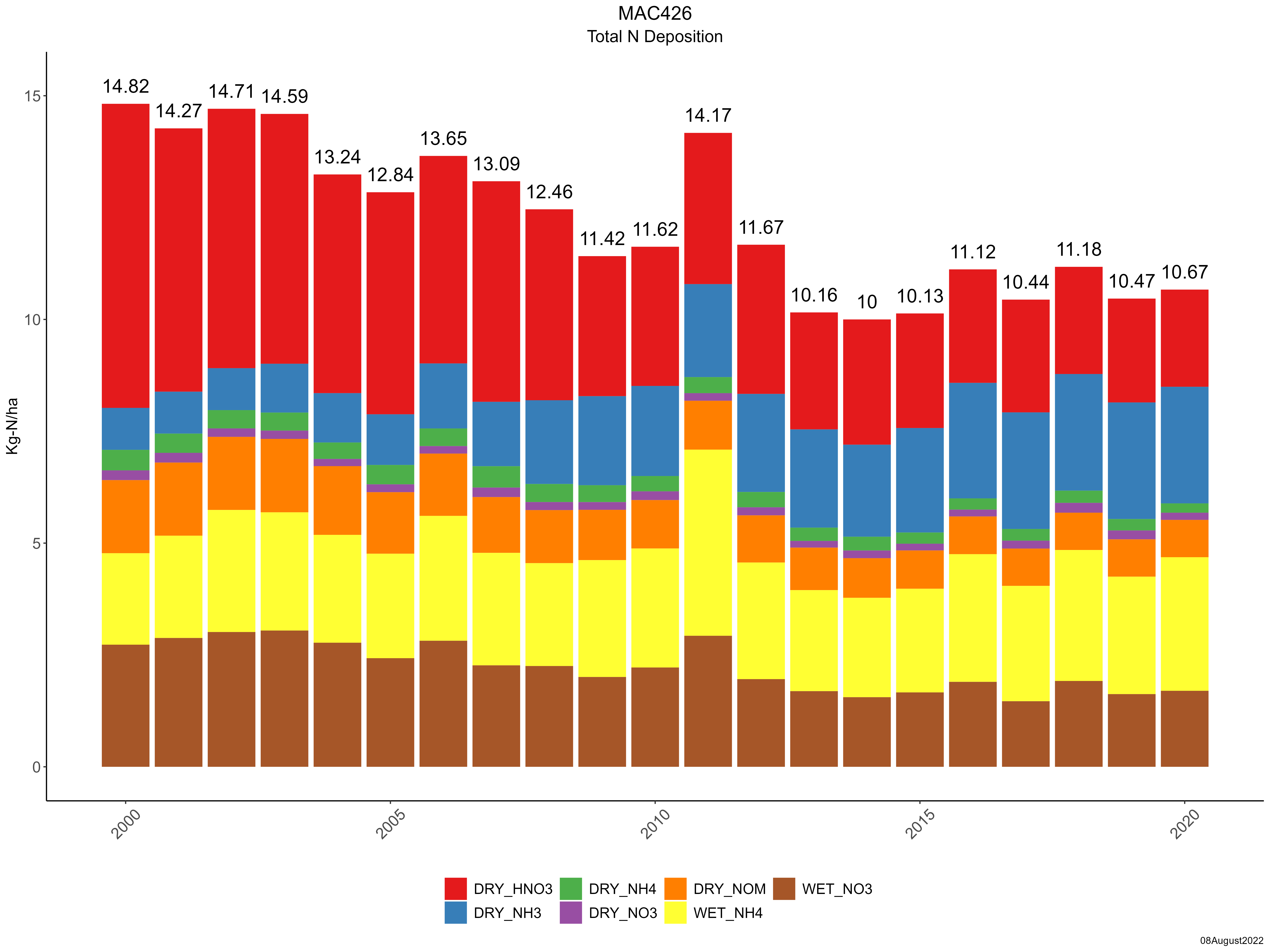
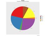
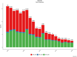
| Composition of total nitrogen deposition by species |
 |
| Trends in total nitrogen deposition |
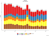 |
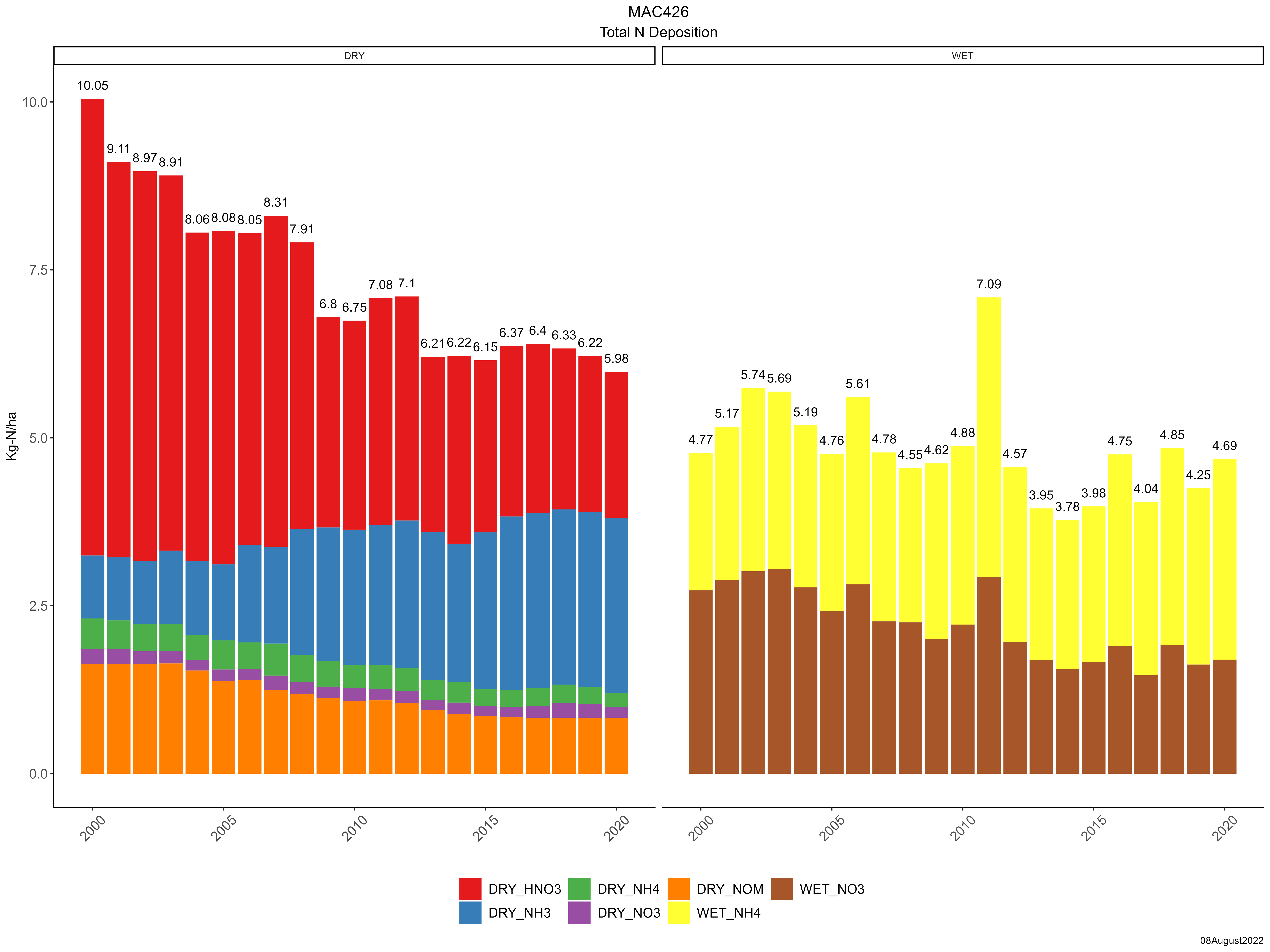
| Trends in wet and dry nitrogen deposition |
 |
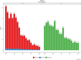
| Composition of total sulfur deposition by species |
 |
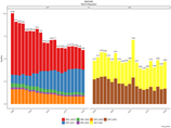
| Trends in total sulfur deposition |
 |
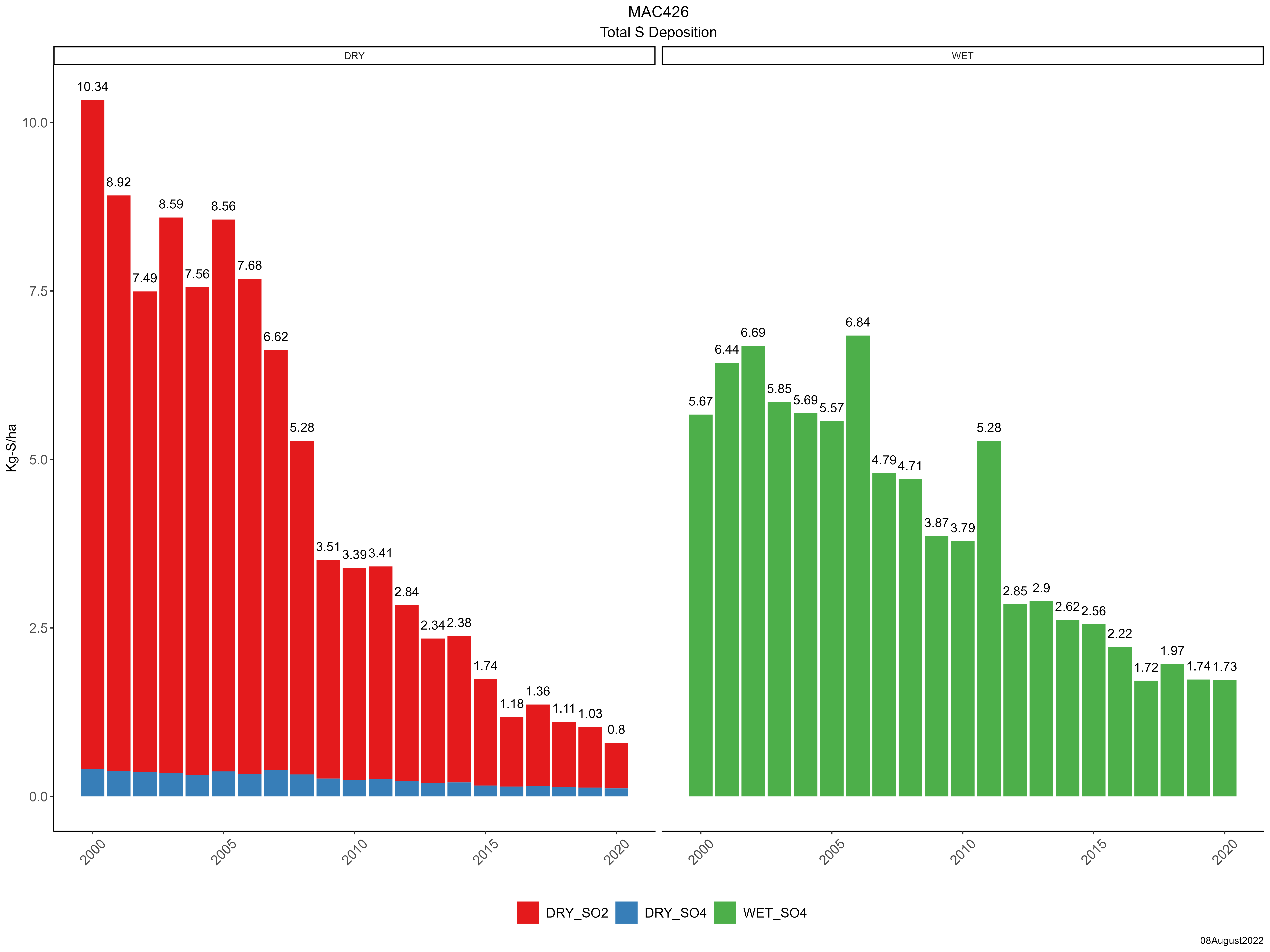
| Trends in wet and dry sulfur deposition |
 |
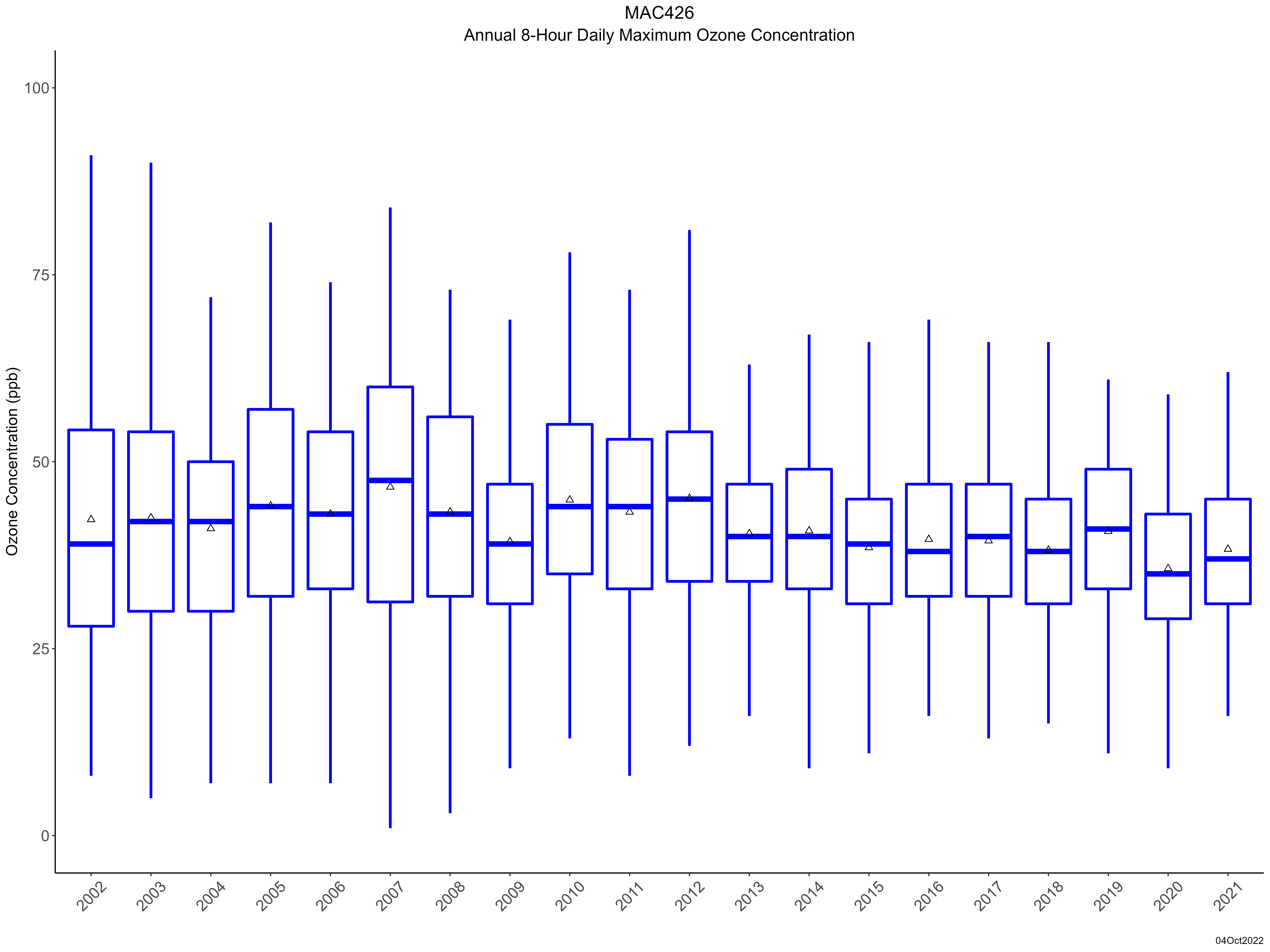
| Trend in maximum 8-hour average ozone concentrations |
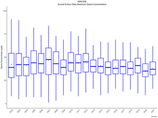 |
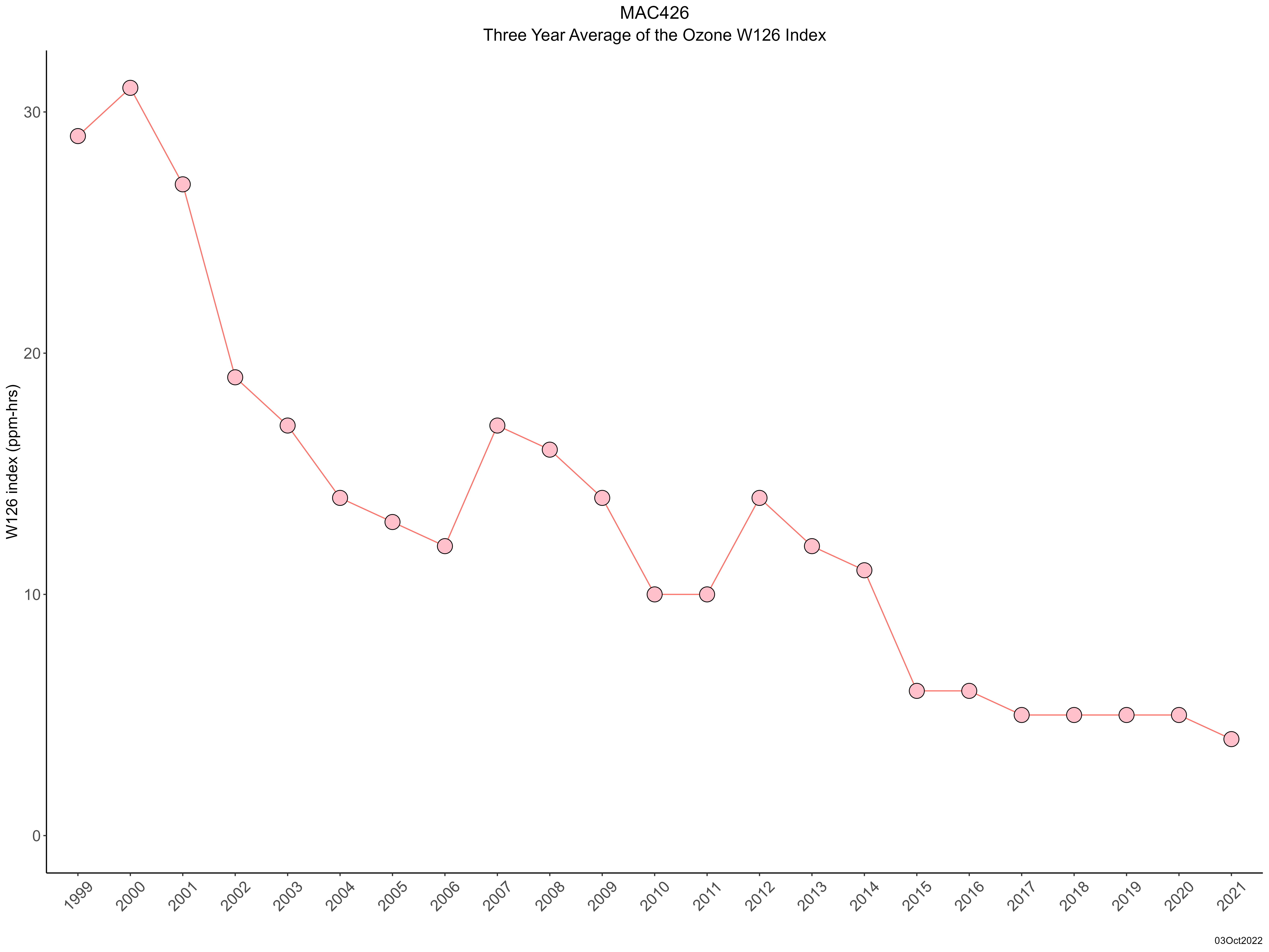
| Trend in 3-year average of ozone W126 index |
 |
|