| Site Photos |
| Site photos not available |
| Site Information |
| Site ID |
HOW132 |
| Site name |
Howland |
| County |
Penobscot |
| State abbreviation |
ME |
| AQS ID |
230199991 |
| Latitude; decimal degrees |
45.215607 |
| Longitude; decimal degrees |
-68.70851 |
| Elevation; m |
66 |
| Operating agency |
EPA |
| Start date |
11/24/1992 |
| End date |
11/05/2012 |
| Primary Land Use |
Forest |
| Terrain surrounding site |
Rolling |
| NADP/NTN site ID |
ME09 |
| Distance to nearest NTN site; km |
80.859 |
| View Map |
View Map |
|
| Graphical Results |
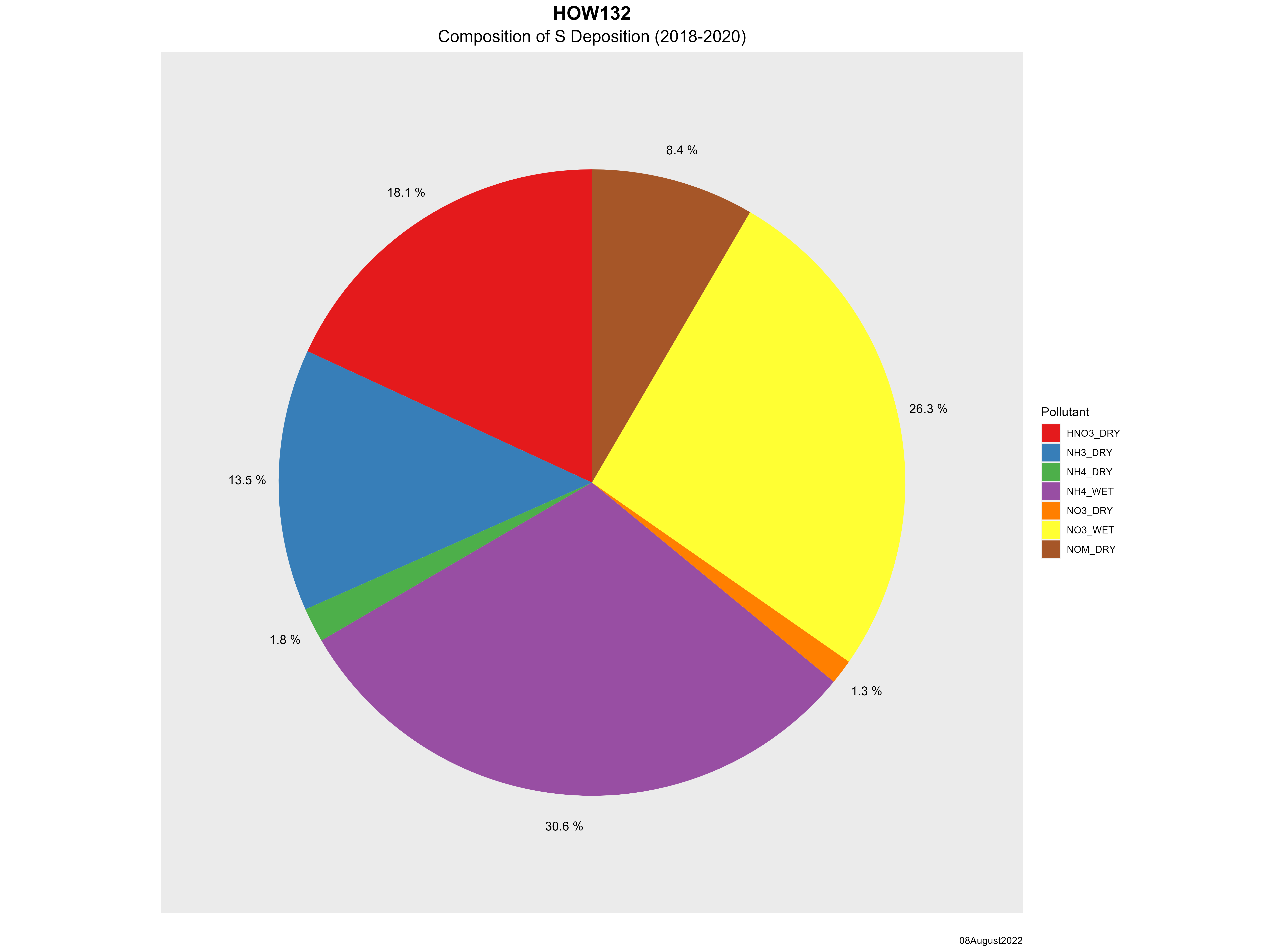
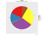
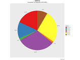
| Composition of total nitrogen deposition by species |
 |
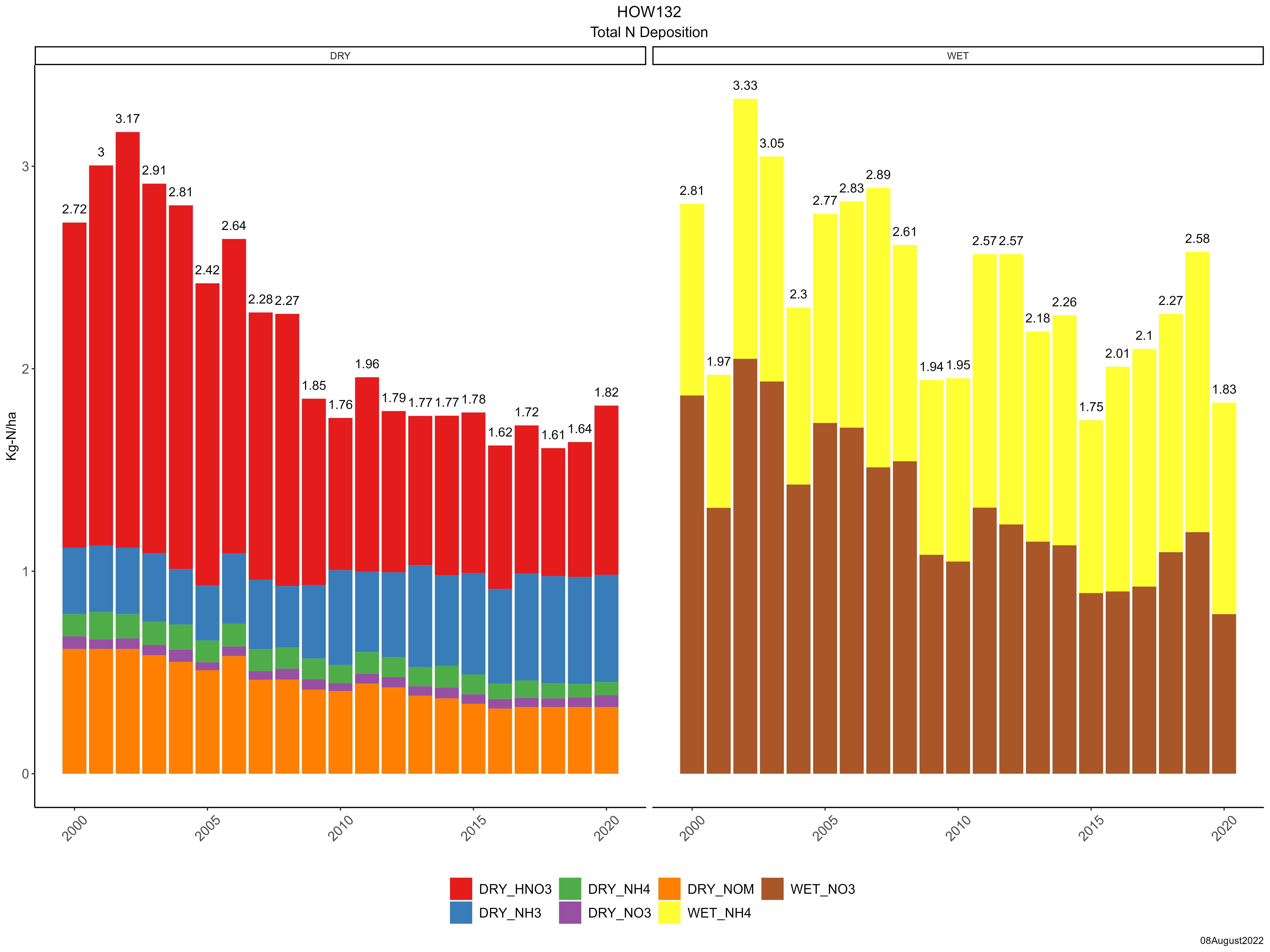
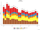
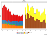
| Trends in total nitrogen deposition |
 |
| Trends in wet and dry nitrogen deposition |
 |
| Composition of total sulfur deposition by species |
 |
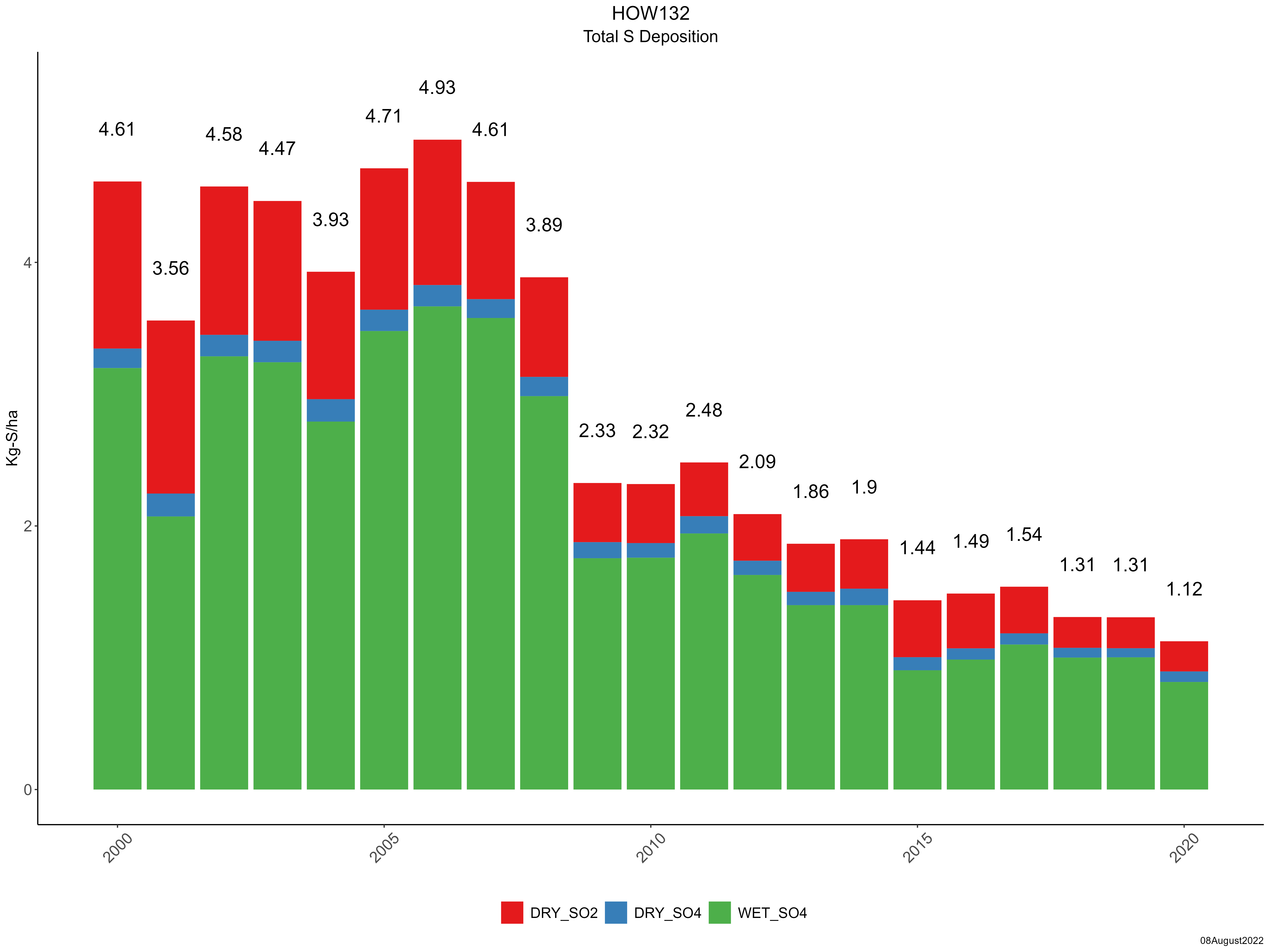
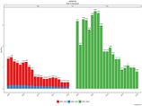
| Trends in total sulfur deposition |
 |
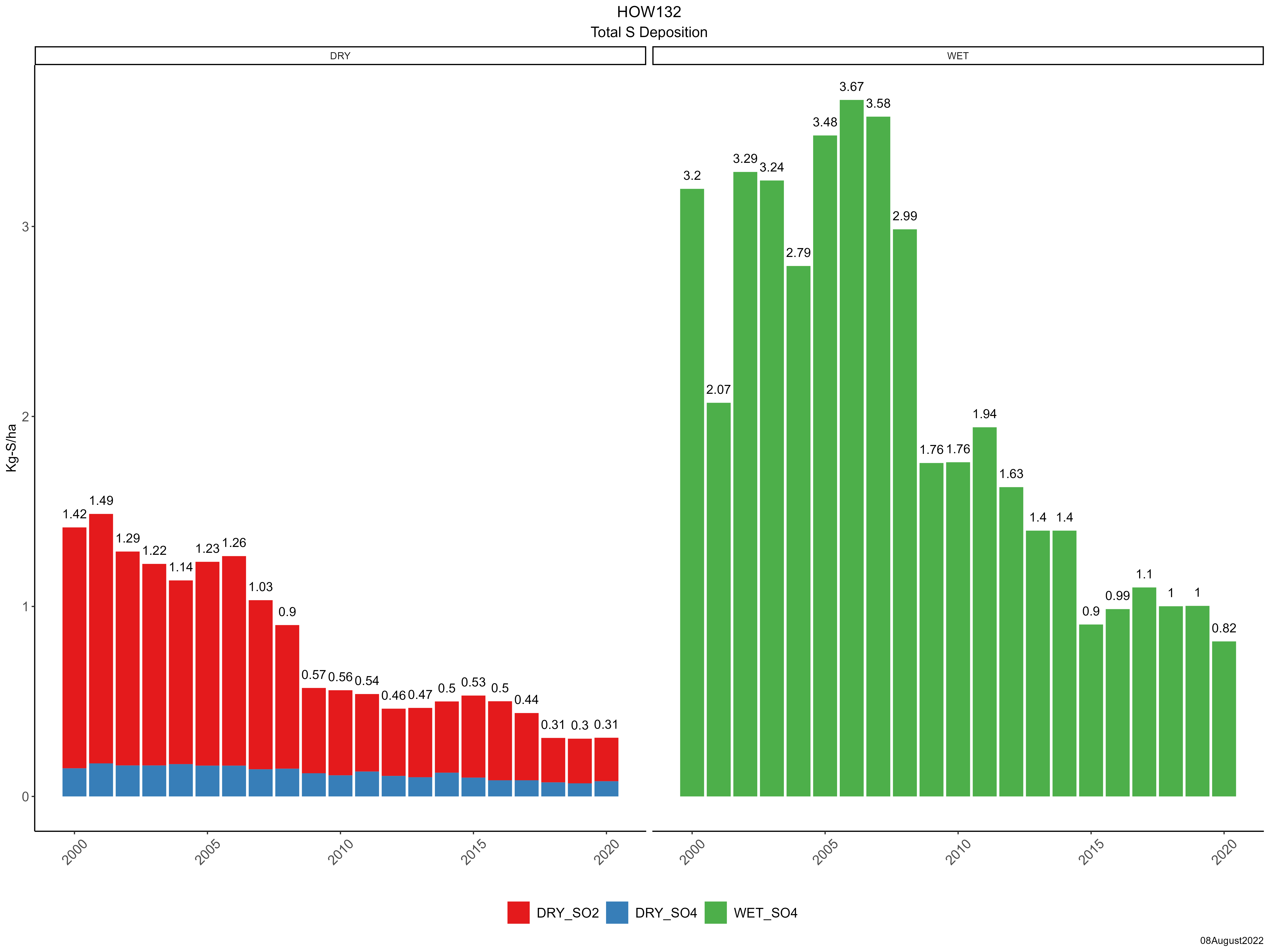
| Trends in wet and dry sulfur deposition |
 |
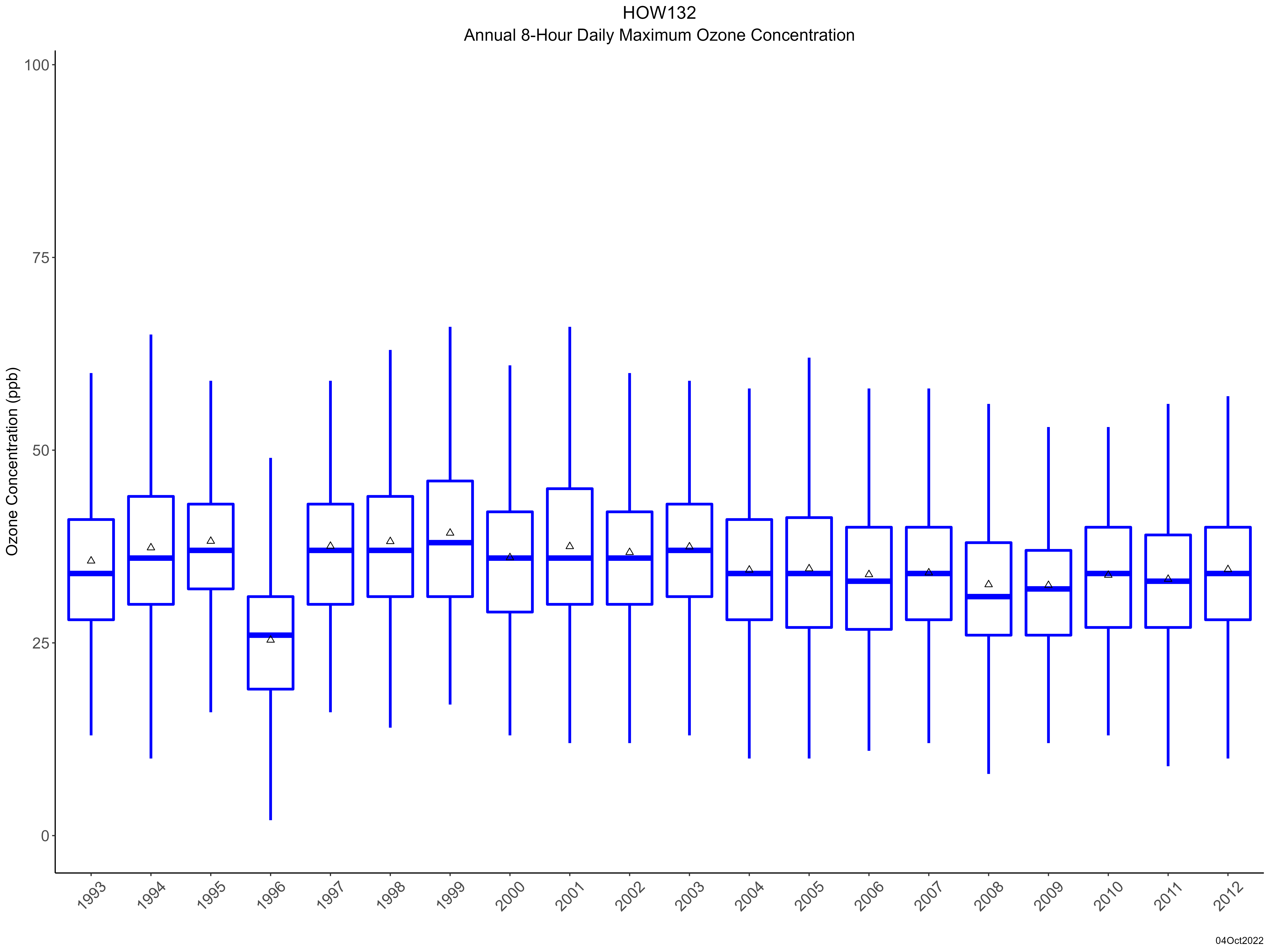
| Trend in maximum 8-hour average ozone concentrations |
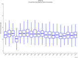 |
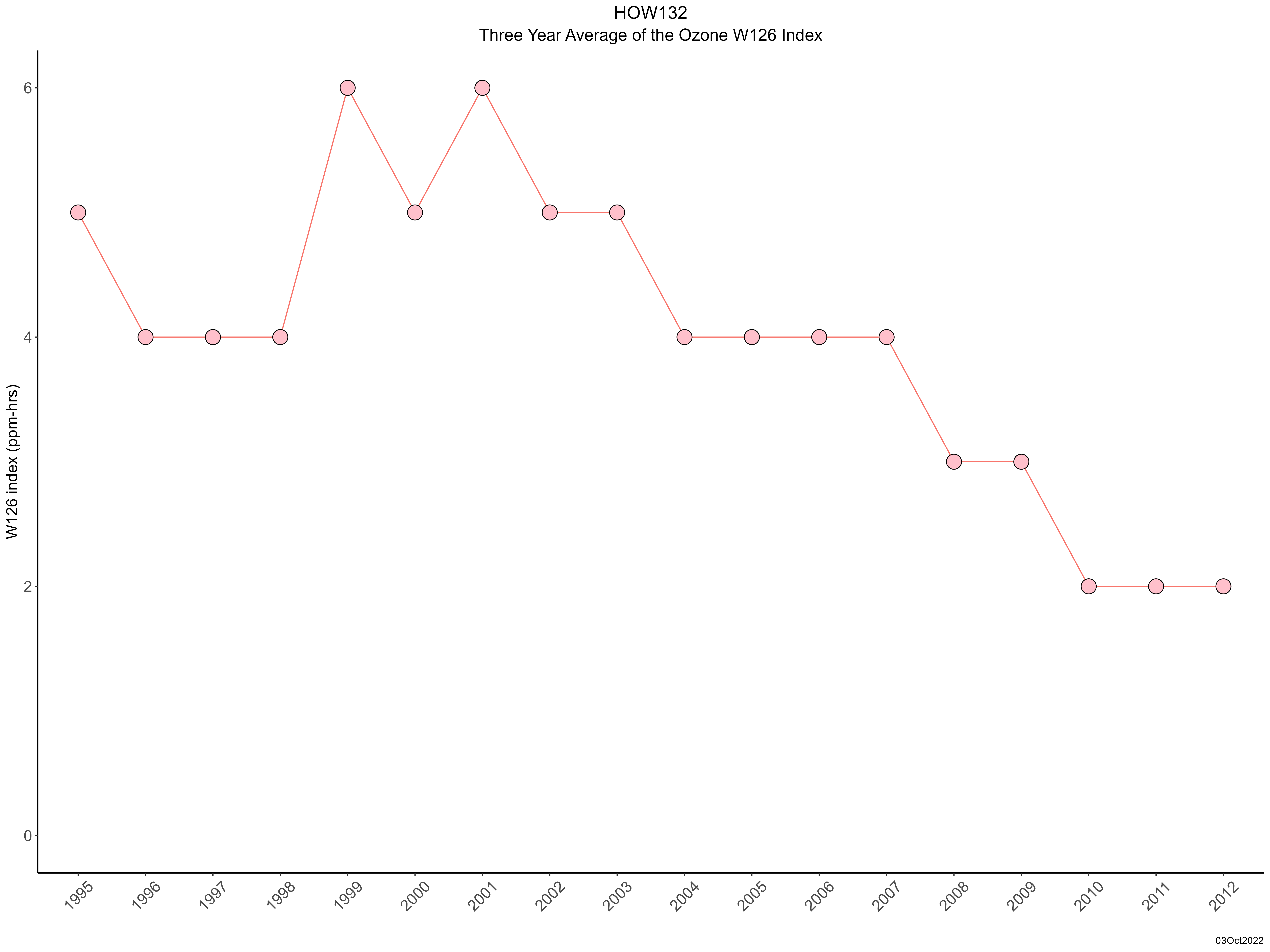
| Trend in 3-year average of ozone W126 index |
 |
|