| Site Photos |
| Site photos not available |
| Site Information |
| Site ID |
GRS420 |
| Site name |
Great Smoky NP - Look Rock |
| County |
Blount |
| State abbreviation |
TN |
| AQS ID |
470090101 |
| Latitude; decimal degrees |
35.633482 |
| Longitude; decimal degrees |
-83.941606 |
| Elevation; m |
793 |
| Operating agency |
NPS |
| Start date |
01/01/1998 |
| Primary Land Use |
Forest |
| Terrain surrounding site |
Complex |
| NADP/NTN site ID |
TN11 |
| Distance to nearest NTN site; km |
32 |
| Co-located NADP/AMoN Site ID |
TN01 |
| View Map |
View Map |
|
| Graphical Results |
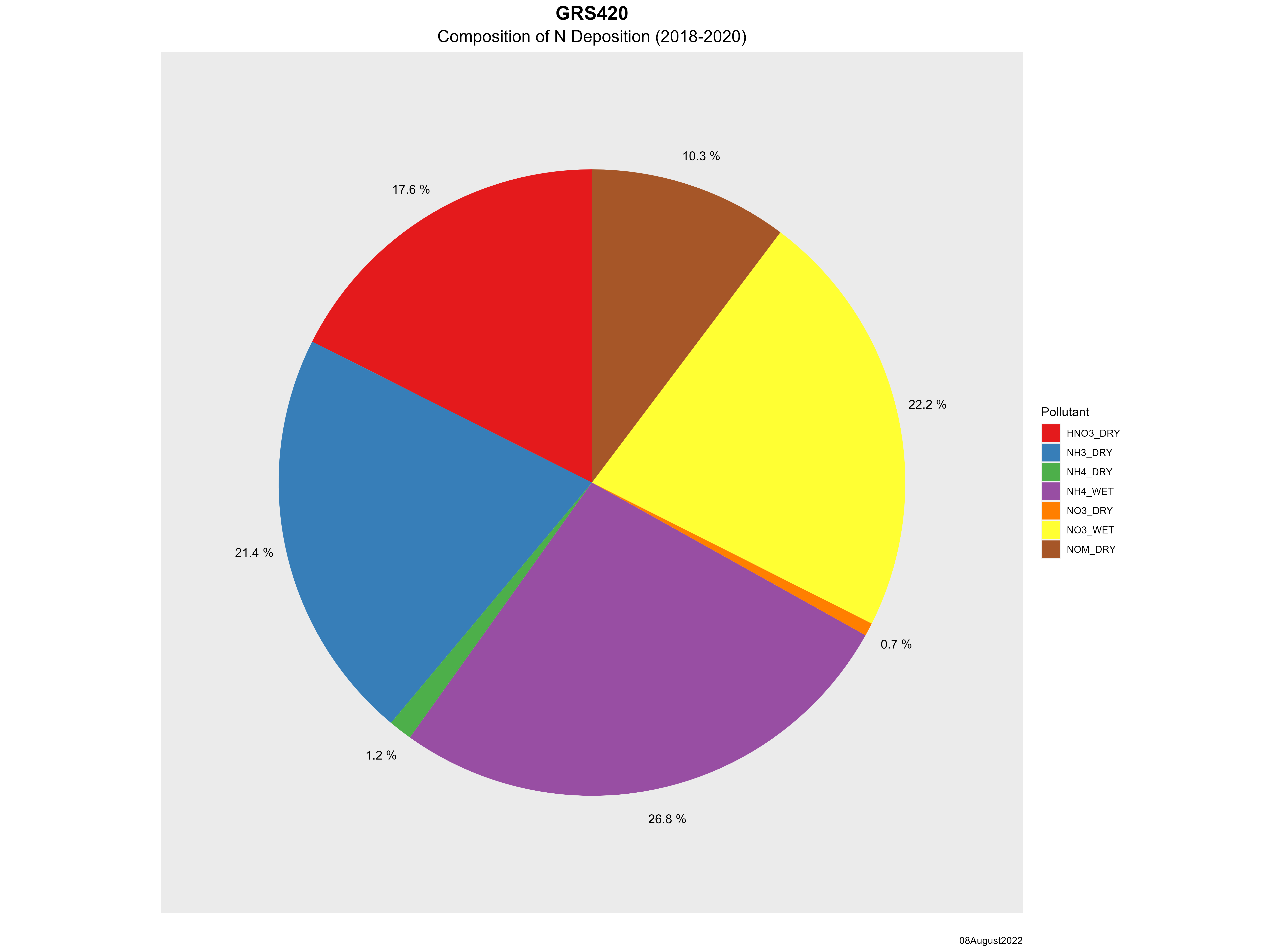
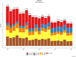
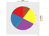
| Composition of total nitrogen deposition by species |
 |
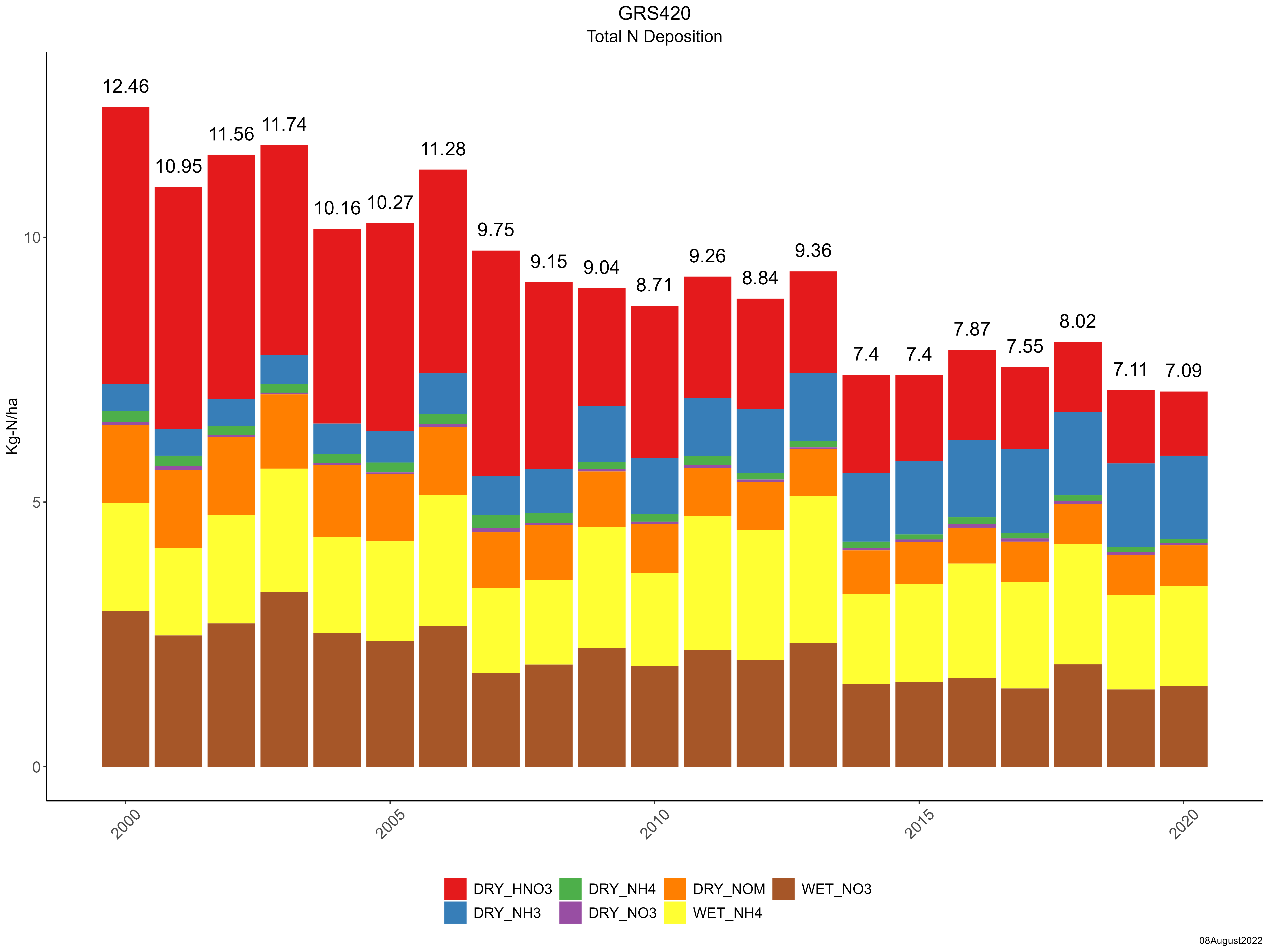
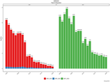
| Trends in total nitrogen deposition |
 |
| Trends in wet and dry nitrogen deposition |
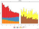 |
| Composition of total sulfur deposition by species |
 |
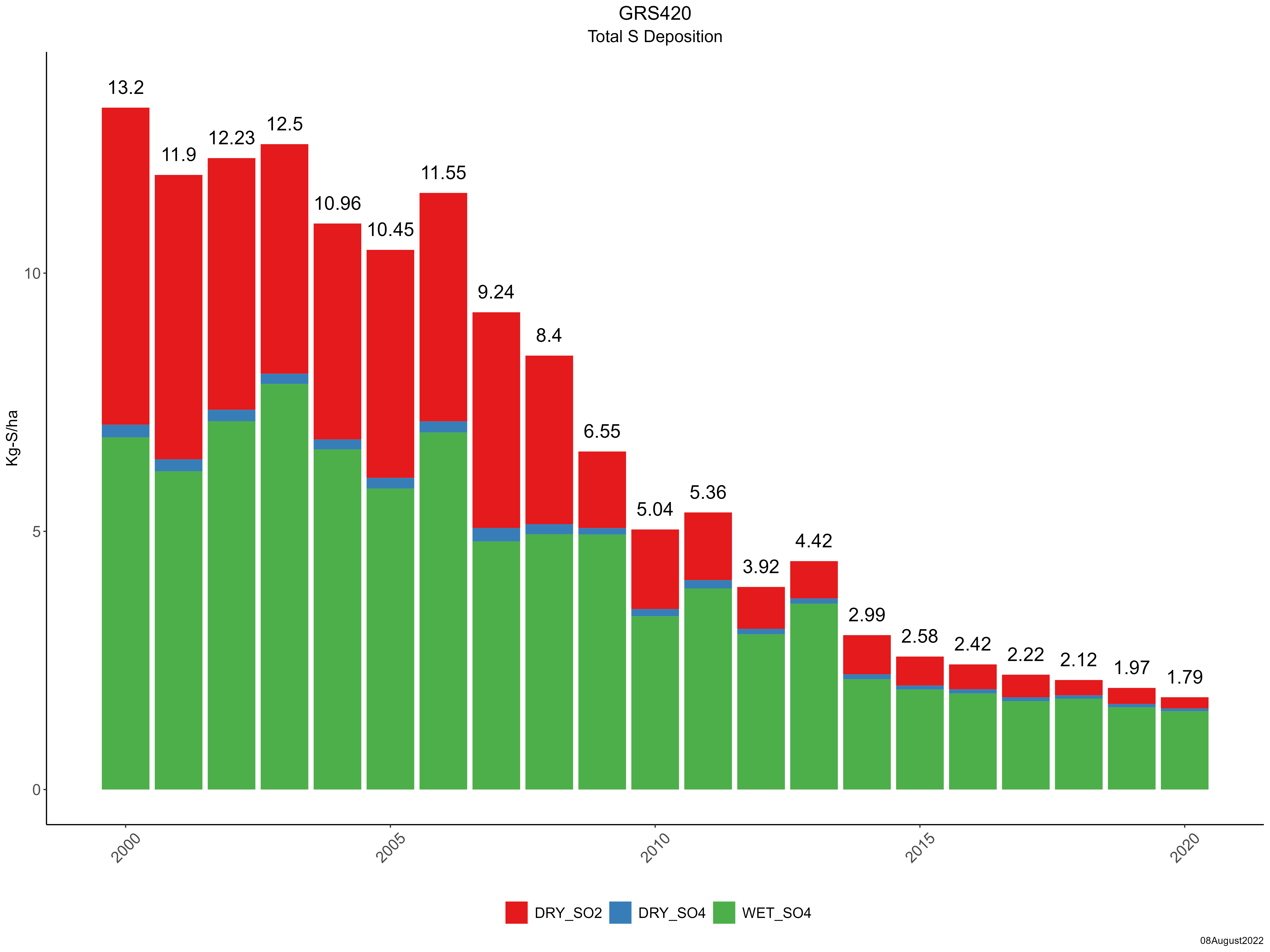
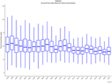
| Trends in total sulfur deposition |
 |
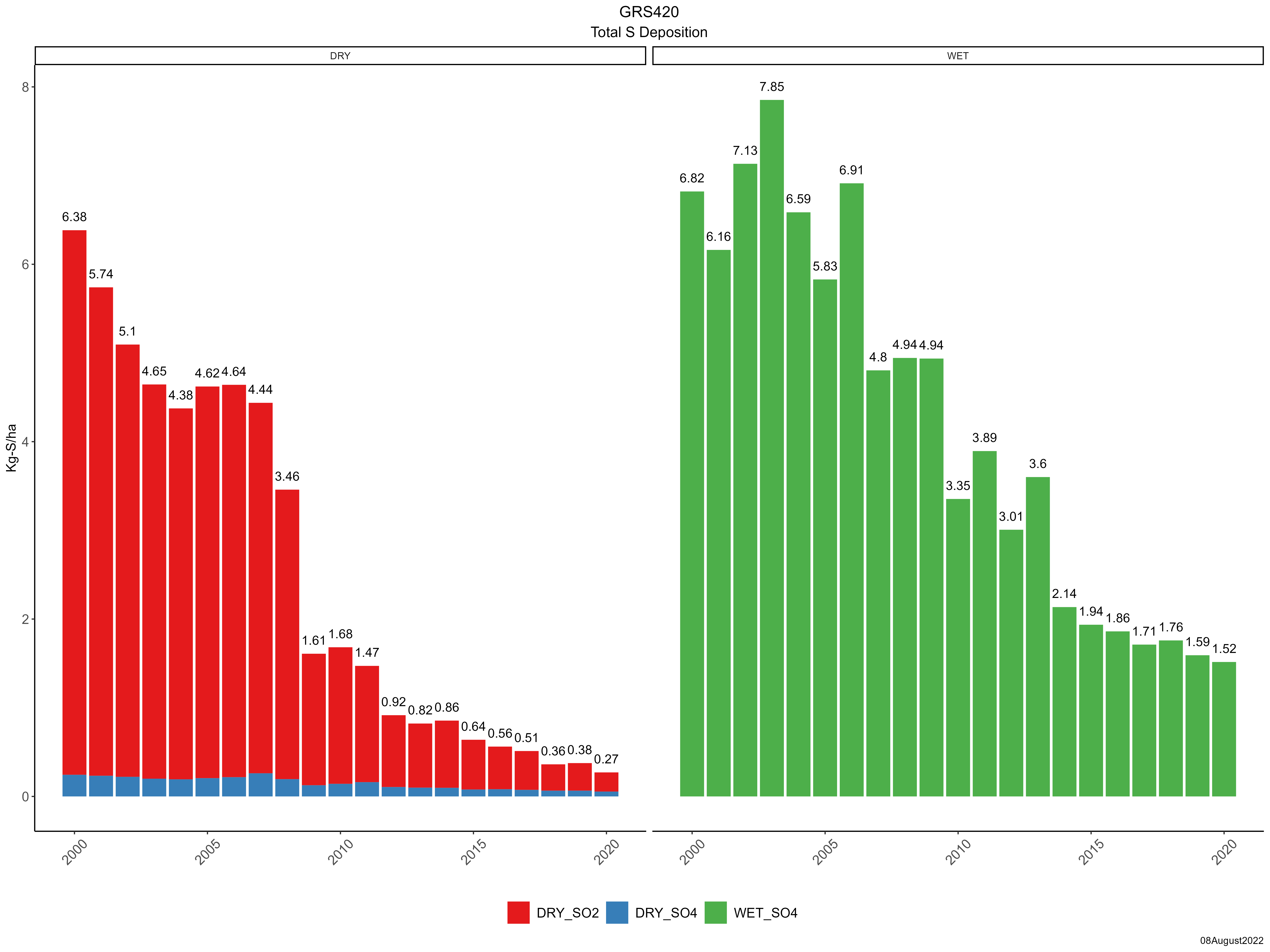
| Trends in wet and dry sulfur deposition |
 |
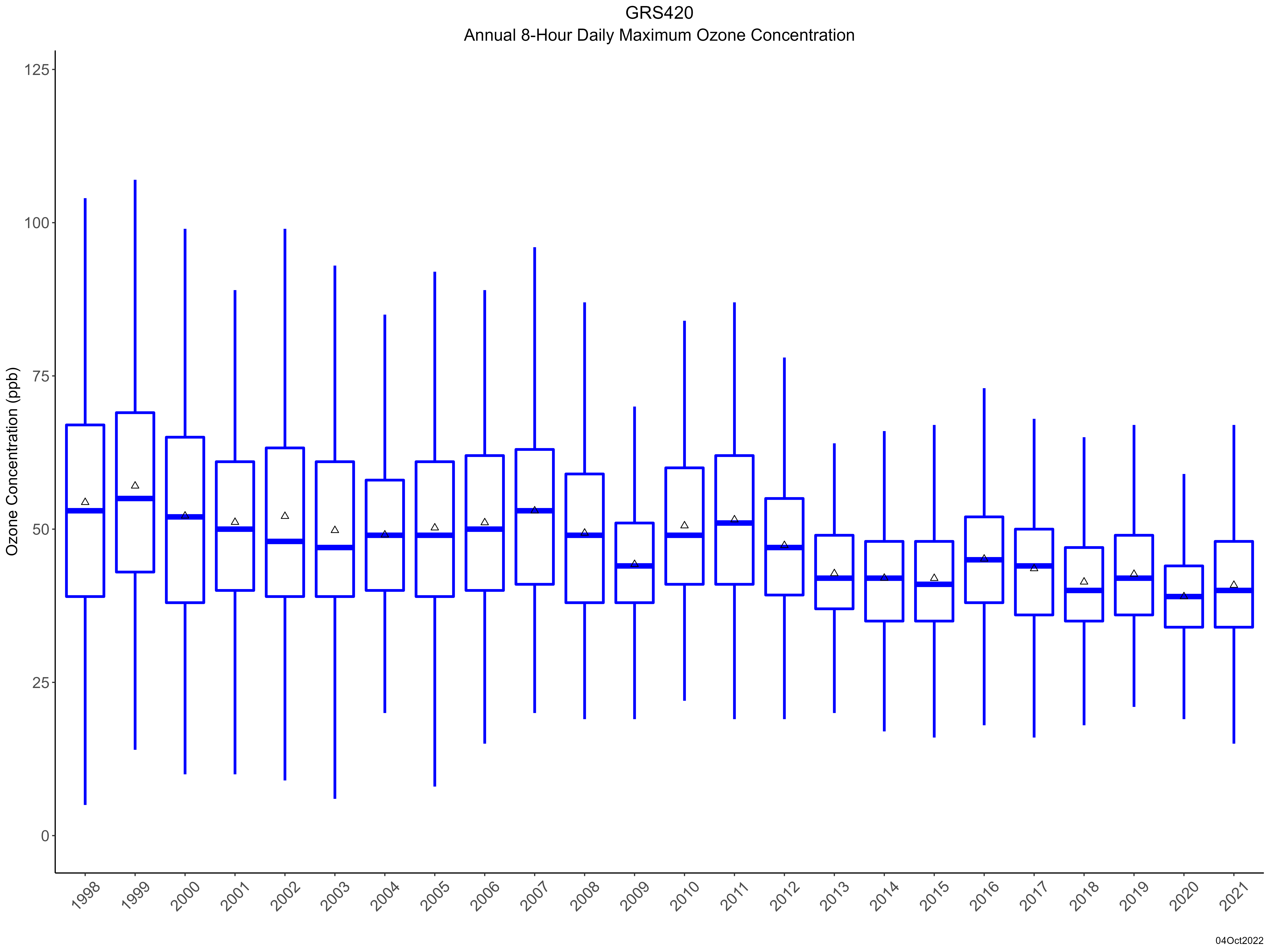
| Trend in maximum 8-hour average ozone concentrations |
 |
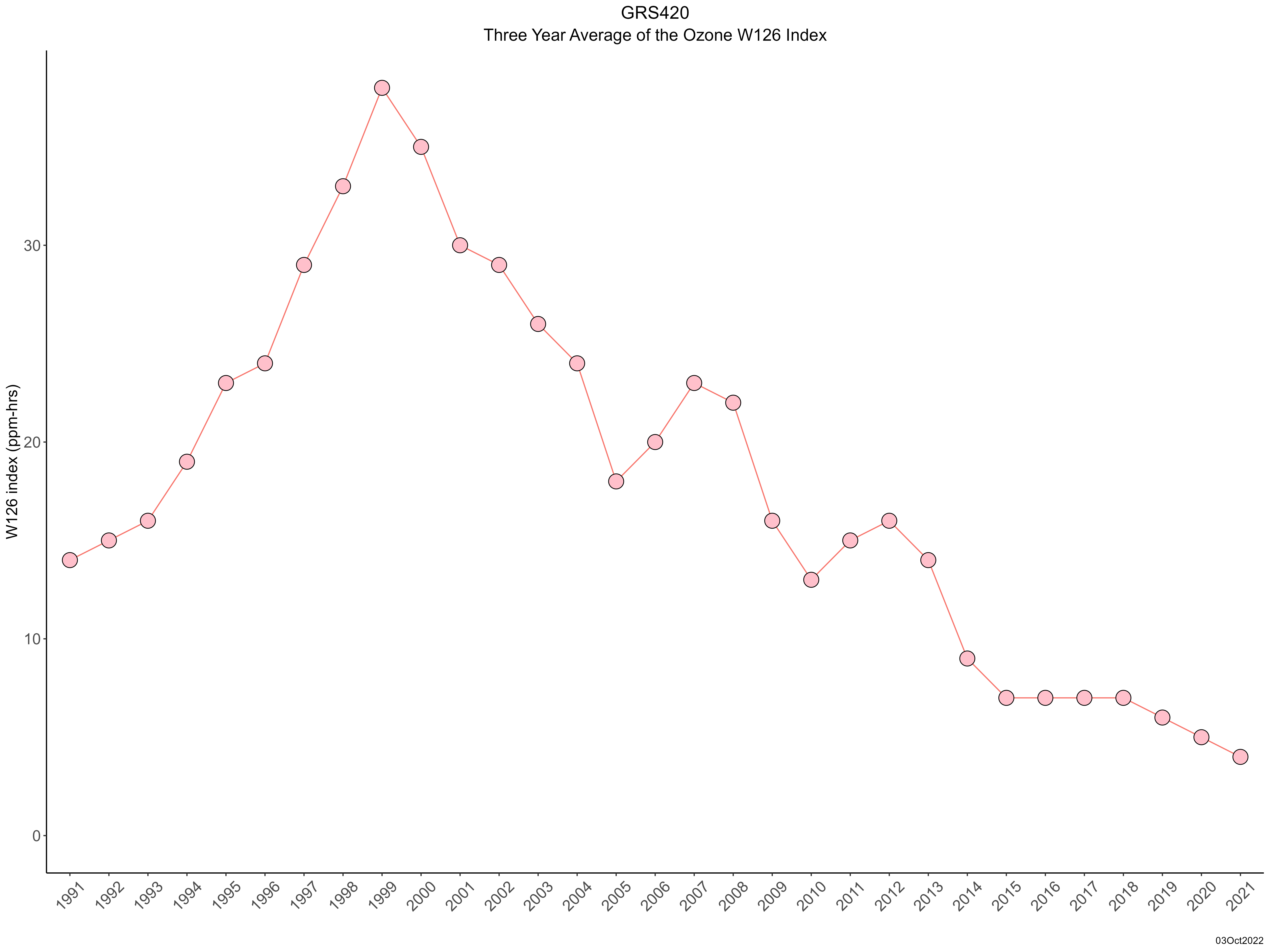
| Trend in 3-year average of ozone W126 index |
 |
|
|
|
| Site History |
| WETNESS : Measurement discontinued on 12/31/2010. |
03-MAY-11 |