| Site Photos |
| Site photos not available |
| Site Information |
| Site ID |
DIN431 |
| Site name |
Dinosaur NM |
| County |
Uintah |
| State abbreviation |
UT |
| AQS ID |
490471002 |
| Latitude; decimal degrees |
40.4373 |
| Longitude; decimal degrees |
-109.3046 |
| Elevation; m |
1463 |
| Operating agency |
NPS |
| Start date |
11/20/2013 |
| Primary Land Use |
Desert |
| Terrain surrounding site |
Complex |
| NADP/NTN site ID |
UT95 |
| Distance to nearest NTN site; km |
37.794 |
| View Map |
View Map |
|
| Graphical Results |
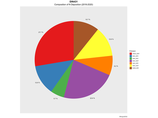
| Composition of total nitrogen deposition by species |
 |
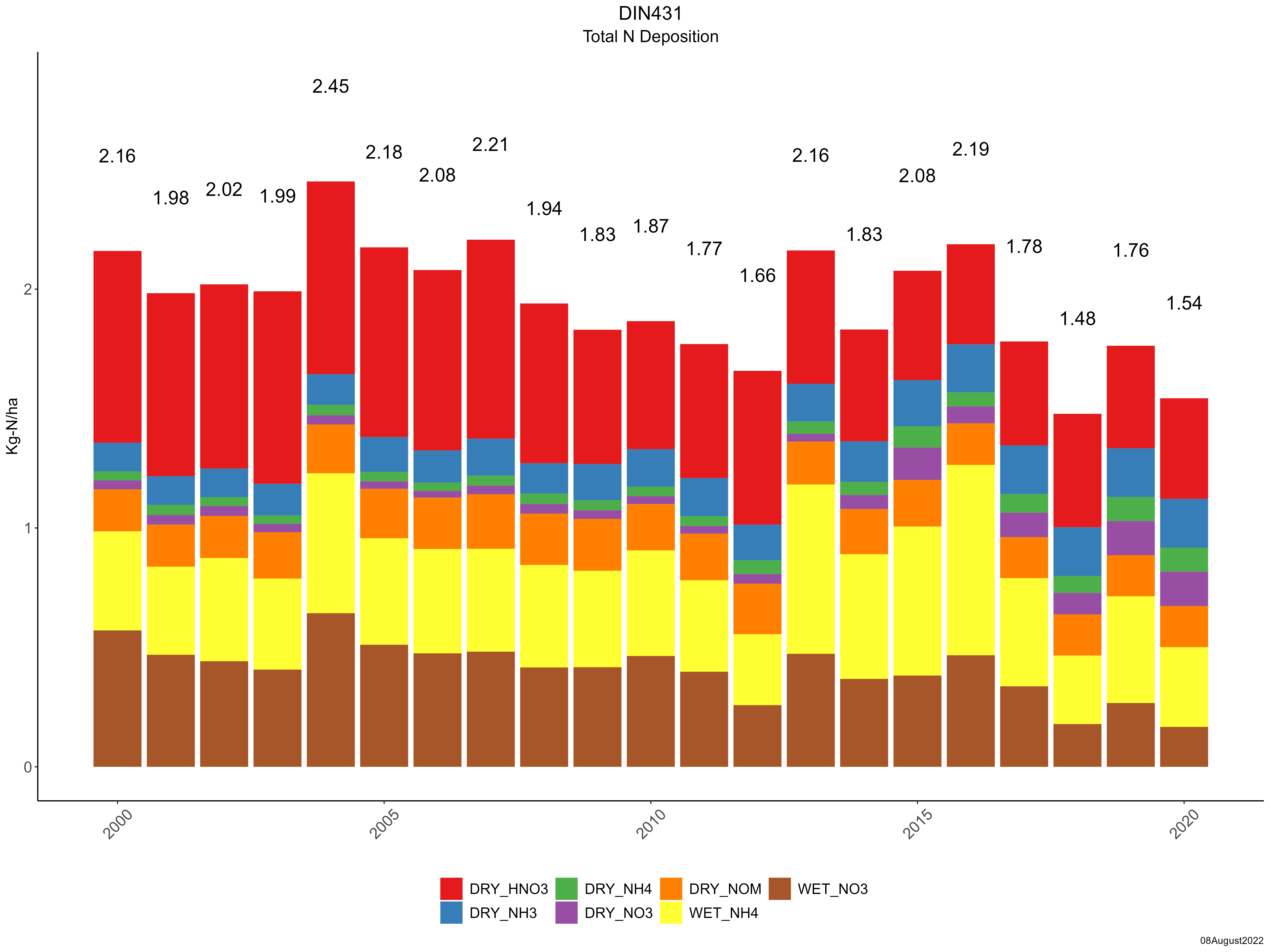
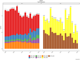
| Trends in total nitrogen deposition |
 |
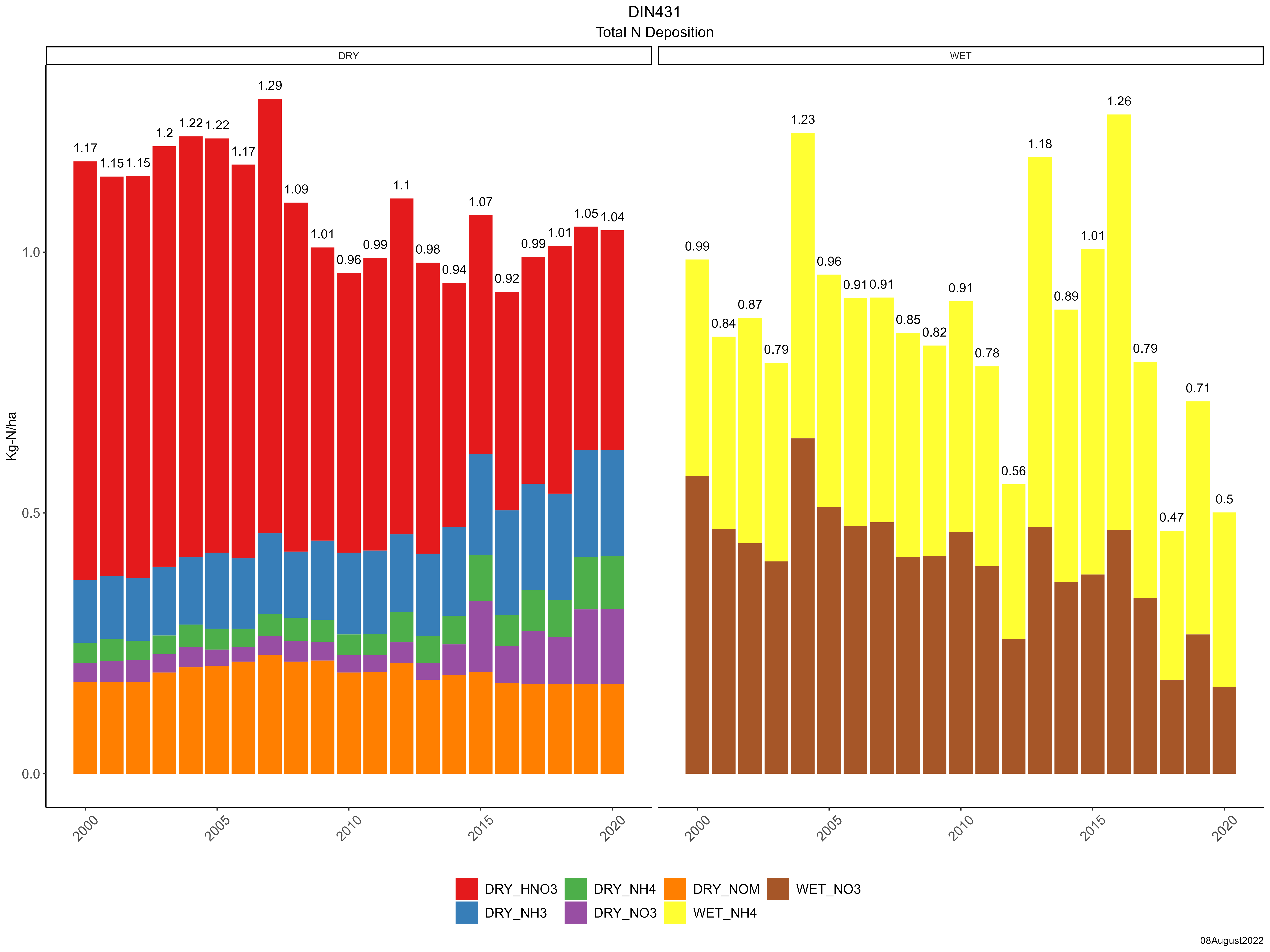
| Trends in wet and dry nitrogen deposition |
 |
| Composition of total sulfur deposition by species |
 |
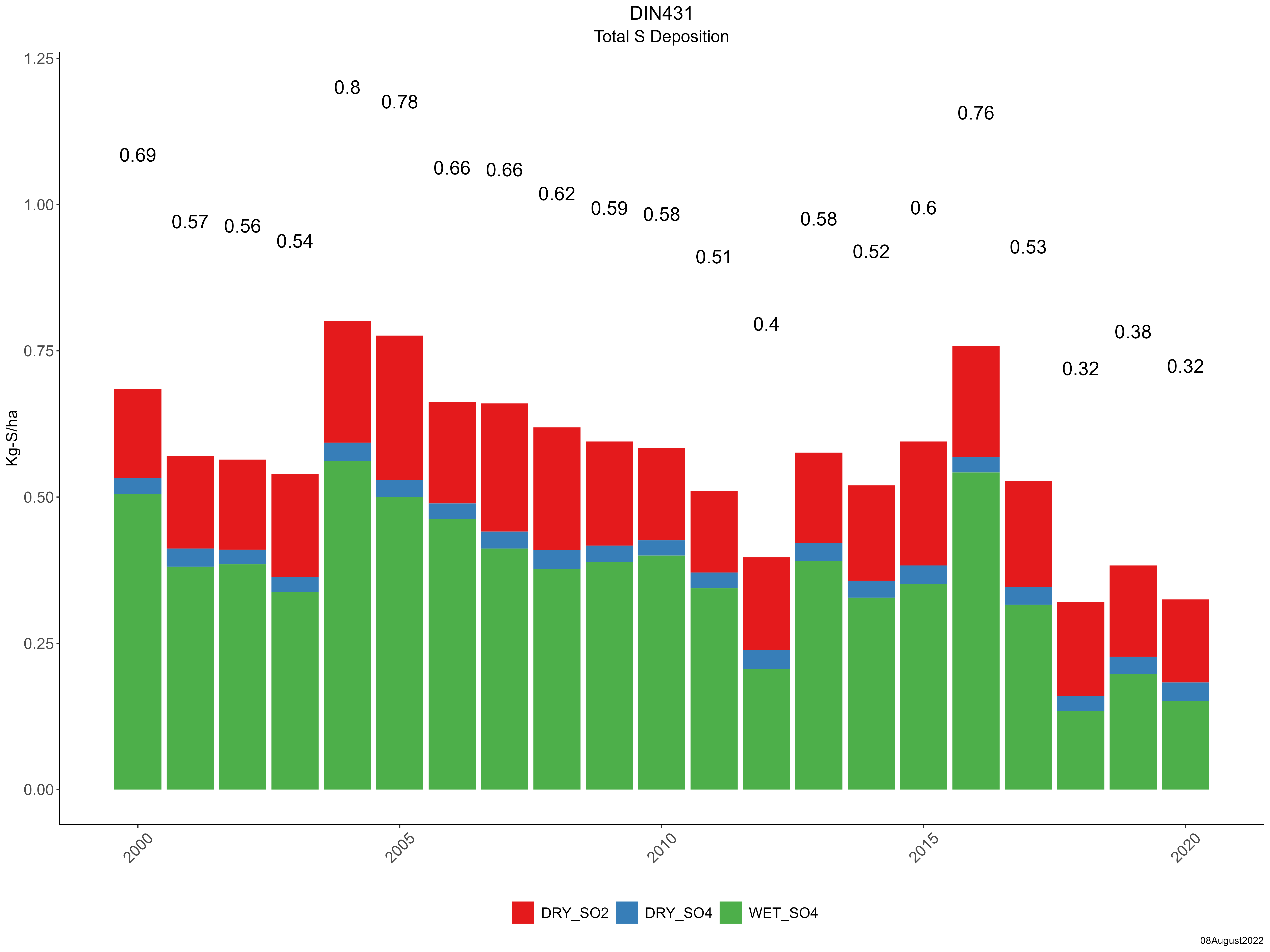
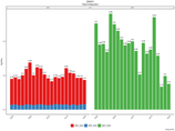
| Trends in total sulfur deposition |
 |
| Trends in wet and dry sulfur deposition |
 |
| Trend in maximum 8-hour average ozone concentrations |
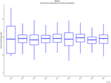 |
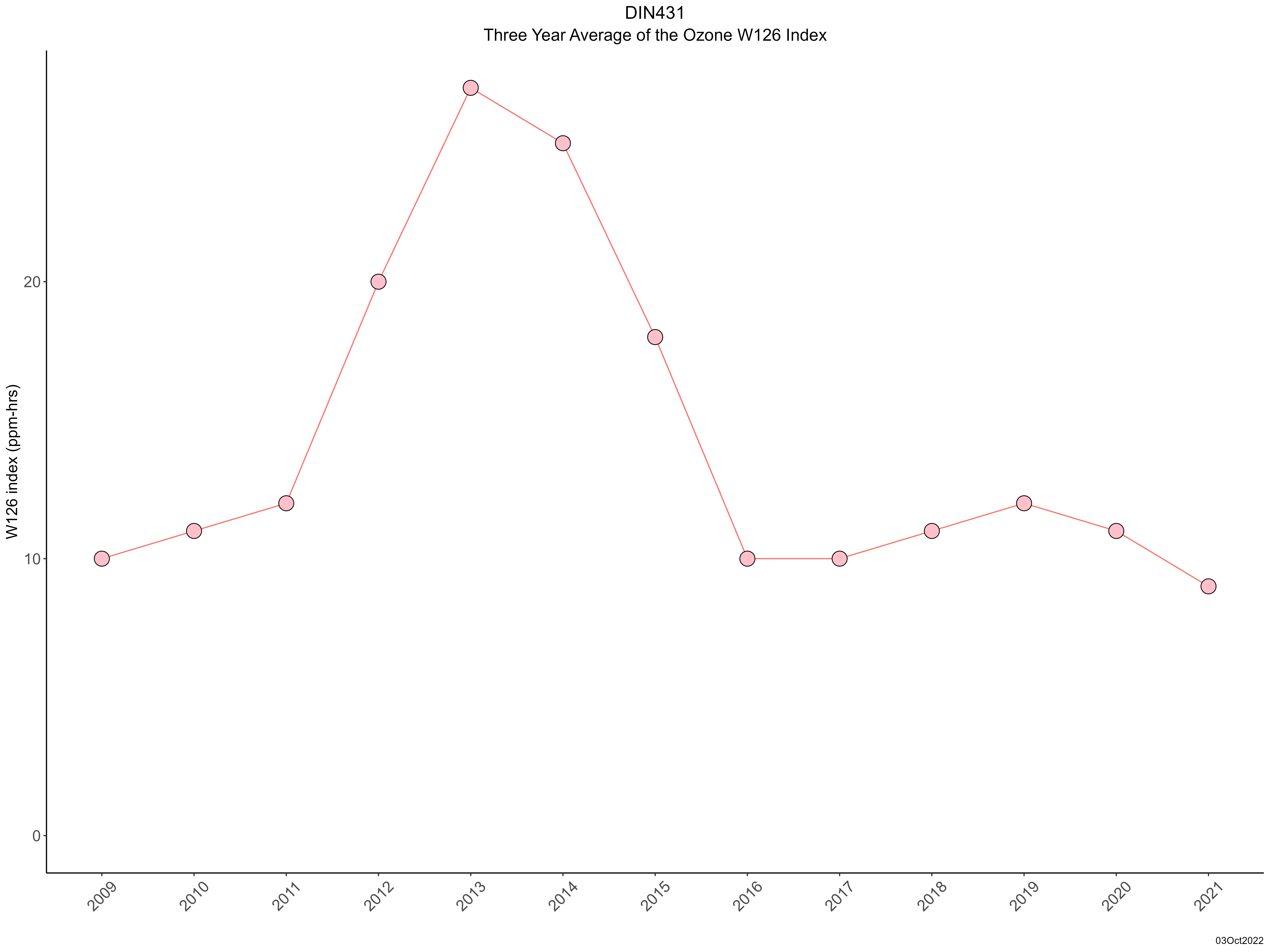
| Trend in 3-year average of ozone W126 index |
 |
|