| Site Photos |
| Site photos not available |
| Site Information |
| Site ID |
CON186 |
| Site name |
Converse Station |
| County |
San Bernardino |
| State abbreviation |
CA |
| Latitude; decimal degrees |
34.194048 |
| Longitude; decimal degrees |
-116.912977 |
| Elevation; m |
1718 |
| Operating agency |
EPA |
| Start date |
06/17/2003 |
| End date |
01/31/2011 |
| Primary Land Use |
Forest/Arid |
| Terrain surrounding site |
Complex |
| NADP/NTN site ID |
CA94 |
| Distance to nearest NTN site; km |
.03 |
| View Map |
View Map |
|
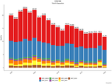
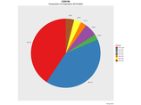
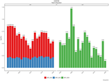
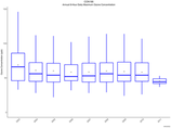
| Graphical Results |
| Composition of total nitrogen deposition by species |
 |
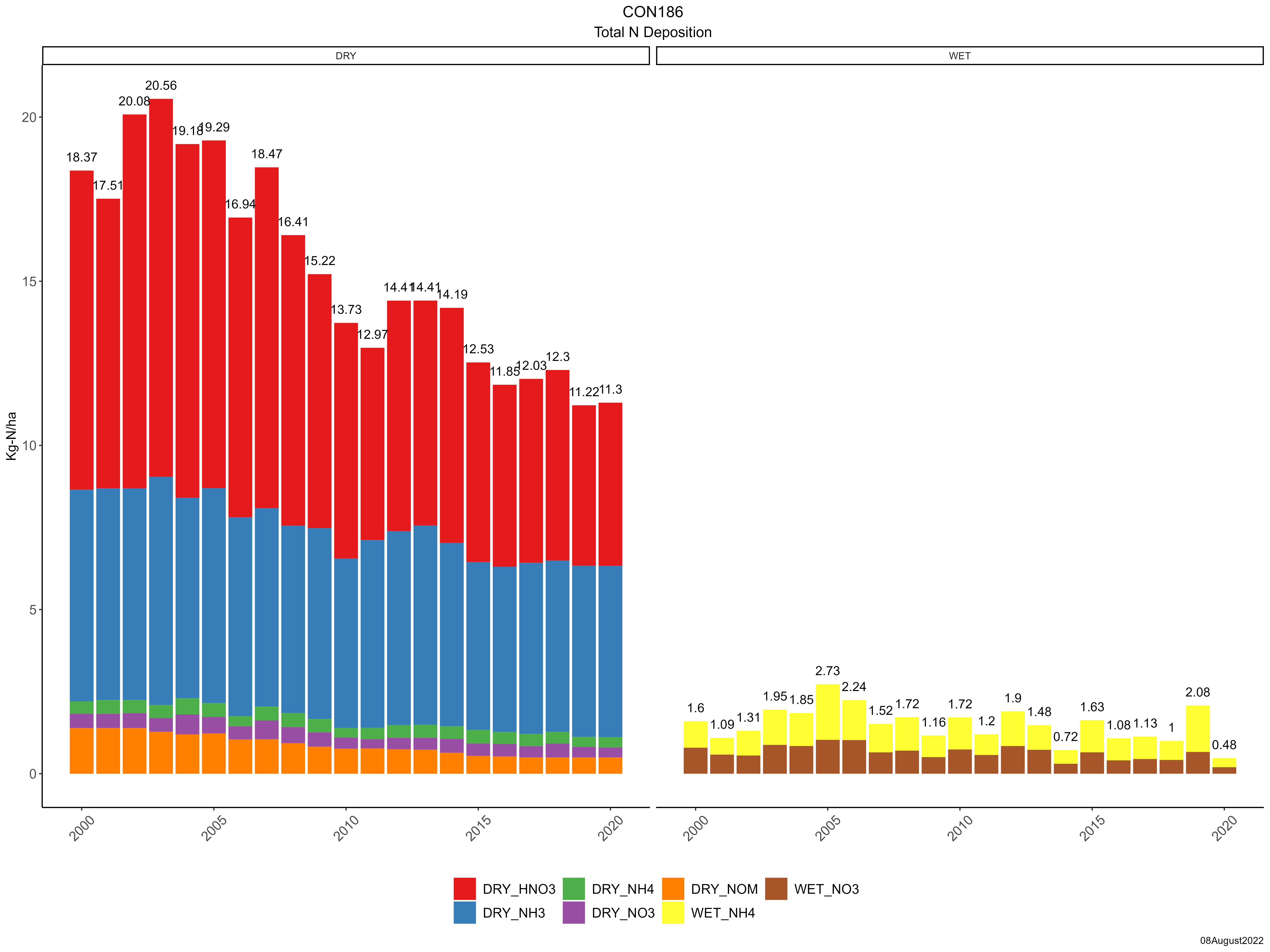
| Trends in total nitrogen deposition |
 |
| Trends in wet and dry nitrogen deposition |
 |
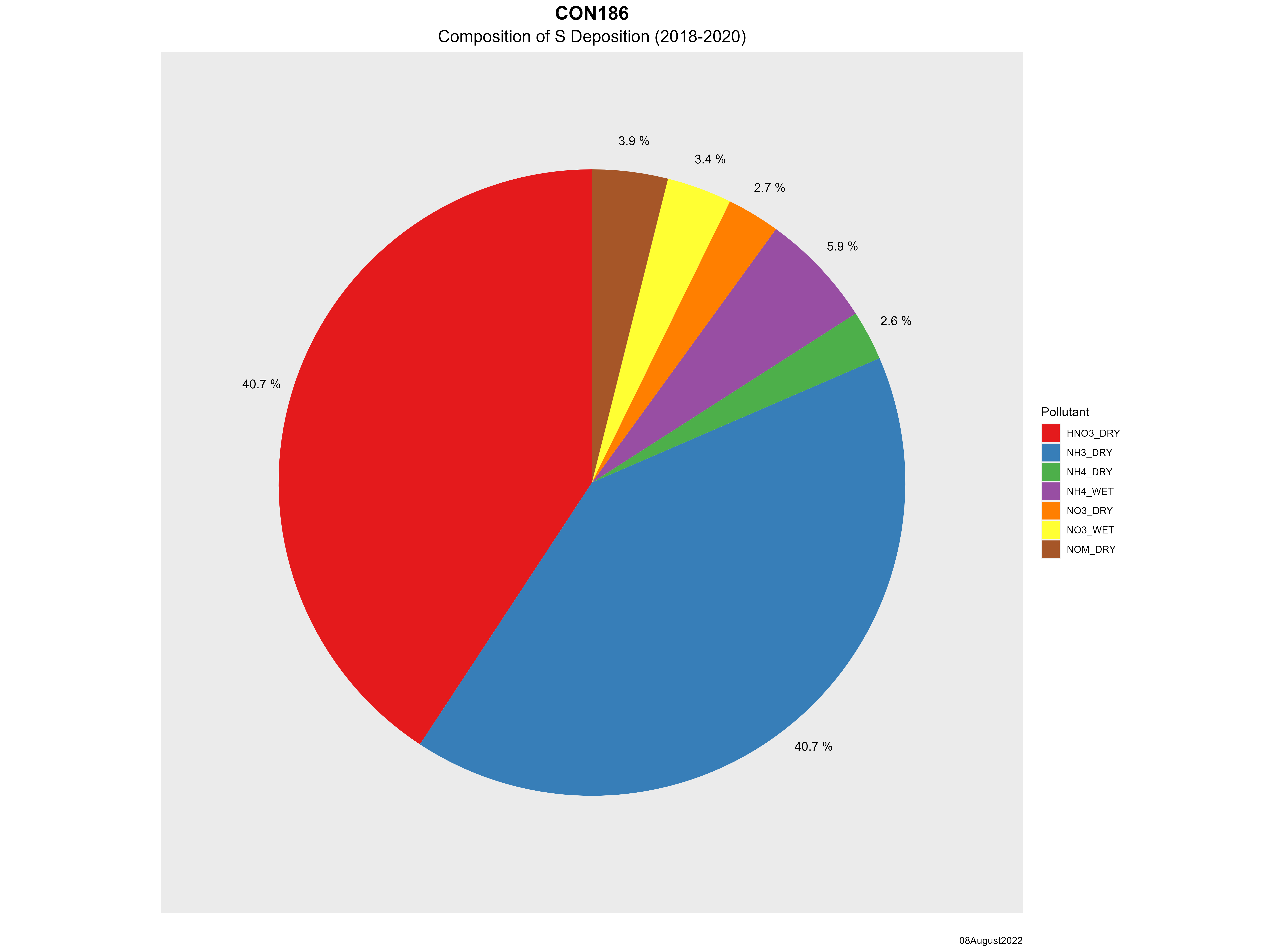
| Composition of total sulfur deposition by species |
 |
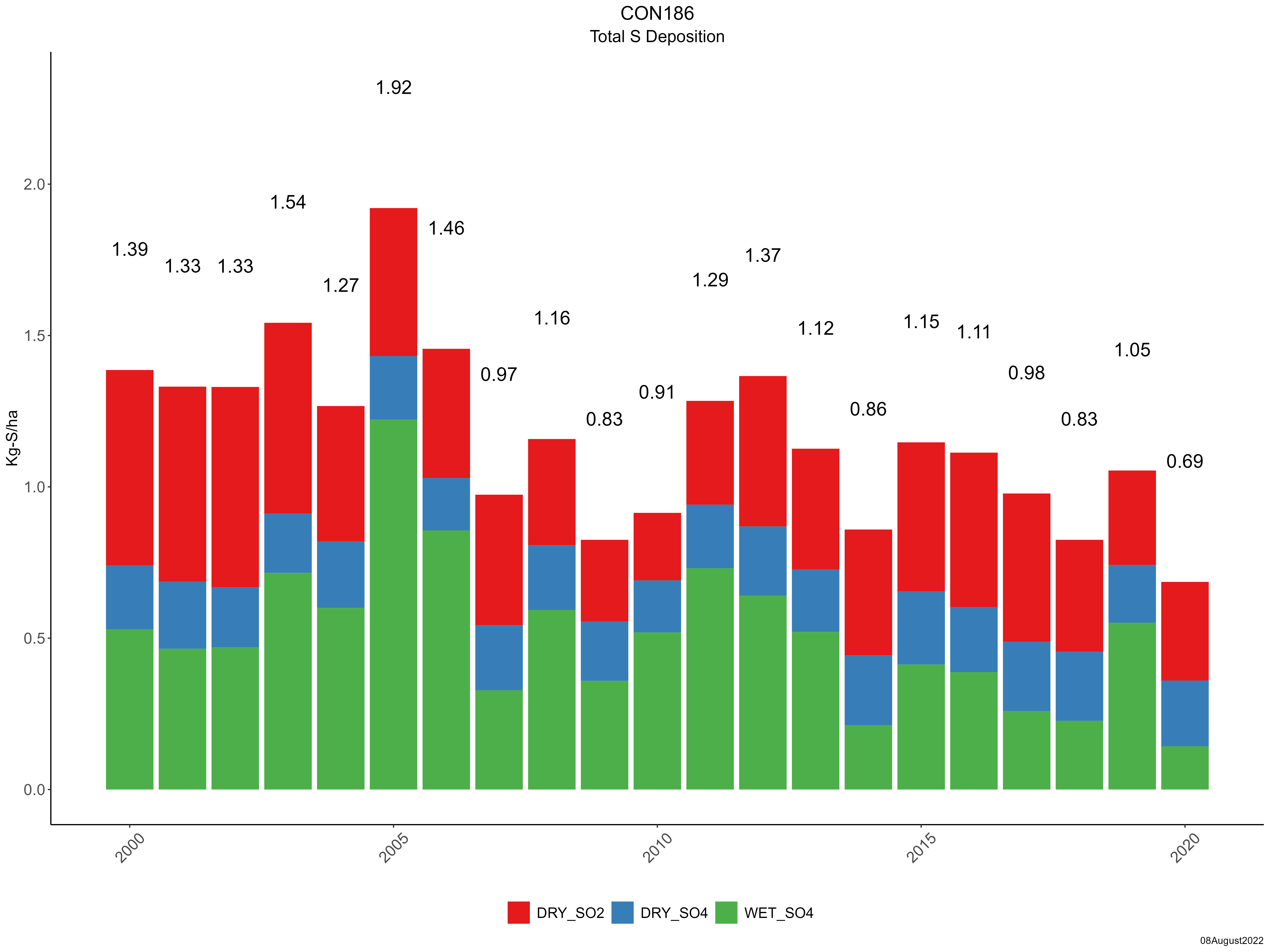
| Trends in total sulfur deposition |
 |
| Trends in wet and dry sulfur deposition |
 |
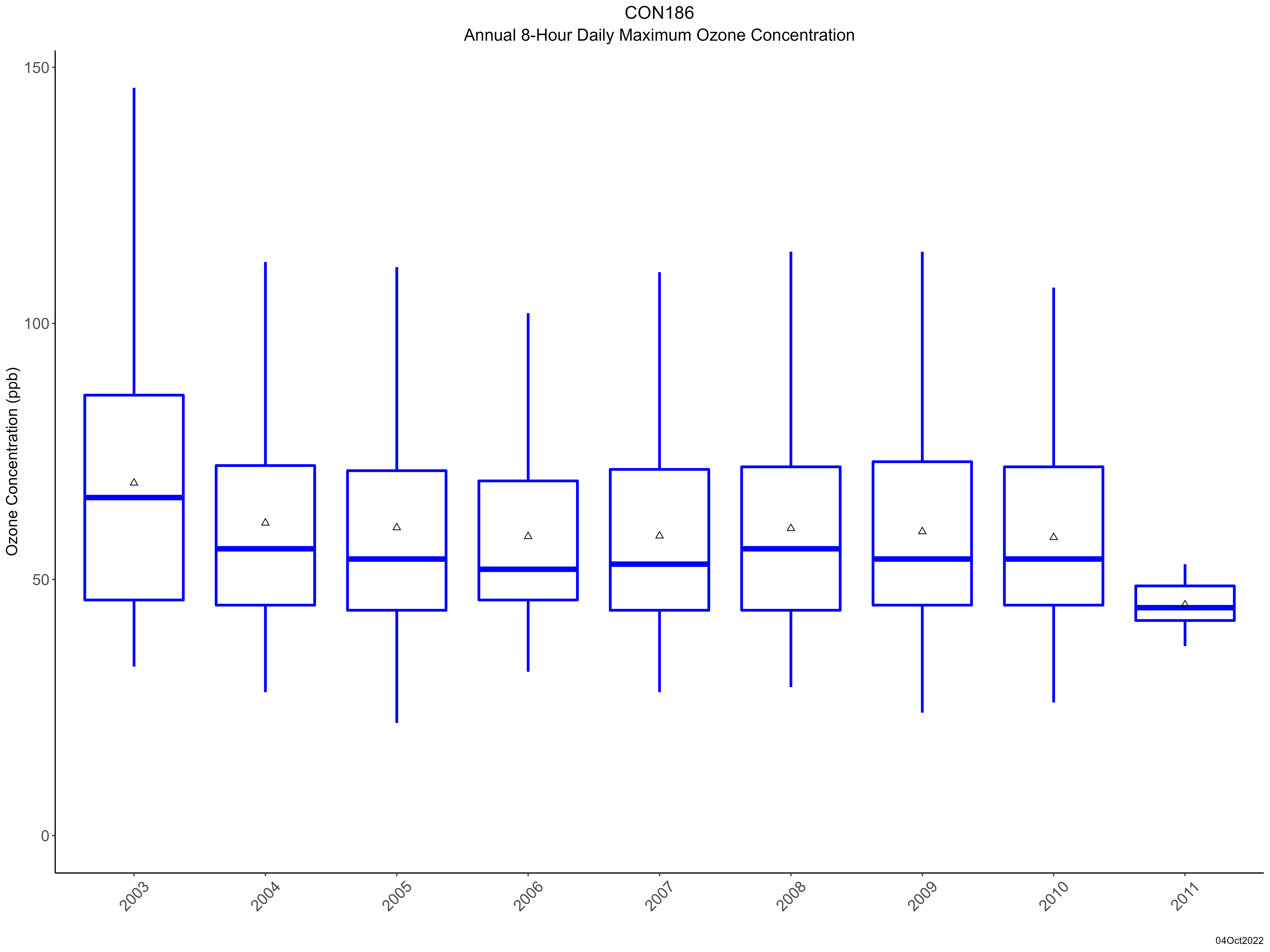
| Trend in maximum 8-hour average ozone concentrations |
 |
|
|
|
| Site History |
| DATALOGGER : CR3000 datalogger installed. Wiring standardized. |
12-NOV-08 |