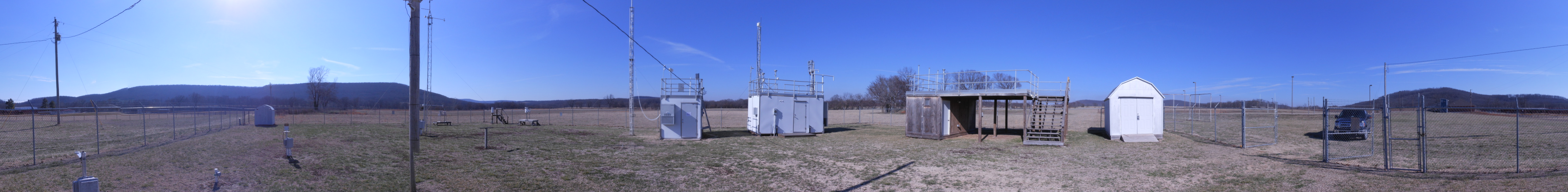
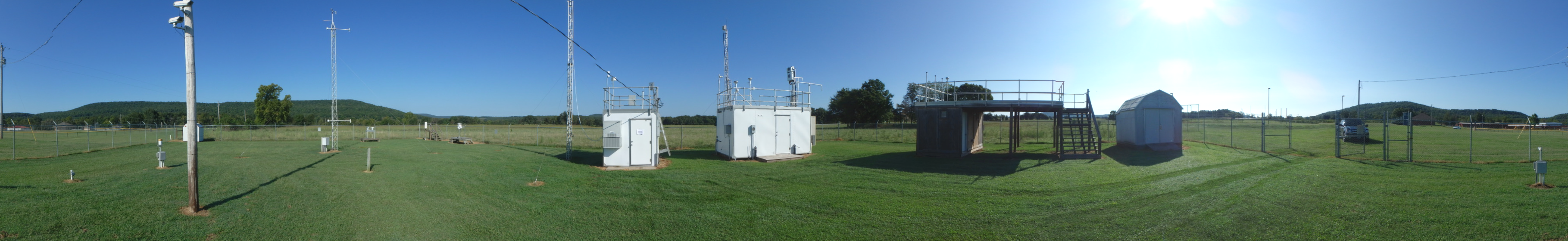
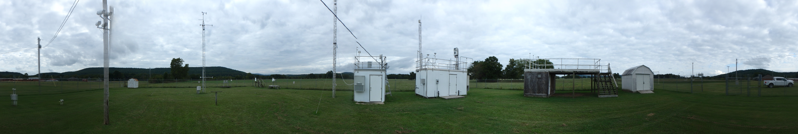
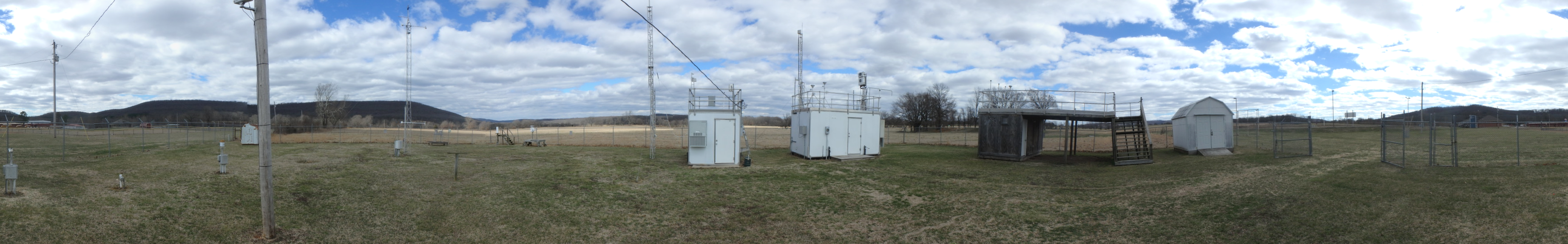
| Site Information |
| Site ID |
CHE185 |
| Site name |
Cherokee Nation |
| County |
Adair |
| State abbreviation |
OK |
| AQS ID |
400019009 |
| Latitude; decimal degrees |
35.750786 |
| Longitude; decimal degrees |
-94.669789 |
| Elevation; m |
305 |
| Operating agency |
EPA |
| Start date |
04/02/2002 |
| Primary Land Use |
Agric |
| Terrain surrounding site |
Rolling |
| NADP/NTN site ID |
AR27 |
| Distance to nearest NTN site; km |
59.29 |
| Co-located NADP/AMoN Site ID |
OK99 |
| View Map |
View Map |
|
| Graphical Results |
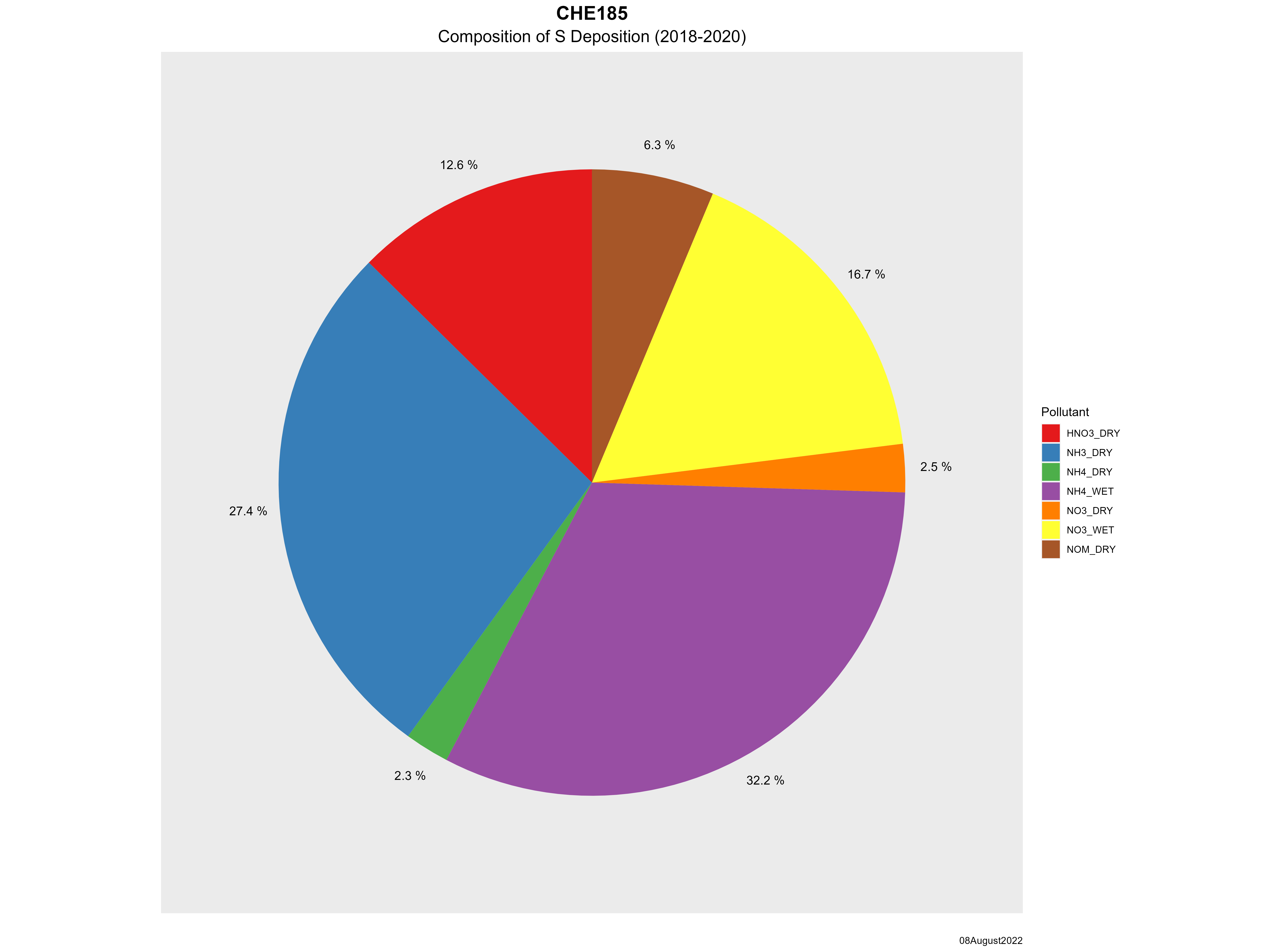
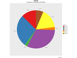
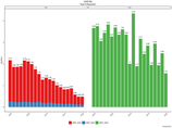
| Composition of total nitrogen deposition by species |
 |
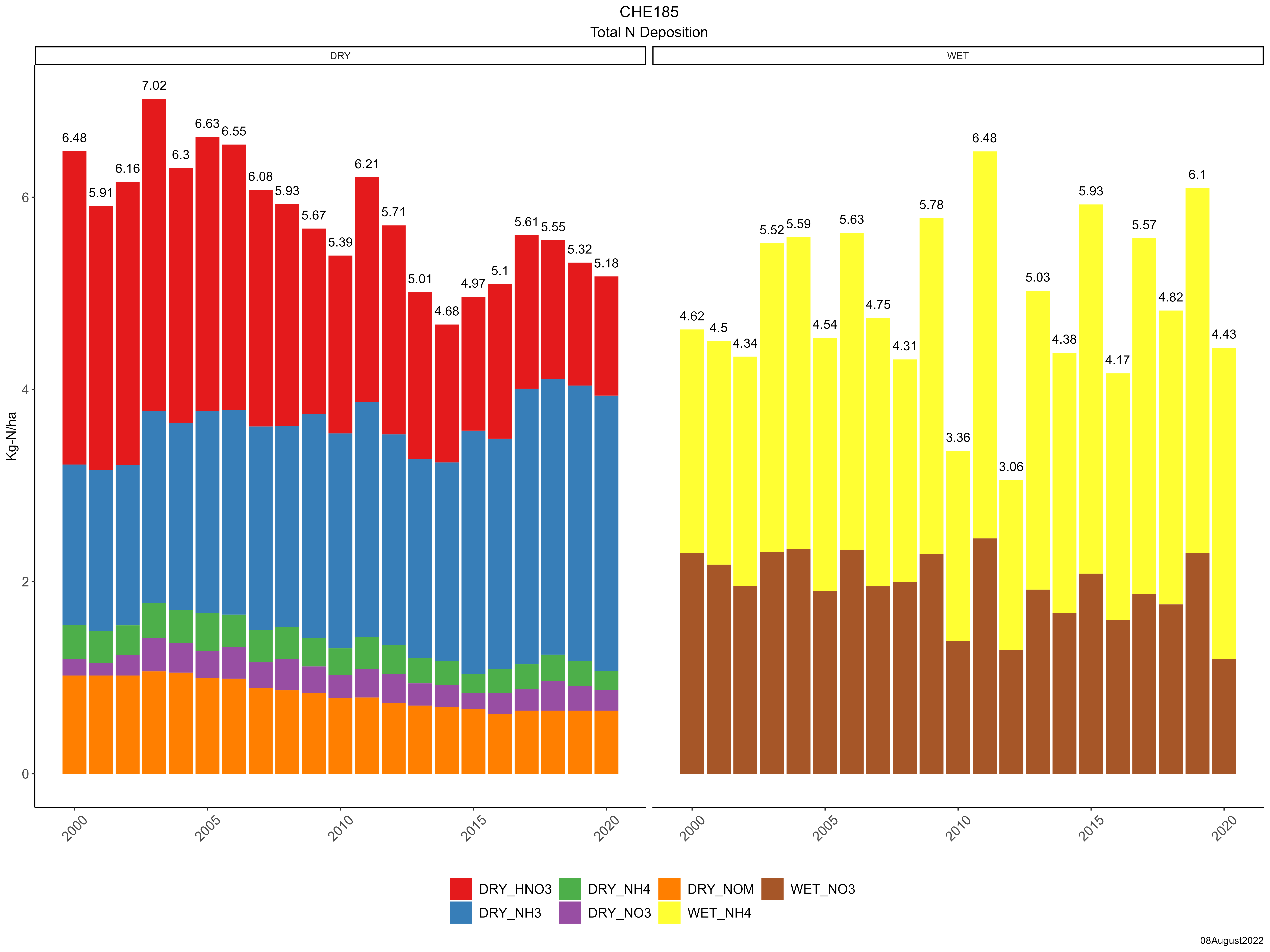
| Trends in total nitrogen deposition |
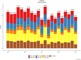 |
| Trends in wet and dry nitrogen deposition |
 |
| Composition of total sulfur deposition by species |
 |
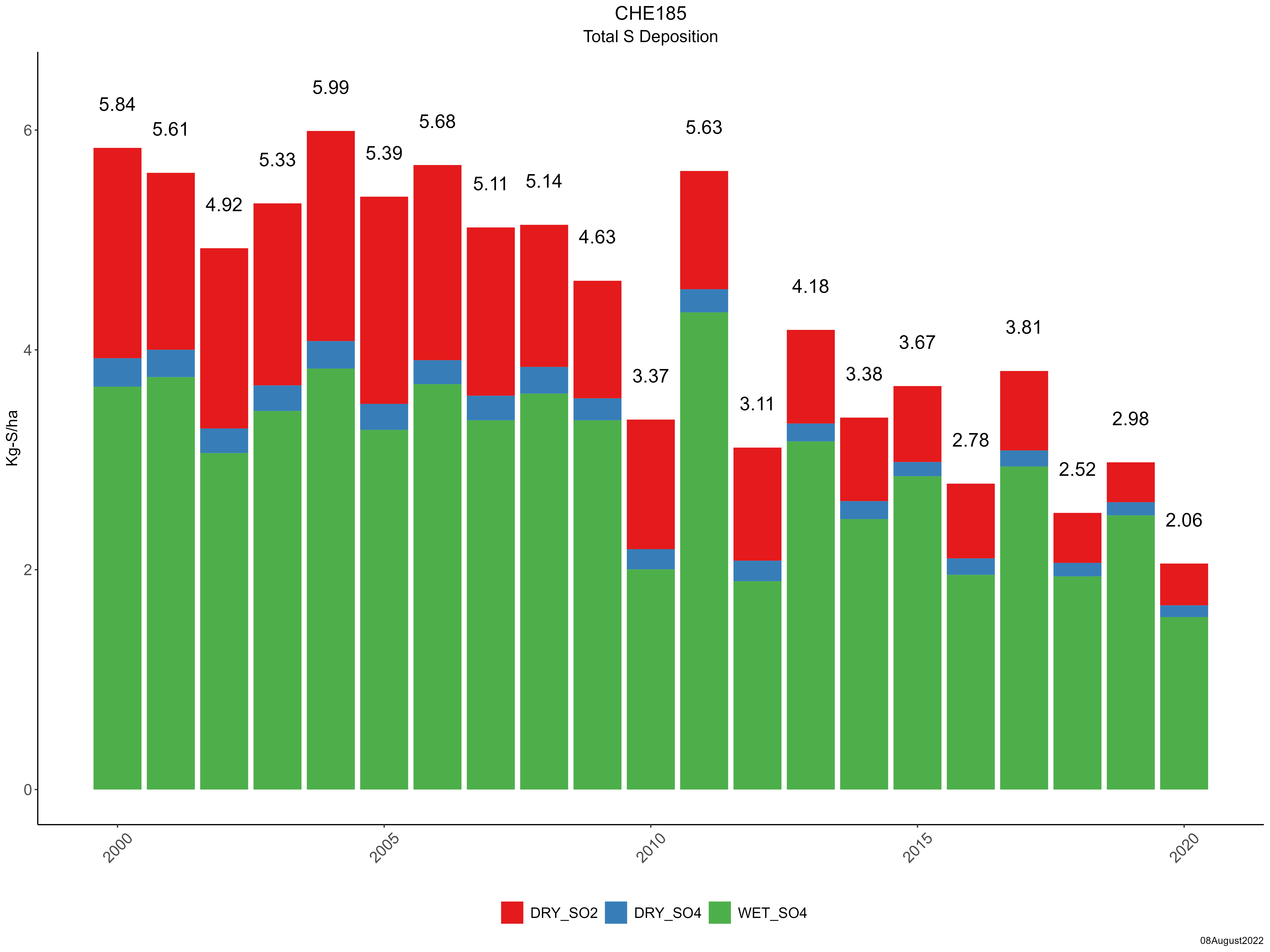
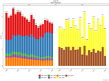
| Trends in total sulfur deposition |
 |
| Trends in wet and dry sulfur deposition |
 |
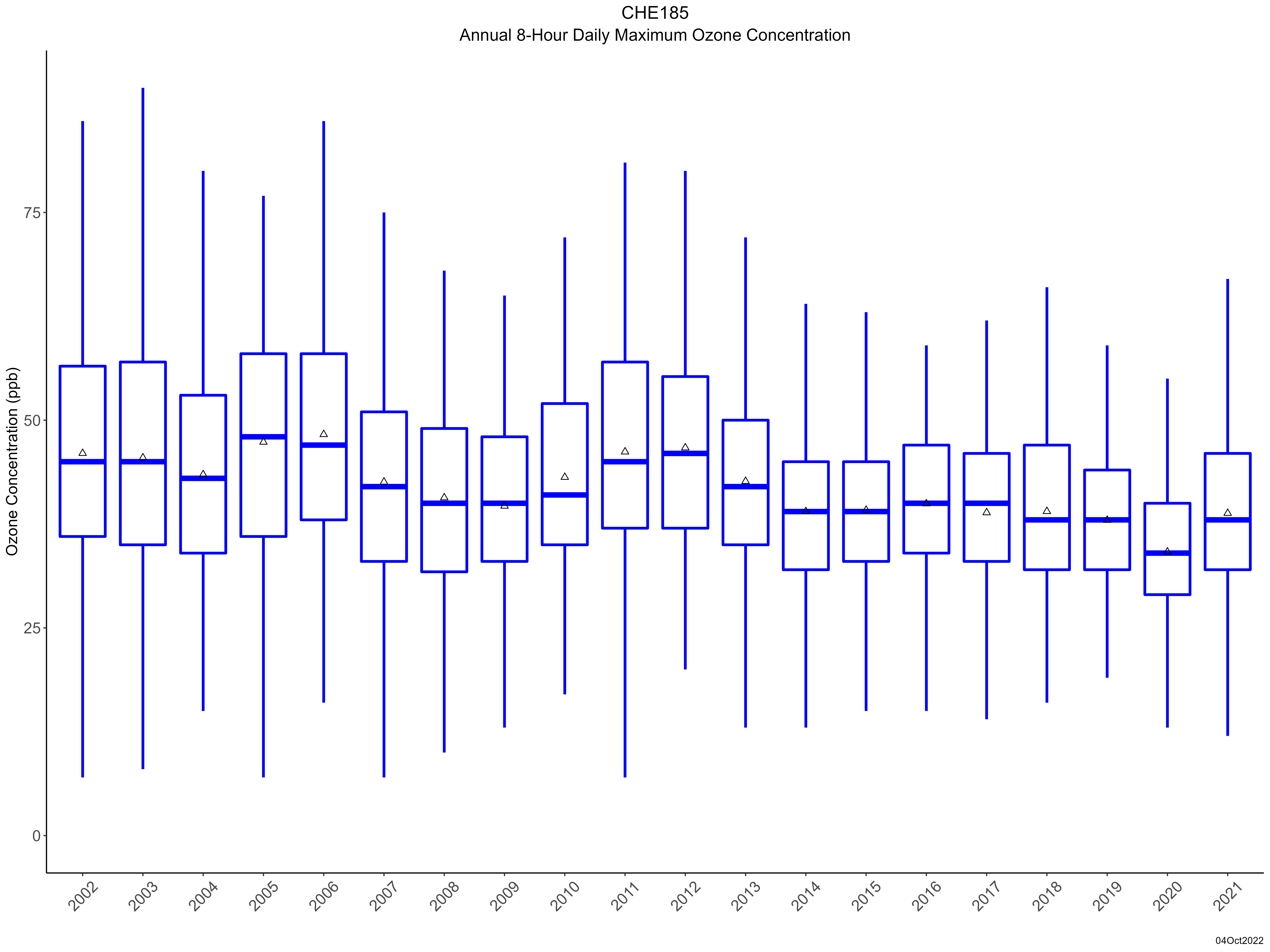
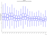
| Trend in maximum 8-hour average ozone concentrations |
 |
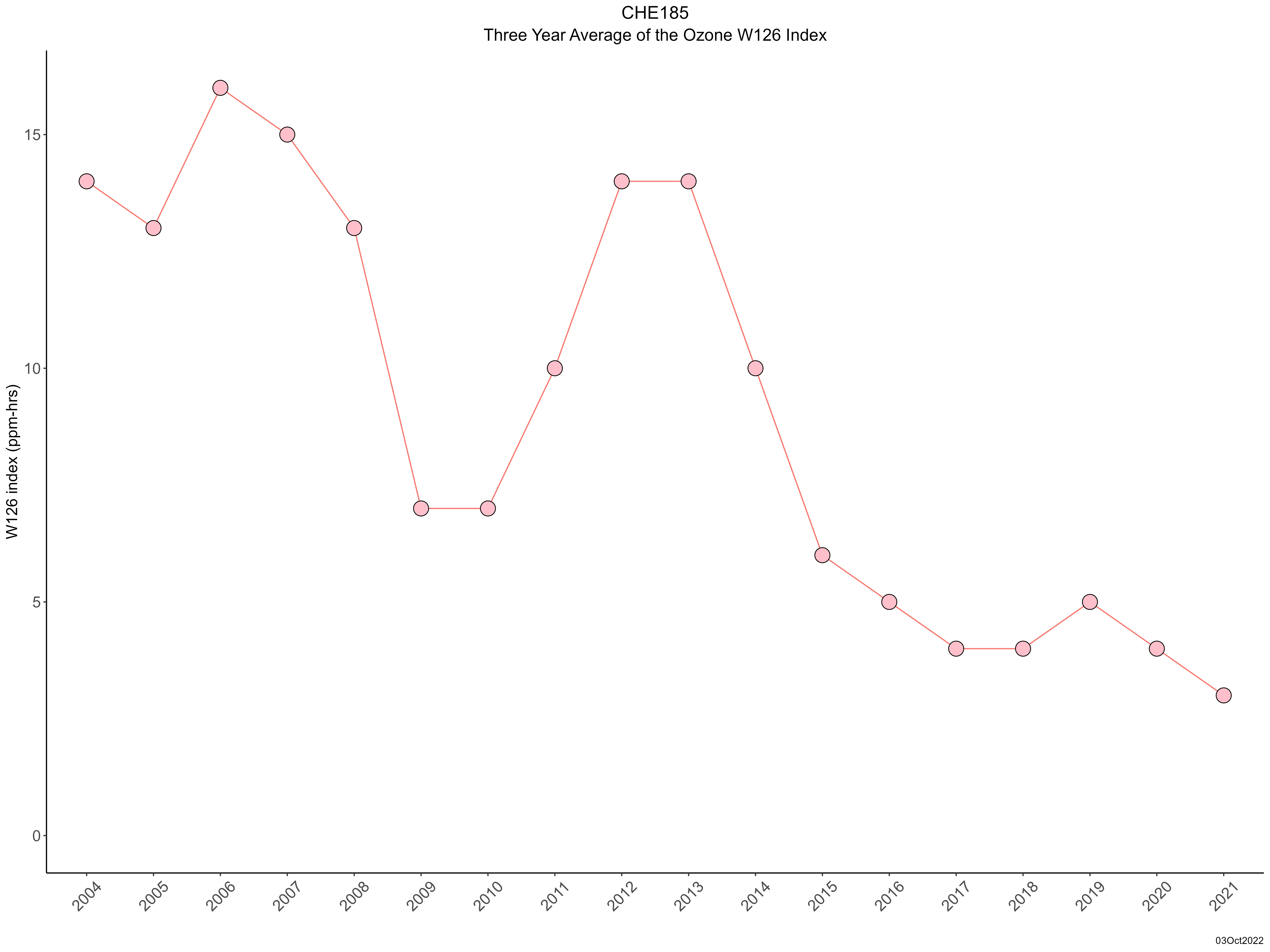
| Trend in 3-year average of ozone W126 index |
 |
|