| Site Photos |
| Site photos not available |
| Site Information |
| Site ID |
CHA267 |
| Site name |
Chiricahua NM Collocated |
| County |
Cochise |
| State abbreviation |
AZ |
| Latitude; decimal degrees |
32.009405 |
| Longitude; decimal degrees |
-109.389058 |
| Elevation; m |
1569 |
| Operating agency |
EPA |
| Start date |
04/23/1989 |
| End date |
10/03/1992 |
| Primary Land Use |
Range |
| Terrain surrounding site |
Complex |
| NADP/NTN site ID |
AZ98 |
| Distance to nearest NTN site; km |
.036 |
| View Map |
View Map |
|
| Graphical Results |
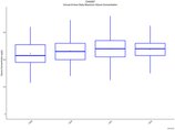
| Trend in maximum 8-hour average ozone concentrations |
 |
|
