| Site Photos |
| Site photos not available |
| Site Information |
| Site ID |
BAS601 |
| Site name |
Basin |
| County |
Big Horn |
| State abbreviation |
WY |
| AQS ID |
560030002 |
| Latitude; decimal degrees |
44.28 |
| Longitude; decimal degrees |
-108.0411 |
| Elevation; m |
1242 |
| Operating agency |
BLM |
| Start date |
11/06/2012 |
| Primary Land Use |
Prairie |
| Terrain surrounding site |
Rolling |
| NADP/NTN site ID |
MT00 |
| Distance to nearest NTN site; km |
151.068 |
| Co-located NADP/AMoN Site ID |
WY93 |
| View Map |
View Map |
|
| Graphical Results |
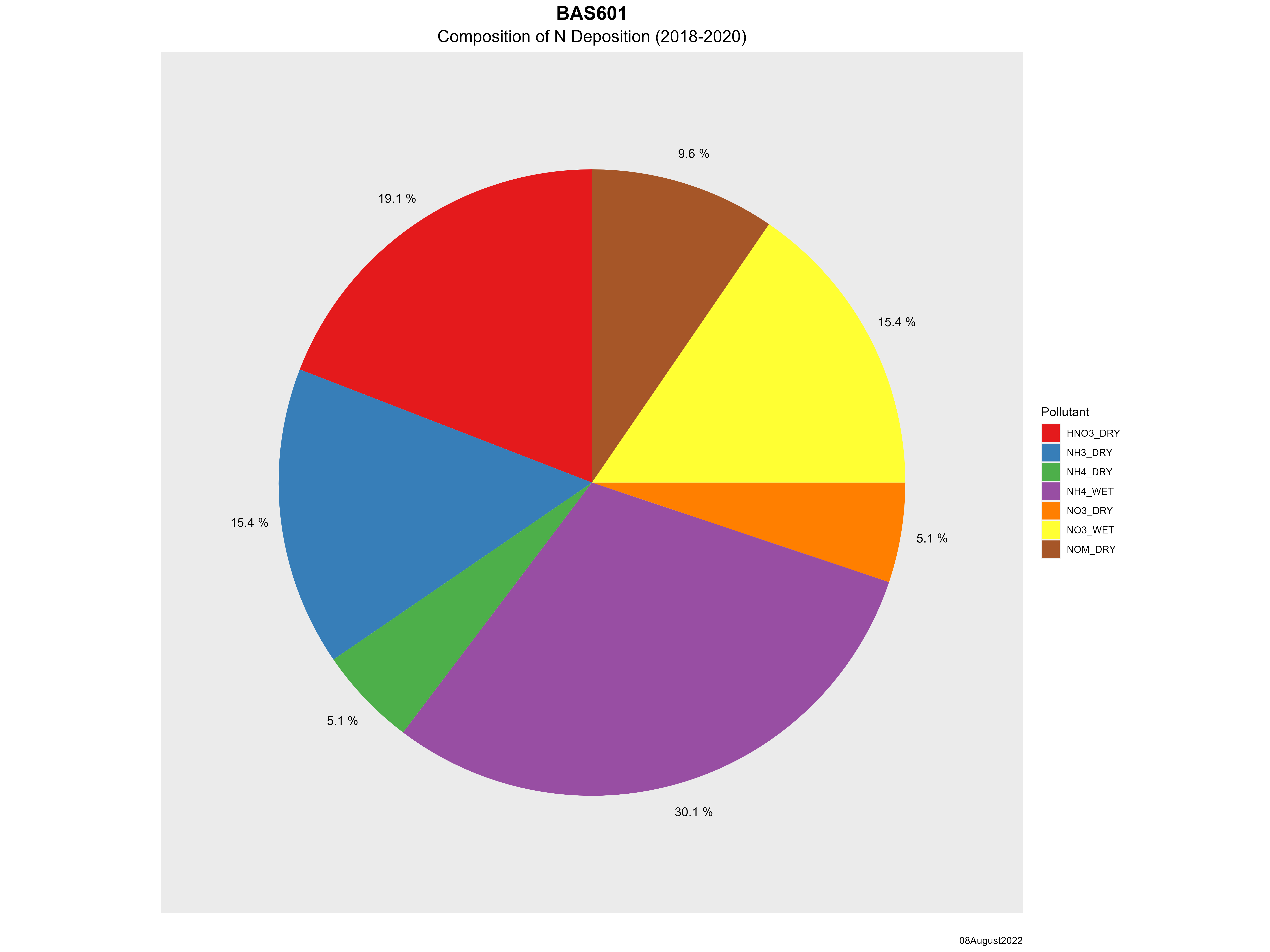
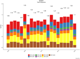
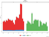
| Composition of total nitrogen deposition by species |
 |
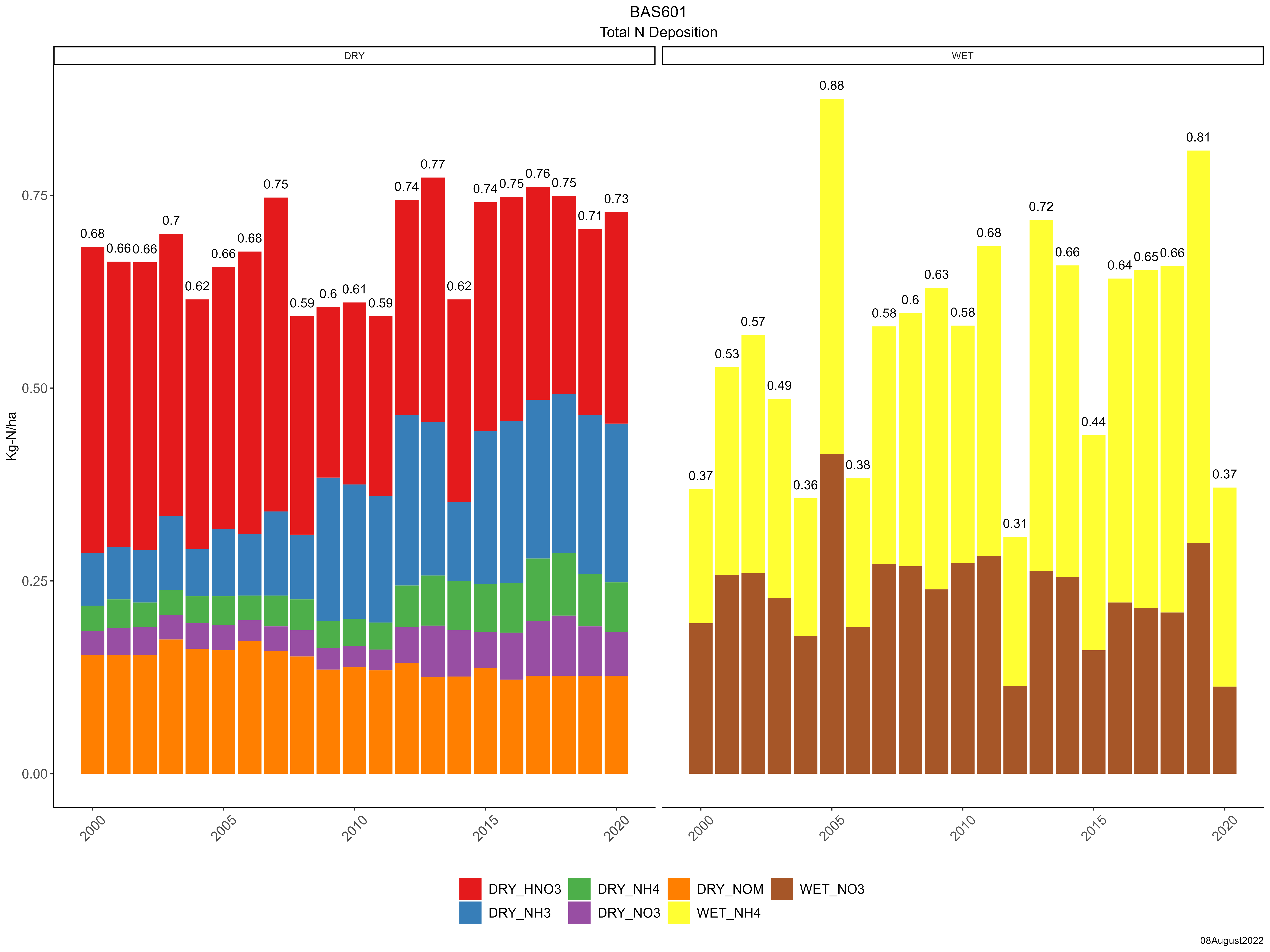
| Trends in total nitrogen deposition |
 |
| Trends in wet and dry nitrogen deposition |
 |
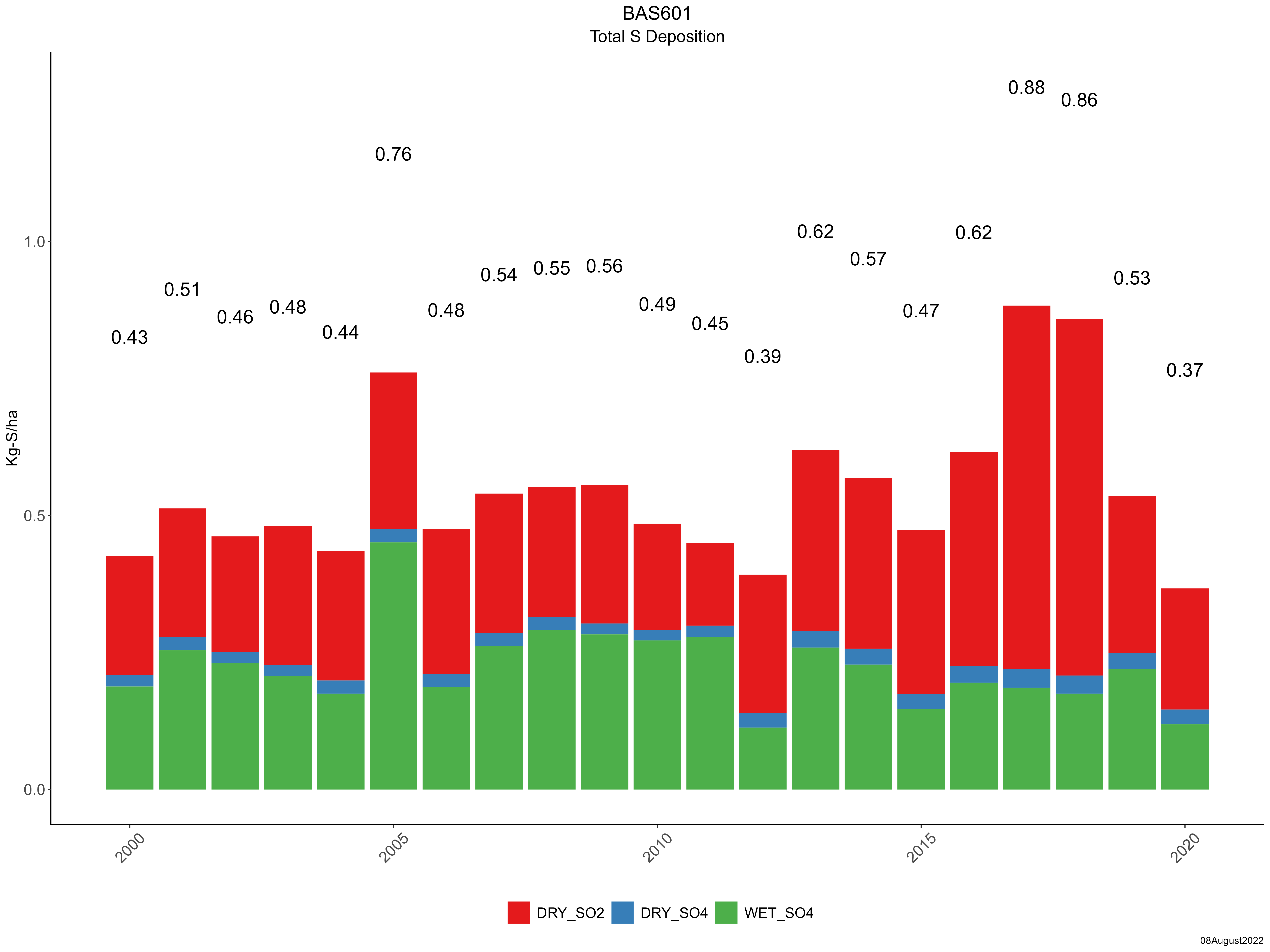
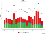
| Composition of total sulfur deposition by species |
 |
| Trends in total sulfur deposition |
 |
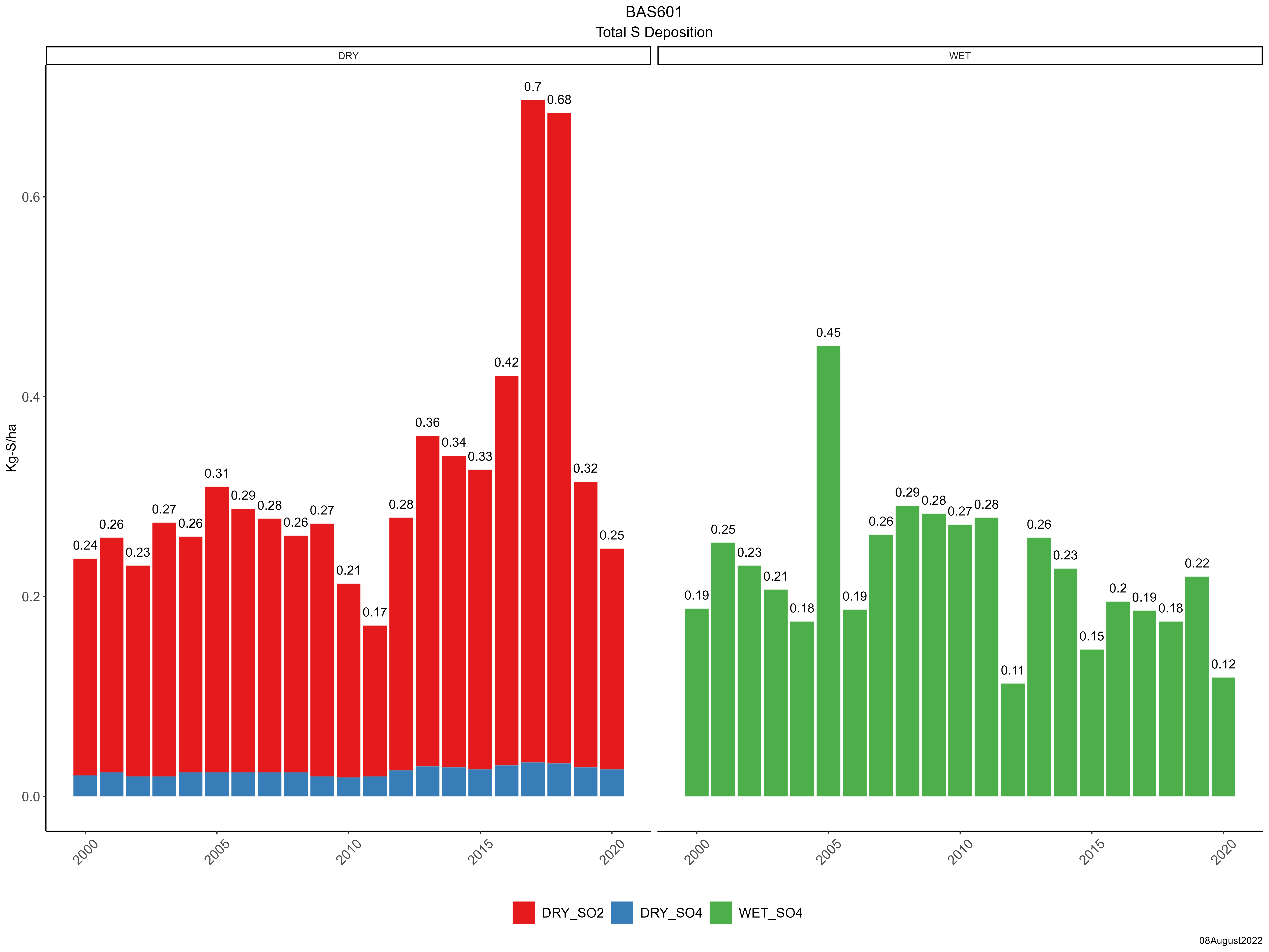
| Trends in wet and dry sulfur deposition |
 |
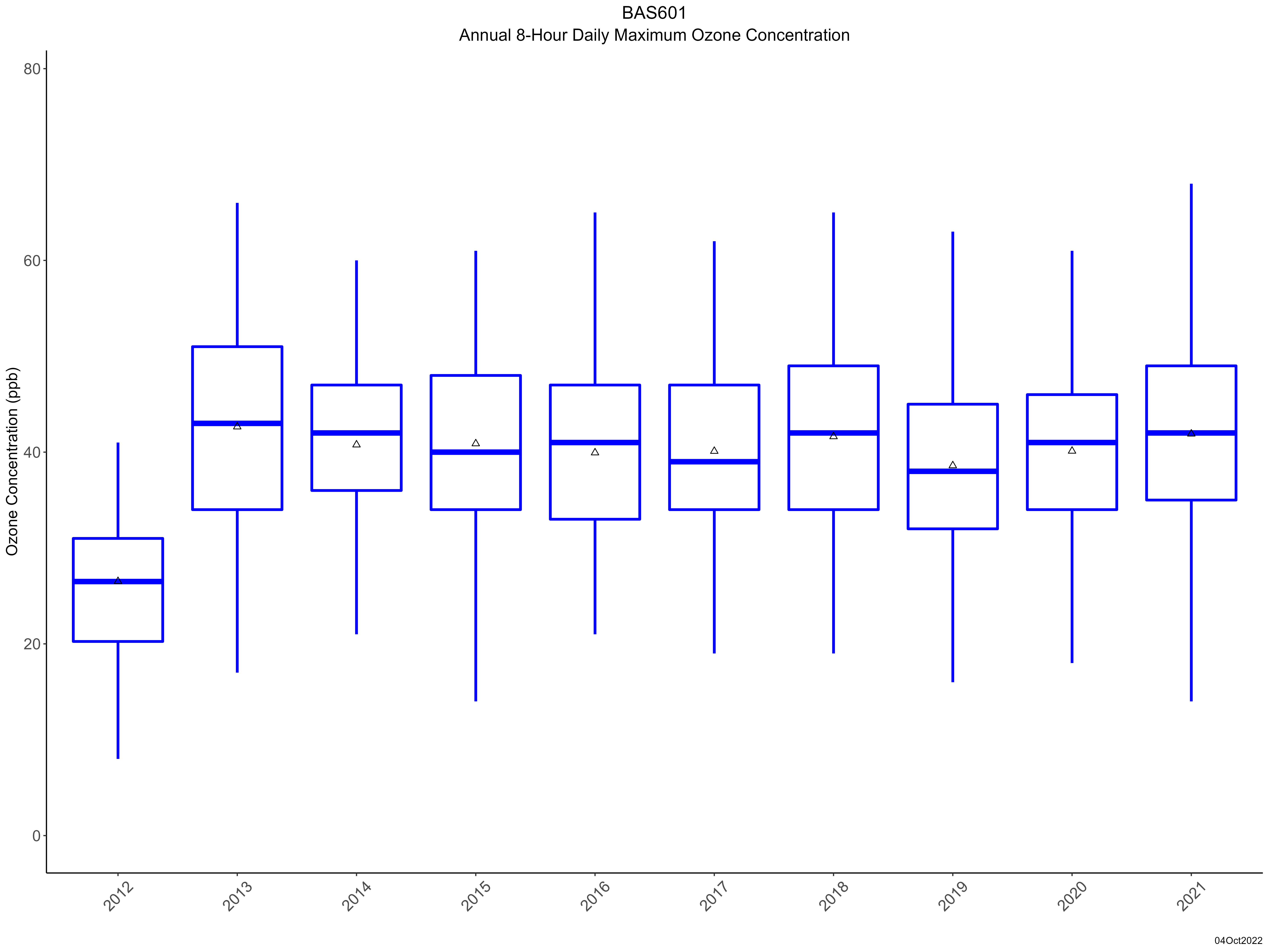
| Trend in maximum 8-hour average ozone concentrations |
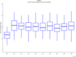 |
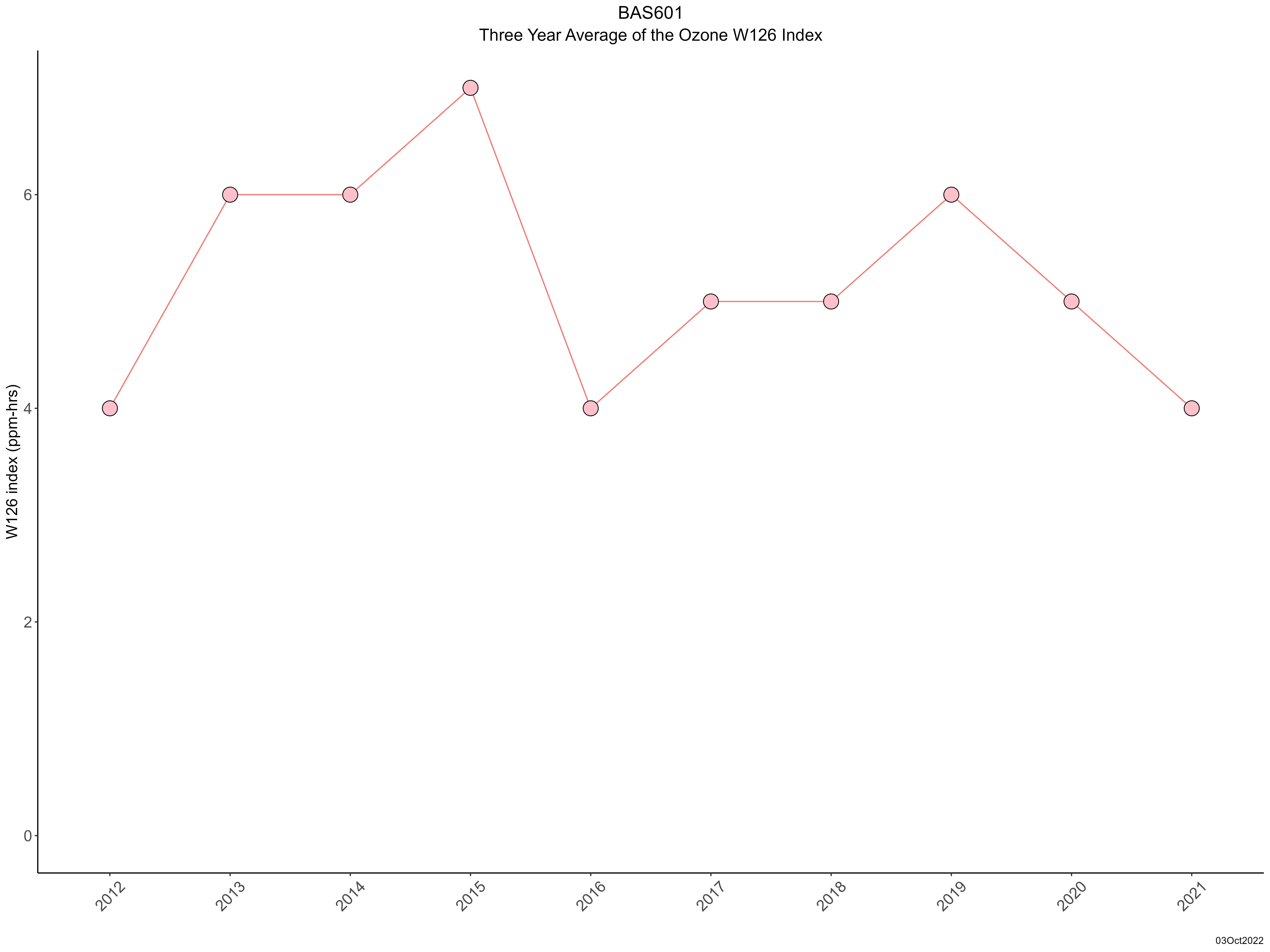
| Trend in 3-year average of ozone W126 index |
 |
|