| Site Photos |
| Site photos not available |
| Site Information |
| Site ID |
ASH235 |
| Site name |
Ashland Collocated |
| County |
Aroostook |
| State abbreviation |
ME |
| Latitude; decimal degrees |
46.603832 |
| Longitude; decimal degrees |
-68.413227 |
| Elevation; m |
231 |
| Operating agency |
EPA |
| Start date |
09/05/1995 |
| End date |
07/31/2001 |
| Primary Land Use |
Agric |
| Terrain surrounding site |
Flat |
| NADP/NTN site ID |
ME00 |
| Distance to nearest NTN site; km |
42.343 |
| View Map |
View Map |
|
| Graphical Results |
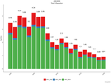
| Composition of total nitrogen deposition by species |
 |
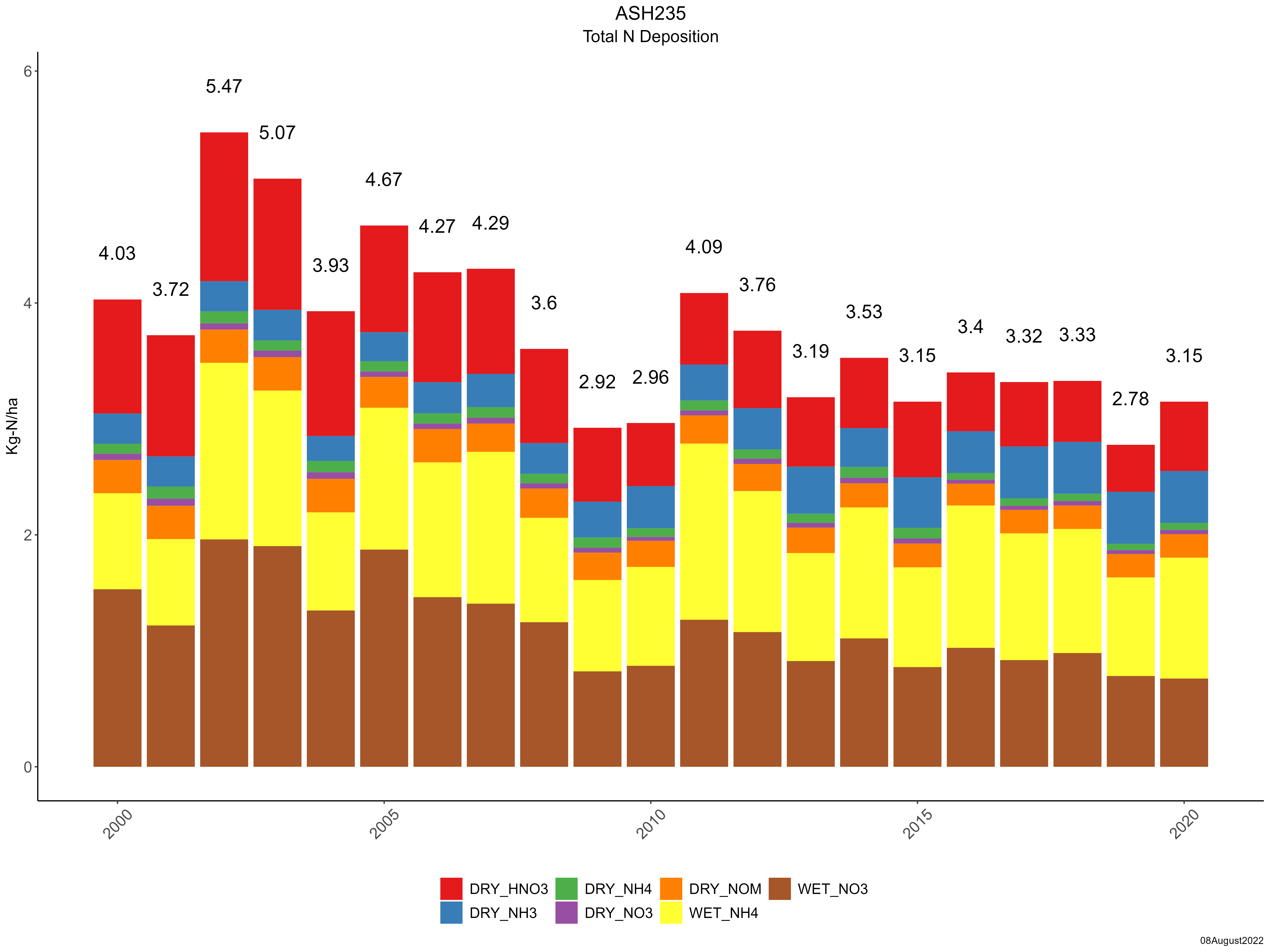
| Trends in total nitrogen deposition |
 |
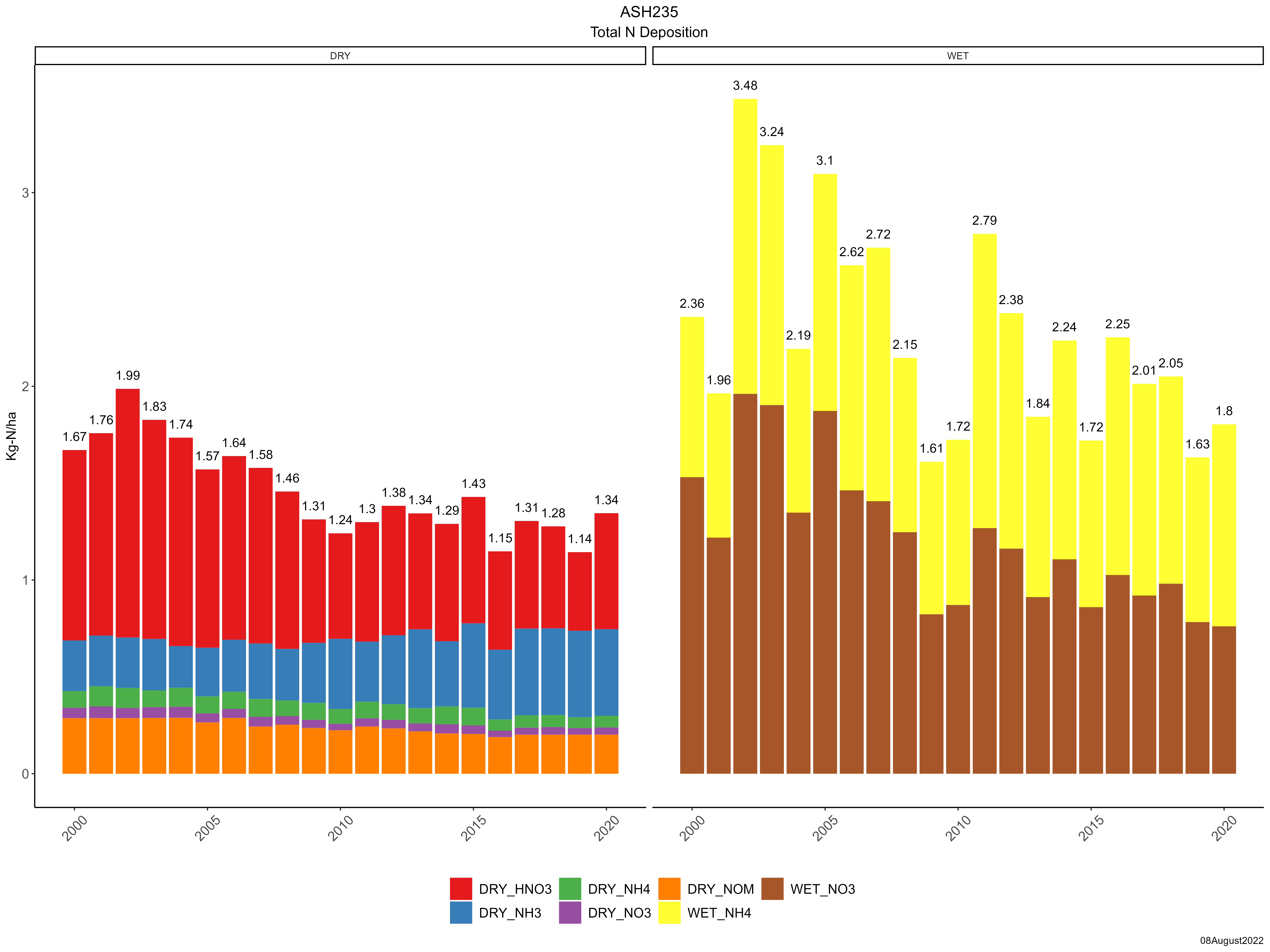
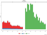
| Trends in wet and dry nitrogen deposition |
 |
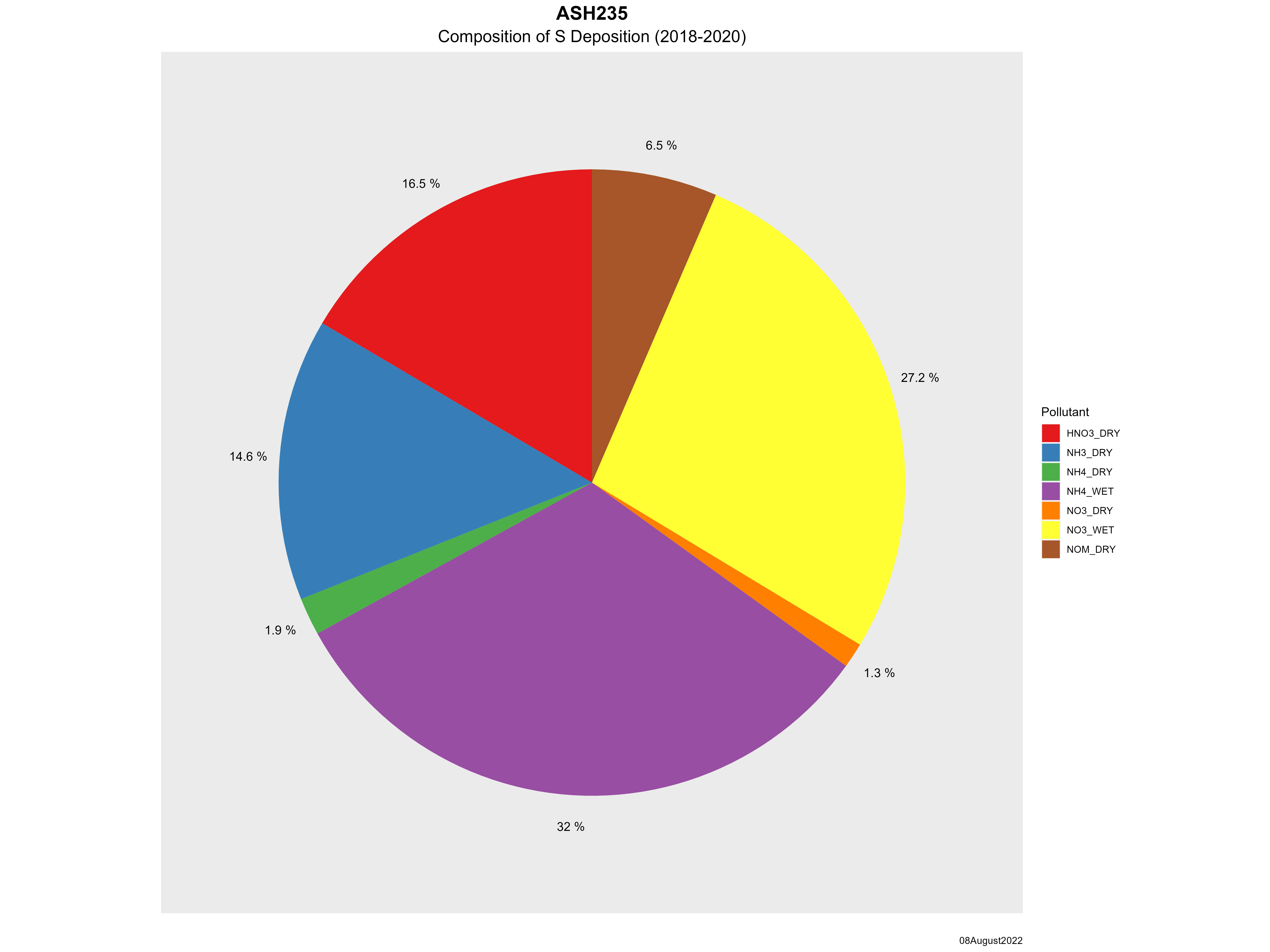
| Composition of total sulfur deposition by species |
 |
| Trends in total sulfur deposition |
 |
| Trends in wet and dry sulfur deposition |
 |
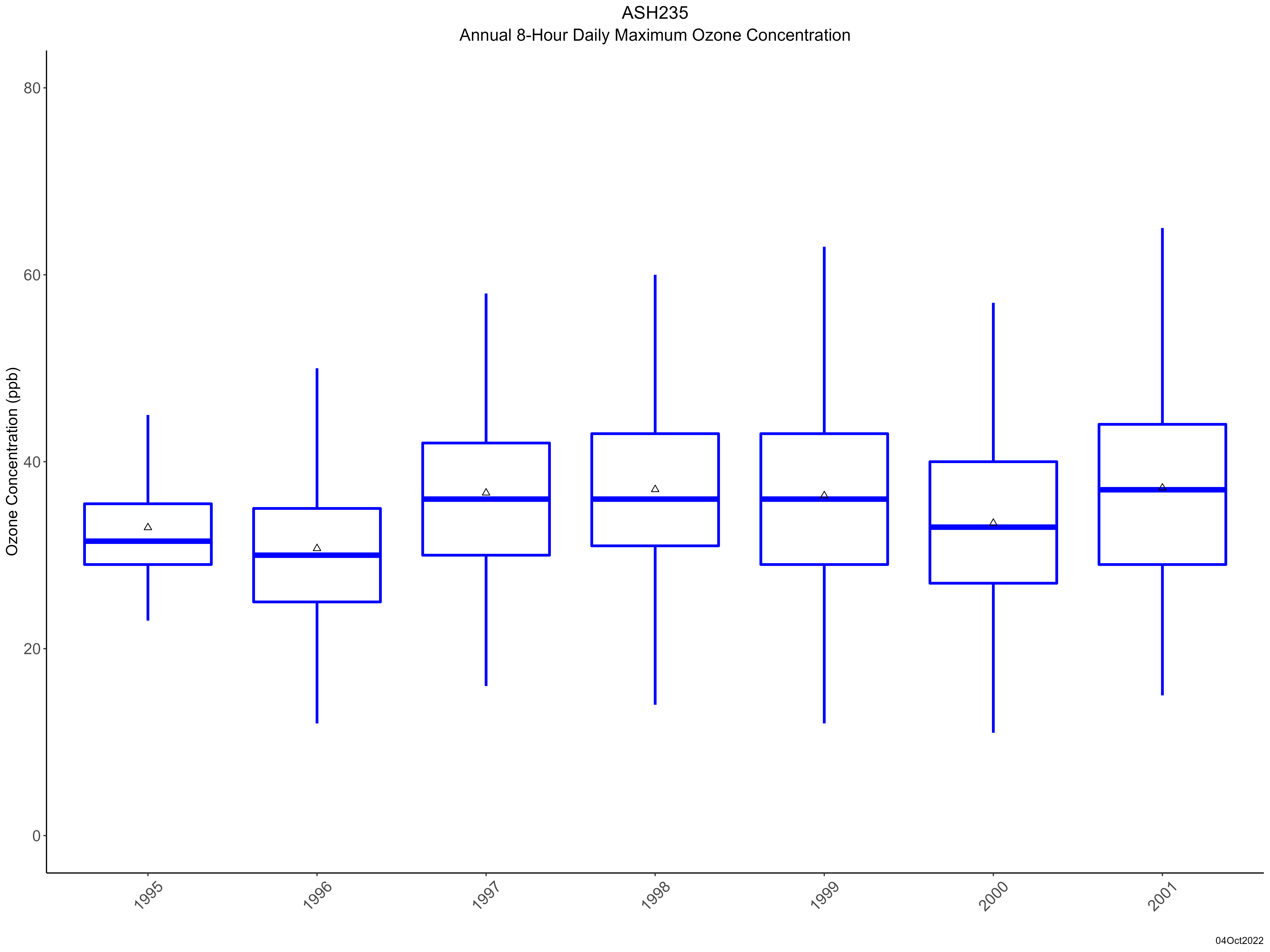
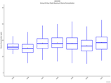
| Trend in maximum 8-hour average ozone concentrations |
 |
|