| Site Photos |
| Site photos not available |
| Site Information |
| Site ID |
UIN162 |
| Site name |
Uinta |
| County |
Duchesne |
| State abbreviation |
UT |
| Latitude; decimal degrees |
40.55 |
| Longitude; decimal degrees |
-110.32 |
| Elevation; m |
2500 |
| Operating agency |
EPA |
| Start date |
04/30/1989 |
| End date |
09/28/1993 |
| Primary Land Use |
Range |
| Terrain surrounding site |
Complex |
| NADP/NTN site ID |
UT95 |
| Distance to nearest NTN site; km |
75.618 |
| View Map |
View Map |
|
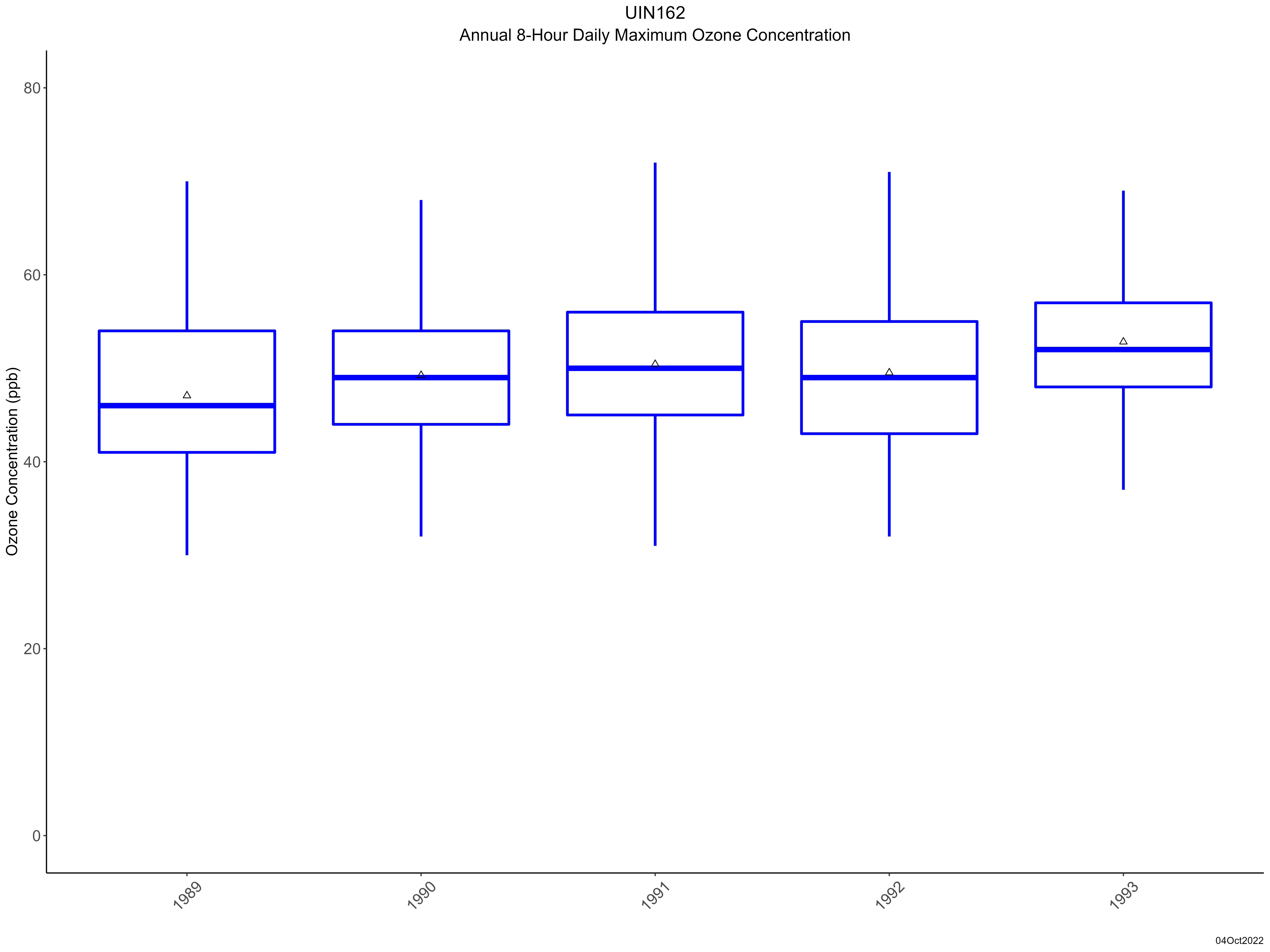
| Graphical Results |
| Trend in maximum 8-hour average ozone concentrations |
 |
|