| Site Photos |
| Site photos not available |
| Site Information |
| Site ID |
SHE604 |
| Site name |
Sheridan |
| County |
Sheridan |
| State abbreviation |
WY |
| Latitude; decimal degrees |
44.93 |
| Longitude; decimal degrees |
-106.85 |
| Elevation; m |
1115 |
| Operating agency |
BLM |
| Start date |
11/06/2012 |
| Primary Land Use |
Prairie |
| Terrain surrounding site |
Rolling |
| NADP/NTN site ID |
MT00 |
| Distance to nearest NTN site; km |
84.802 |
| View Map |
View Map |
|
| Graphical Results |
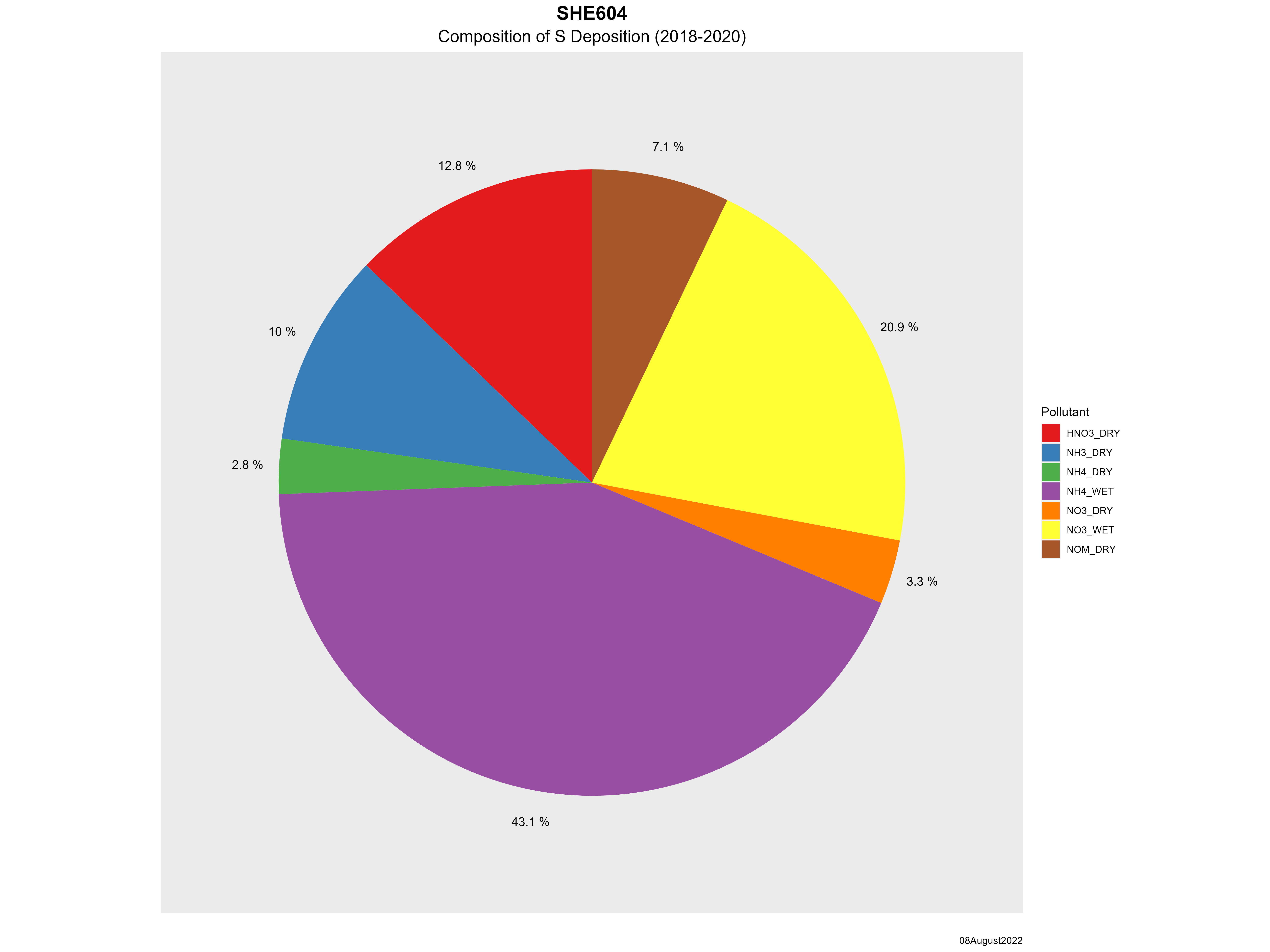
| Composition of total nitrogen deposition by species |
 |
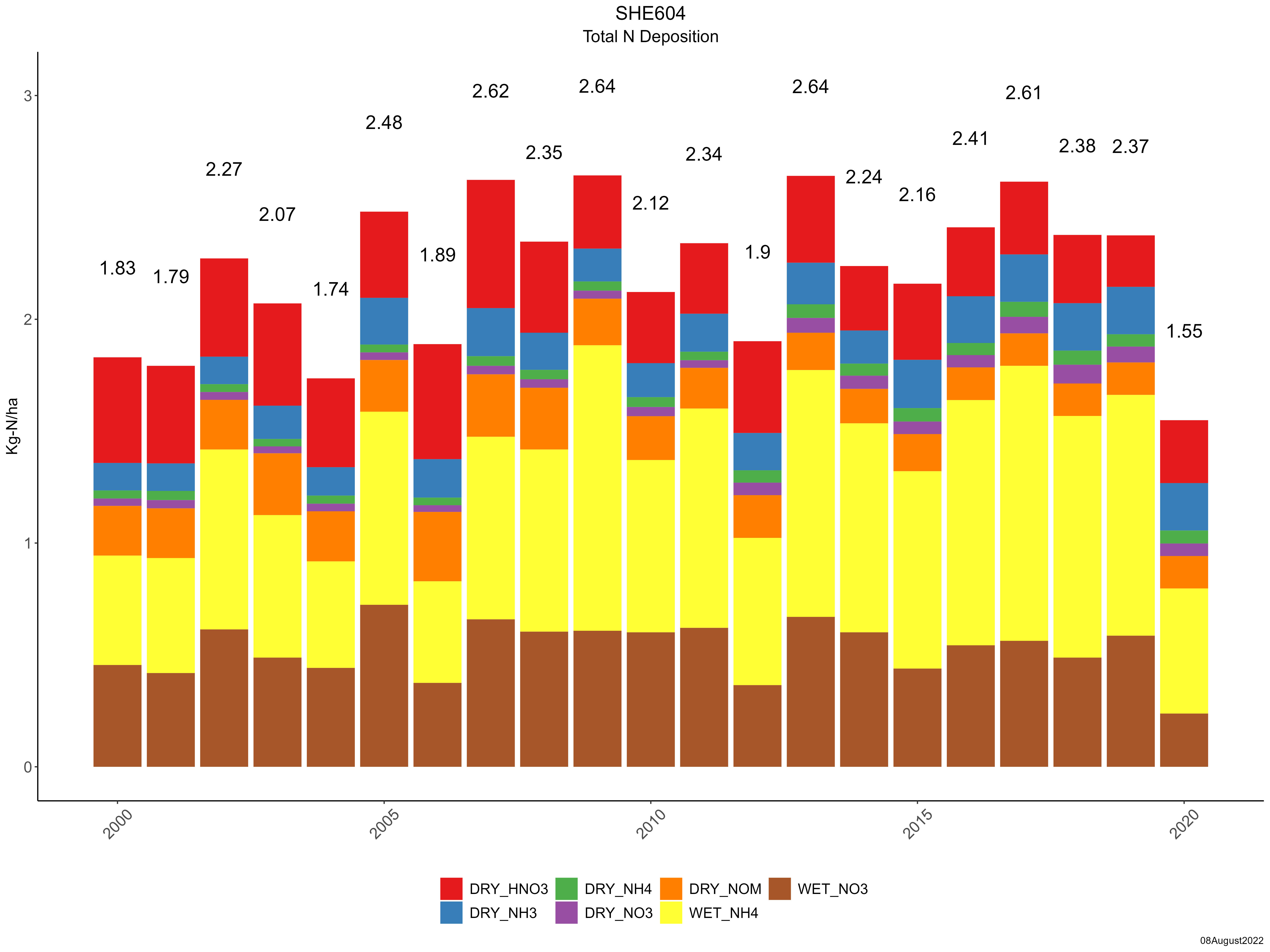
| Trends in total nitrogen deposition |
 |
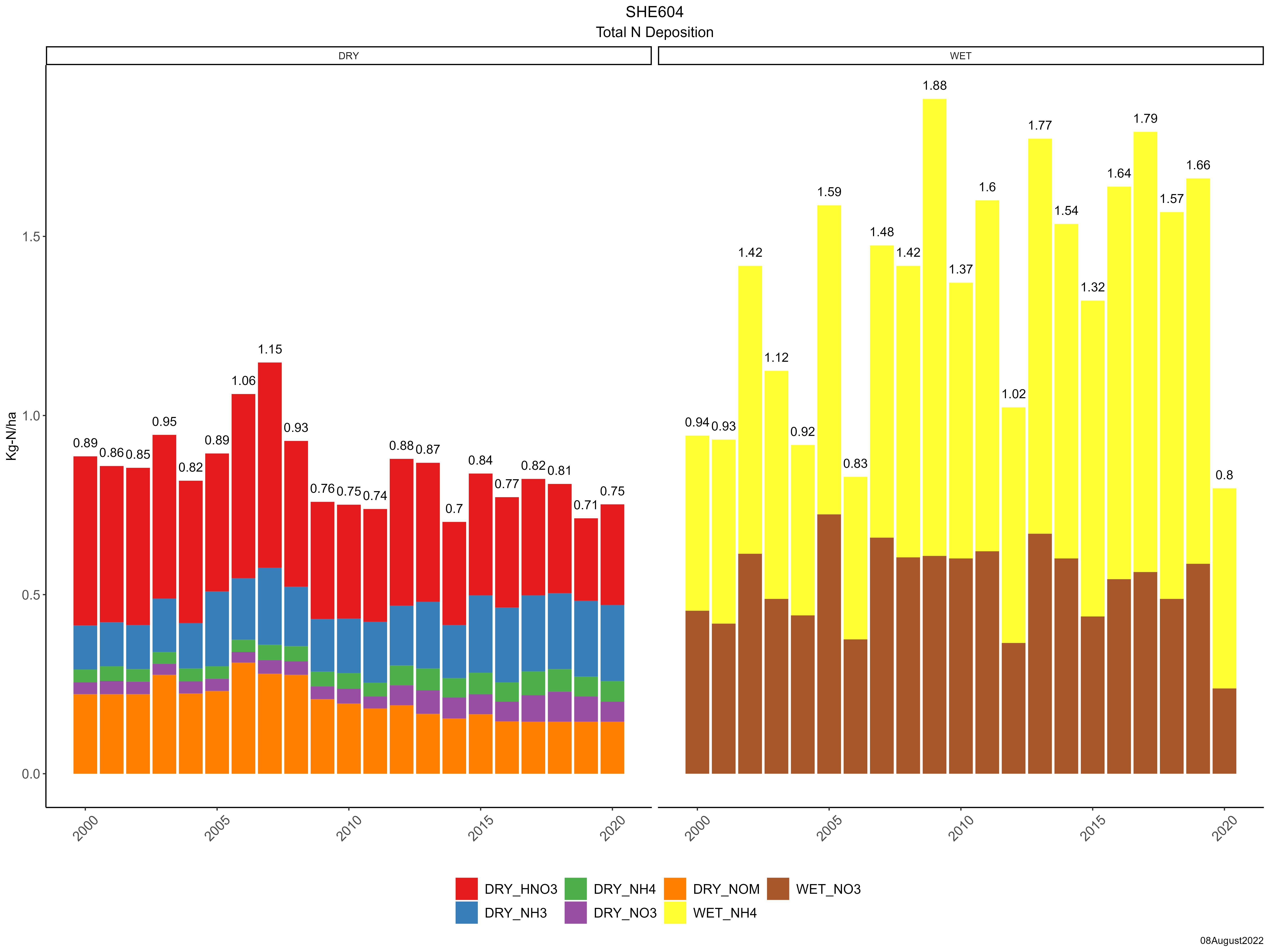
| Trends in wet and dry nitrogen deposition |
 |
| Composition of total sulfur deposition by species |
 |
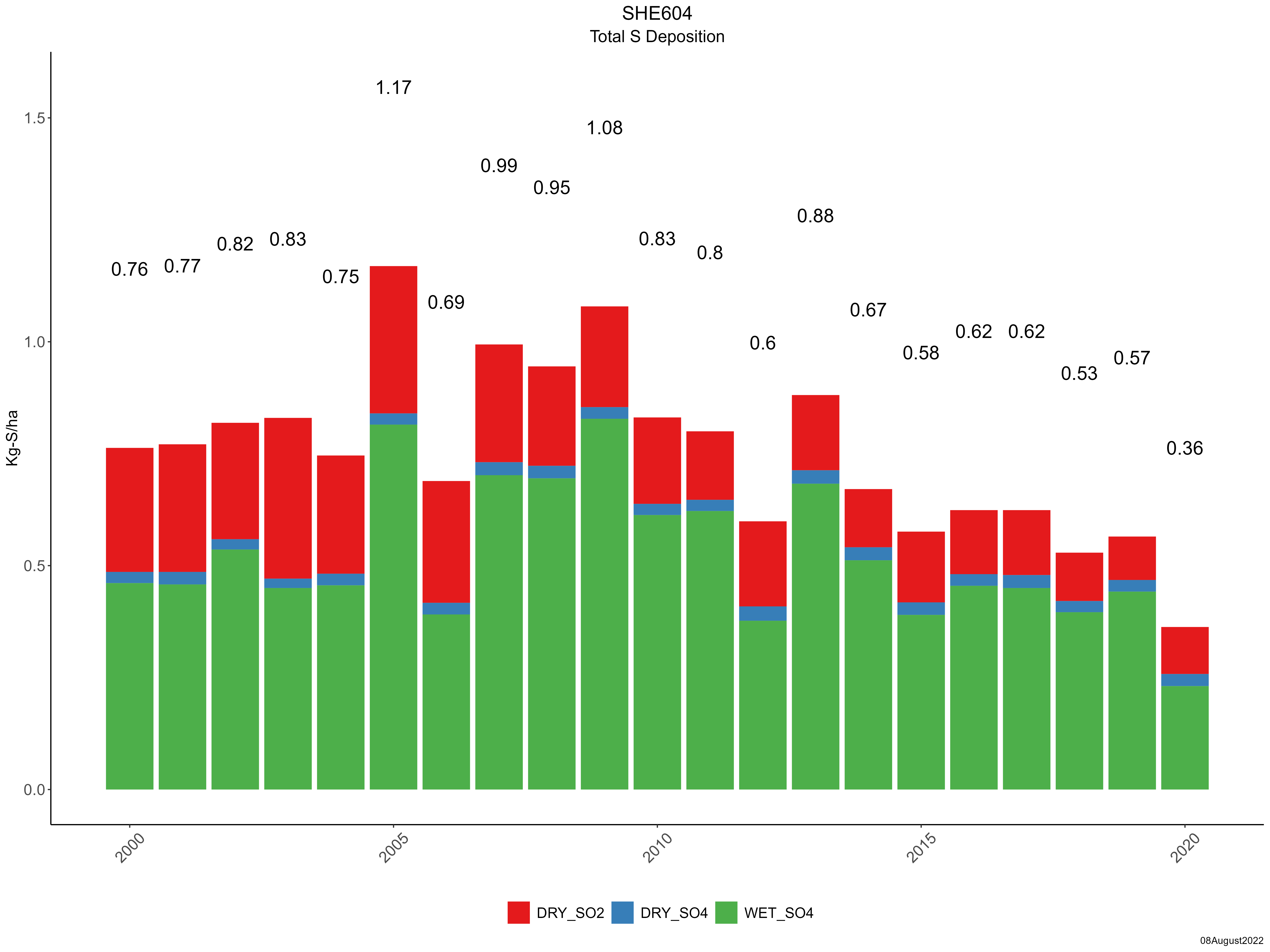
| Trends in total sulfur deposition |
 |
| Trends in wet and dry sulfur deposition |
 |
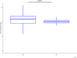
| Trend in maximum 8-hour average ozone concentrations |
 |
|