| Site Photos |
| Site photos not available |
| Site Information |
| Site ID |
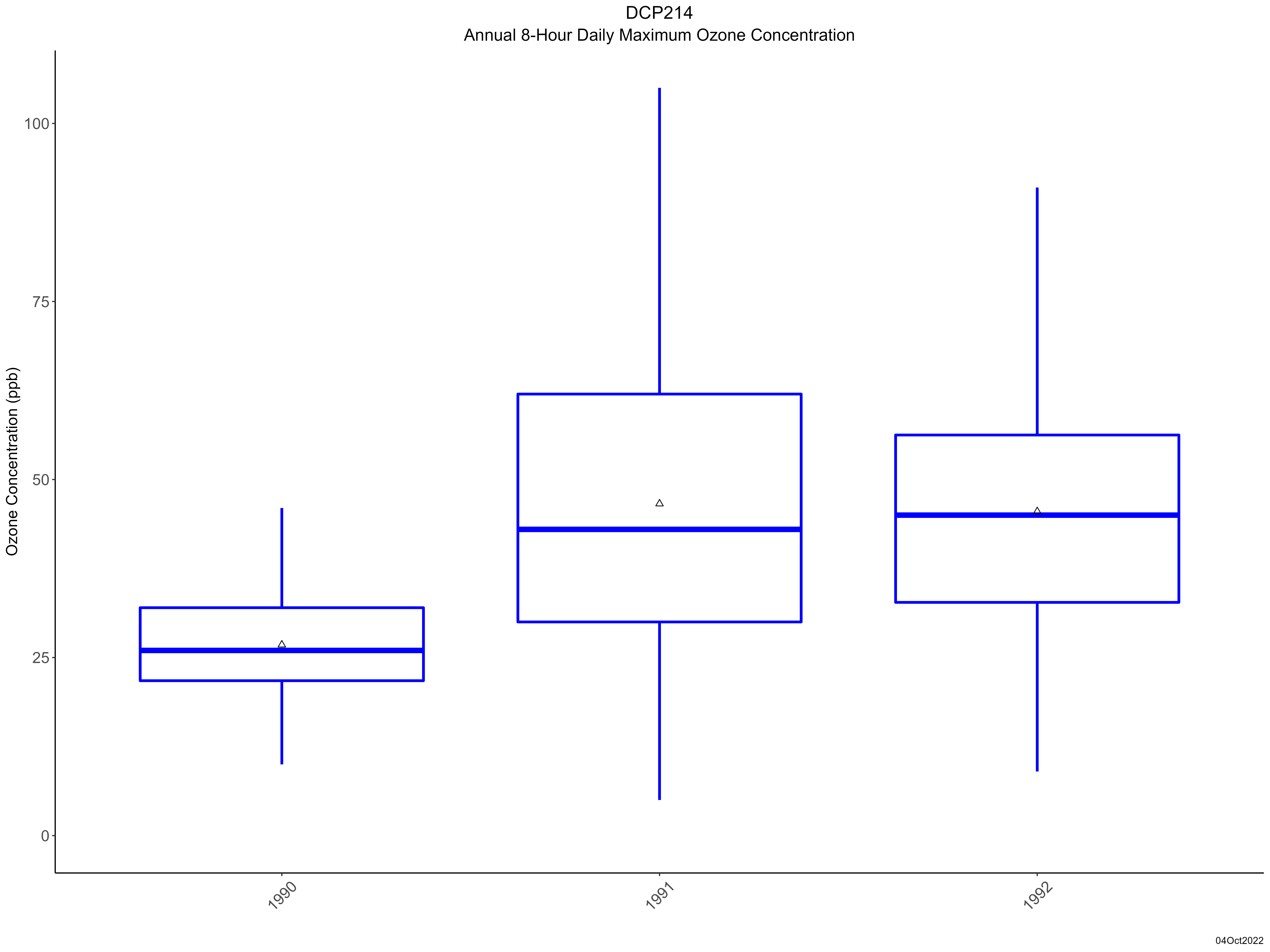
DCP214 |
| Site name |
Deer Creek Collocated |
| County |
Fayette |
| State abbreviation |
OH |
| Latitude; decimal degrees |
39.635888 |
| Longitude; decimal degrees |
-83.260563 |
| Elevation; m |
264 |
| Operating agency |
EPA |
| Start date |
10/01/1990 |
| End date |
09/24/1992 |
| Primary Land Use |
Agric |
| Terrain surrounding site |
Rolling |
| NADP/NTN site ID |
OH54 |
| Distance to nearest NTN site; km |
.003 |
| View Map |
View Map |
|
| Graphical Results |
| Trend in maximum 8-hour average ozone concentrations |
 |
|